Old Maps of Goliad County, Texas for Academic Research
Study the evolution of Goliad County with 142 high-resolution historic maps. Whether you're teaching, researching, or modeling changes in land use, these maps provide essential visual documentation of urban, environmental, and geographic change.
- Analyze long-term change: Track patterns in development, transportation, and natural features.
- Ideal for environmental or urban studies: Support academic projects with primary historical map data.
- Use in the classroom or lab: Educators and researchers rely on these maps to bring historical context to life.
These maps are a powerful tool for teaching, research, and visualizing how Goliad County has changed over the decades.
Goliad County, TX maps
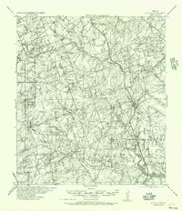
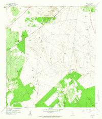
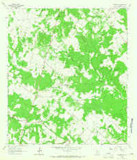
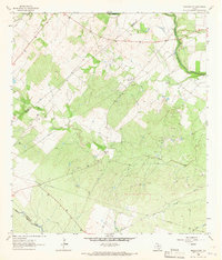
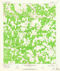
(142)- 1936 Map of Pettus
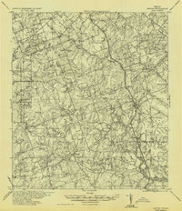 1936 Pettus1936 Print · USGSCoastal plains ranching meets the 1930s oil boom in this detailed survey of Bee and Karnes counties. Genealogists can locate family-named landmarks and rural hubs such as Zunkerville, Salt Branch Church, and the Pettus Oil Field.
 - 1953 Map of Beeville
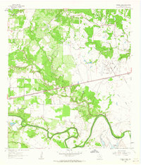
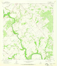
 1953 Beeville1953 Print · USGSThe Texas Coastal Bend in the early fifties shows a landscape of growing regional hubs and vital maritime corridors. Trace the rail-and-river economy through Goliad, locate the Matagorda Lighthouse, and explore the sprawling Aransas National Wildlife Refuge.
 - 1954 Map of Skidmore, 1956 Print
 1954 Skidmore1956 Print · USGSBee County and Goliad County are captured here in the mid-fifties, showing a landscape defined by ranching and naval aviation. Genealogists can locate family burial sites at St Joseph and Glenwood Cem and Evergreen Cem or trace old rural schoolhouses like Poesta Sch.2 unique versions available
 - 1954 Map of Vidaurri, 1956 Print
 1954 Vidaurri1956 Print · USGSCoastal Texas ranching and petroleum industry collide in the mid-fifties as massive oil fields expanded across Refugio County. Genealogists and historians can trace family-named sites like Welder Ranch, Lambert Ranch, and the settlements of Vidaurri and Greta.2 unique versions available
 - 1954 Map of Refugio, 1956 Print
 1954 Refugio1956 Print · USGSIn the mid-1950s, this portion of the Texas Coastal Bend was a landscape defined by the growing energy sector and deep-rooted ranching traditions. Researchers can trace family landmarks and rural infrastructure including Blanconia, the Refugio Oil Field, and McQuill Cem.
 - 1956 Map of Beeville
 1956 Beeville1956 Print · USGSCoastal Texas and the brush country interior are shown in the mid-fifties, from the coastal bays to the inland oil fields. Trace the old rail lines of the Southern Pacific RR or locate the historic Matagorda Lighthouse and the Aransas National Wildlife Refuge.2 unique versions available
 - 1956 Map of Pettus
 1956 Pettus1956 Print · USGSBee and Karnes counties are shown during the mid-century oil boom, when petroleum production and rail transport defined the landscape. Researchers can trace family homesteads and vanished schools such as Richland School, the North Pettus Oil Field, and the Salt Branch Church.
 - 1960 Map of Beeville
 1960 Beeville1960 Print · USGSCoastal Texas in the mid-fifties reveals a landscape of growing towns and vital military outposts like Foster AFB. Researchers can trace old rail lines including the Missouri Pacific and explore the vast Aransas National Wildlife Refuge.
 - 1962 Map of Live Oak Lake, 1963 Print
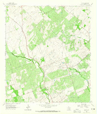
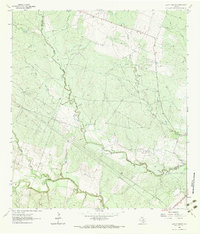
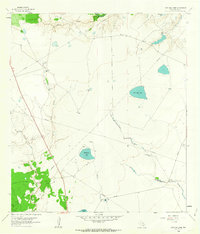 1962 Live Oak Lake1963 Print · USGSCoastal prairie and river bottomlands in Goliad County come alive in this early sixties record of ranching and energy development. Researchers can locate family landmarks like Fant Ranch and River Ranch alongside windmills and the extensive Sarco Gas Field.2 unique versions available
 - 1962 Map of Fannin, 1963 Print
 1962 Fannin1963 Print · USGSGoliad County in the early 1960s is a landscape of historic battlegrounds and active petroleum production. You can trace family roots at the Swickheimer Ranch or locate the Battlefield Mon and Mallalieu Ch near the town of Fannin.2 unique versions available
 - 1962 Map of Lott Lake, 1963 Print
 1962 Lott Lake1963 Print · USGSIn the early sixties, the San Antonio River meanders through the borders of Goliad and Victoria counties. Researchers can trace family history through sites like Lott Cem and Mt Zion Ch or locate old river crossings at Duke Bridge.2 unique versions available
 - 1962 Map of Melo, 1964 Print
 1962 Melo1964 Print · USGSSouth Texas ranching and energy infrastructure are on display in the early 1960s. Trace family landholdings and rural landmarks like the Sarco Cem, Melo Ranch, and the Southern Pacific rail line.3 unique versions available
 - 1962 Map of Hensley Lake, 1964 Print
 1962 Hensley Lake1964 Print · USGSThe San Antonio River valley in the early sixties reveals a landscape of river-bottom oxbows and rural rail sidings. Genealogists and historians can trace the Southern Pacific line to Fannin, locating the Sepenter Cem and Manahuilla Ch.2 unique versions available
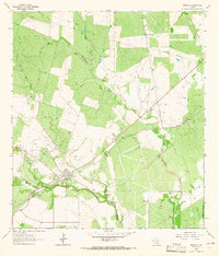
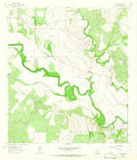
 - 1962 Map of Goliad, 1964 Print
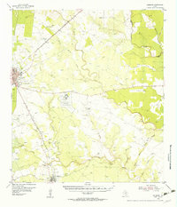
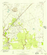
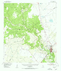
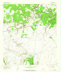
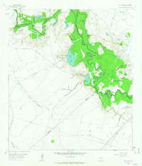
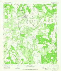
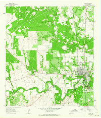 1962 Goliad1964 Print · USGSGoliad sits at a historic crossroads in the early sixties, where colonial Spanish ruins meet the mid-century river economy. Researchers can trace ancestral sites like Glendale Cem and the grounds of Presidio La Bahia (Ruins).3 unique versions available
 - 1963 Map of Tulsita, 1965 Print
 1963 Tulsita1965 Print · USGSThe Texas oil fields and cattle country come alive in the early sixties as industrial development meets rural settlement. Trace the legacy of petroleum at Burnell Oil Field, locate family roots at Refugio Cem, or follow the Southern Pacific tracks.2 unique versions available
 - 1963 Map of Meyersville, 1965 Print
 1963 Meyersville1965 Print · USGSMeyersville and Arneckeville appear at a peak of energy production in the early sixties, as gas fields began to overlay the older ranching landscape. Researchers can trace family sites at St Peter and Pauls Ch, the De Witt Sch, and St Joseph Cem.2 unique versions available
 - 1963 Map of Choate, 1965 Print
 1963 Choate1965 Print · USGSSouth Texas petroleum production and ranching define this area in the early sixties as the oil industry expanded across Karnes County. Researchers can locate the settlement of Choate, trace the Southern Pacific rail line, and find the Cabeza Creek Refinery.2 unique versions available
 - 1963 Map of Lazy F Ranch, 1965 Print
 1963 Lazy F Ranch1965 Print · USGSRanching and early energy extraction define this Bee and Goliad county borderland in the early sixties. Researchers can trace the Southern Pacific rail line, the Dallas Husky Gas Field, and local landmarks like Colony Ch.3 unique versions available
 - 1963 Map of Weesatche, 1965 Print
 1963 Weesatche1965 Print · USGSThe rural crossing of Goliad and De Witt counties comes into focus in the 1960s as a landscape of ranching and energy. Genealogists and historians can trace family ties at Weesatche Cem or locate the old community at Barnes amidst the Weesatche Gas Field.2 unique versions available
 - 1963 Map of Berclair NW, 1965 Print
 1963 Berclair NW1965 Print · USGSThe borderlands of Bee, Goliad, and Karnes Counties are captured in the early sixties as the regional energy economy expanded. Genealogists and researchers can trace local landmarks like Charco Cem, the San Antonio River, and the Pettus North Oil Field.2 unique versions available
 - 1963 Map of Berclair, 1965 Print
 1963 Berclair1965 Print · USGSGoliad County's brush country comes into focus in the early sixties as the Southern Pacific tracks bisected the village of Berclair. Researchers can trace old property boundaries at the Bee Co Goliad Co line or locate the Myers Cem near the banks of Blanco Creek.2 unique versions available
 - 1963 Map of Runge SE, 1965 Print
 1963 Runge SE1965 Print · USGSThe South Texas plains between Goliad and Karnes counties were a hub of energy production in the early sixties. Researchers can trace the layout of the Slick Oil Field and Boceta Oil Field or locate the historic Melrose (Site).2 unique versions available
 - 1963 Map of Yorktown East, 1965 Print
 1963 Yorktown East1965 Print · USGSDeWitt County's agricultural and energy landscape comes into focus in the early sixties as the oil and gas industry expanded across the ranch lands. Genealogists can trace family footprints at Rabke Cem, the Mean Treude Cem, and along the Southern Pacific rail line.2 unique versions available
 - 1963 Map of Ander, 1965 Print
 1963 Ander1965 Print · USGSThe ranchlands of Goliad and Victoria counties are captured here in the early sixties as the regional gas industry expanded across the coastal plain. Researchers can locate family landmarks like Killebrew Cem, the settlement of Weser, and the vast Meyersville Gas Field.2 unique versions available
 - 1963 Map of Charco, 1966 Print
 1963 Charco1966 Print · USGSGoliad County ranching and oil production are in full swing in the early sixties along the winding San Antonio River. Genealogists can locate several family burial grounds including John Pettus Cem and the Lost Pettus Cem near the Riverdale Site.2 unique versions available
Showing maps 1-25 of 142
Top cities of Goliad County
Frequently asked questions
- What are the different types of historical maps available for Goliad County?
- What is the oldest map of Goliad County?
- Where can I purchase historical maps of Goliad County for my home or office?
- Where can I download high-res historical maps of Goliad County?
- Are there historical topographic maps available for Goliad County?
- Is there historical aerial imagery available for Goliad County?
- Where are historical maps of Goliad County sourced from?