Old Maps of Seguin, Texas for Genealogy
Trace your family roots with 51 historic maps of Seguin. These high-res maps reveal old neighborhoods, homesites, landmarks, and streets — helping you uncover where your ancestors lived and how the area evolved over time.
- Explore historic neighborhoods: Identify where your relatives may have lived in the 1800s or 1900s.
- Compare maps over time: Trace the changes in streets, buildings, and landmarks for multi-generational research.
- Perfect for genealogy & ancestry research: Used by family historians and researchers to map out lineage and migration.
These maps are an incredible resource for exploring your personal connection to Seguin's past.
Seguin, TX maps
(51)- 1911 Map of San Marcos
 1911 San Marcos1911 Print · USGSCentral Texas at the peak of the railroad era shows a landscape of small farming communities and country schools. Genealogists can trace family footprints across Comanche Flat or locate long-gone sites like Highpoint School and Bethany Church.2 unique versions available
 - 1919 Map of San Marcos
 1919 San Marcos1919 Print · USGSTexas at the close of the Great War was a landscape of river-fed farms and emerging rail corridors between San Marcos and Lockhart. Genealogists can trace family footprints through numerous rural landmarks like Clark Chapel, High Prairie School, and Larremore.
 - 1924 Map of New Braunfels No 4
 1924 New Braunfels No 41924 Print · USGSGuadalupe County in the mid-1920s shows a landscape of river-driven industry and rural schoolhouses. Genealogists and local historians can trace family roots through landmarks like Gaudalupe College or rural hubs such as Mc Queeny and Scheffel School.
 - 1924 Map of San Marcos 3-c
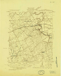
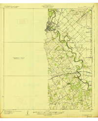
 1924 San Marcos 3-c1924 Print · USGSGuadalupe County in the mid-1920s centers on the bustling rail-and-river town of Seguin. Researchers can trace the legacy of early schools and industry, from Ilka School to the Faust Gin, across a landscape shaped by the Guadalupe River.
 - 1924 Map of San Marcos 3-d
 1924 San Marcos 3-d1924 Print · USGSGuadalupe County in the mid-1920s shows a landscape of small family farms and rural school districts clustered along the Guadalupe River. Researchers can trace early commerce and community life through landmarks like Wait Store, Capote School, and Cottonwood Spring.
 - 1925 Map of New Braunfels No 1
 1925 New Braunfels No 11925 Print · USGSCentral Texas farming communities thrive along the river as the mid-twenties approach. Researchers can trace rural lineages through numerous country schoolhouses like Austin Hill School and local landmarks such as HORTONTOWN CEMETERY and Gruene.
 - 1927 Map of New Braunfels
 1927 New Braunfels1927 Print · USGSNew Braunfels and the surrounding river valleys are captured here during the mid-twenties, when the regional rail and school networks were at their peak. Genealogists and historians can trace family locations near landmarks like Gaudalupe College, Hortontown Cemetery, and dozens of rural schoolhouses like Austin Hill School.3 unique versions available
 - 1930 Map of Seguin
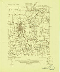
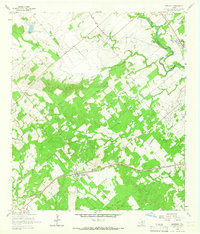
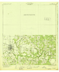 1930 Seguin1930 Print · USGSGuadalupe County at the height of the mid-twenties reflects a thriving rural economy centered on the Southern Pacific rail line. Researchers can locate numerous local landmarks including Walter Nixon Sch, the Faust Gin, and Mill Creek Salt.2 unique versions available
 - 1953 Map of Seguin, 1965 Print
 1953 Seguin1965 Print · USGSSouth Texas in the early fifties shows a thriving river-and-rail economy across the Guadalupe and Colorado basins. Genealogists and historians can trace rail routes like the Southern Pacific through Seguin, locate oil wells, or find the Gary AAF near San Marcos.4 unique versions available
 - 1954 Map of San Antonio, 1964 Print
 1954 San Antonio1964 Print · USGSSan Antonio and the Texas Hill Country are captured here in the mid-fifties, showing a landscape defined by massive military air bases and the rising Canyon Reservoir. Trace family ties through historic rail towns like D'Hanis and Castroville or explore the Cold War footprint of Lackland AFB and Randolph AFB.3 unique versions available
 - 1957 Map of San Antonio
 1957 San Antonio1957 Print · USGSSan Antonio and the Texas Hill Country are shown here during the mid-fifties, capturing the region's expanding post-war military and transportation footprint. Genealogists and local historians can trace the early residential boundaries of Alamo Heights or locate rural landmarks like St Hedwig and Medina Lake.
 - 1958 Map of Seguin
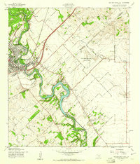
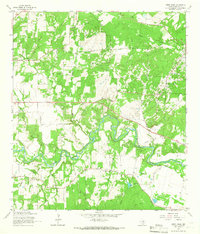
 1958 Seguin1958 Print · USGSSouth Texas in the late fifties was a network of river-valley settlements and active oilfields tied together by major rail lines. Genealogists and historians can trace family-named sites across Rabb Prairie, locate the Behring Store, or follow the Southern Pacific through Schulenburg.
 - 1958 Map of New Braunfels East, 1961 Print
 1958 New Braunfels East1961 Print · USGSThe Guadalupe River valley in the late fifties shows a landscape of small farming hamlets and emerging military aviation. Trace the locations of old schoolhouses like Booker T Washington Sch, the Gruene Siding railroad stop, and the Clear Springs Air Force Auxiliary Field.3 unique versions available
 - 1958 Map of McQueeney, 1961 Print
 1958 McQueeney1961 Print · USGSThe Guadalupe River and its late-1950s recreational landscape take center stage in this Texas survey. Trace the early development of Lake Mc Queeney, the SOUTHERN PACIFIC railroad line, and old settlements like Muehlsville and Santa Clara.3 unique versions available
 - 1964 Map of Kingsbury, 1965 Print
 1964 Kingsbury1965 Print · USGSGuadalupe and Caldwell Counties are captured here in the mid-1960s, showing the agricultural and transit landscape of the San Marcos River valley. Genealogists and local historians can trace the Southern Pacific line through Kingsbury and locate the Appling Cem or Sweet Canaan Ch.3 unique versions available
 - 1964 Map of Darst Creek, 1965 Print
 1964 Darst Creek1965 Print · USGSGuadalupe County in the mid-sixties reveals a landscape defined by the winding Guadalupe River and the local petroleum industry. Researchers can trace rural lineages at Eden Cem or locate the historic New Salem Ch and the area's extensive Oil Field infrastructure.3 unique versions available
 - 1964 Map of Seguin, 1966 Print
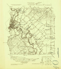
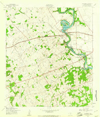
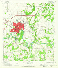 1964 Seguin1966 Print · USGSSeguin during the mid-sixties shows a thriving community centered on the Guadalupe River and the Southern Pacific rail line. Genealogists and local historians can locate early landmarks such as Riverview Cemetery, the Courthouse, and Texas Lutheran College.3 unique versions available
 - 1964 Map of Geronimo, 1966 Print
 1964 Geronimo1966 Print · USGSGeronimo and the surrounding Guadalupe County countryside are captured here in the mid-sixties, showing a landscape of small settlements and active water management. Researchers can locate family sites at San Juan Cem or Jechow Cem and trace the Navarro Sch district.3 unique versions available
 - 1985 Map of New Braunfels
 1985 New Braunfels1985 Print · USGSThe Texas Hill Country meets the growing San Antonio suburbs in the mid-1980s, showing a landscape of river-fed towns and military grounds. Trace family roots in historic Gruene or Boerne, and locate landmarks like Canyon Lake and Randolph Air Force Base.
 - 1985 Map of Seguin, 1986 Print
 1985 Seguin1986 Print · USGSCentral Texas in the mid-1980s is defined by its vital oil industry and the crossroads of major interstate and rail networks. Genealogists and historians can trace the development of Luling Oil Field, identify the site of Old Flatonia, or locate family landmarks near St James and Palmetto State Park.2 unique versions available
 - 1992 Map of New Braunfels
 1992 New Braunfels1992 Print · USGSThe San Antonio and New Braunfels corridor was expanding rapidly in the early nineties, balancing heavy military presence with Hill Country recreation. Trace the footprint of CAMP BULLIS MILITARY RESERVATION or locate old railroad stops along the Southern Pacific and Missouri Pacific lines.2 unique versions available
 - 2010 Map of Seguin, 2010 Print
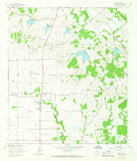
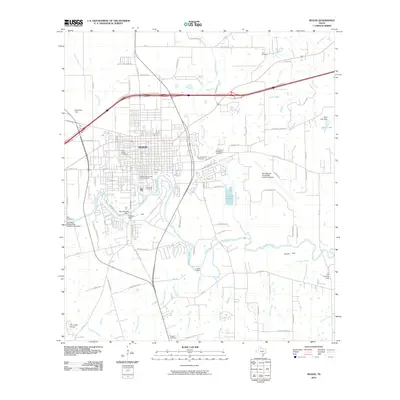 2010 Seguin2010 Print · USGSCovers Seguin, including Dugger, Guadalupe County, and other nearby areas
 - 2010 Map of Kingsbury, 2010 Print
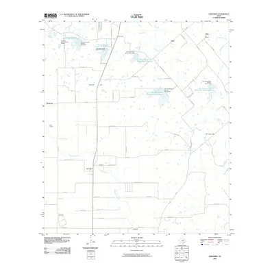
 2010 Kingsbury2010 Print · USGSCovers Seguin, including Staples, Kingsbury, and other nearby areas
 - 2010 Map of Darst Creek, 2010 Print
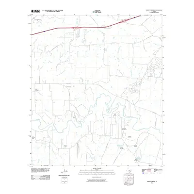 2010 Darst Creek2010 Print · USGSCovers Seguin, including Kingsbury, Guadalupe County, and other nearby areas
 - 2010 Map of Geronimo, 2010 Print
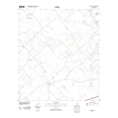
 2010 Geronimo2010 Print · USGSCovers Seguin, including Galle, Geronimo, and other nearby areas
Showing maps 1-25 of 51
Top cities near Seguin
- New Braunfels historical maps
- San Marcos historical maps
- Cibolo historical maps
- Saint Hedwig historical maps
- Marion historical maps
- Santa Clara historical maps
See more
Top neighborhoods of Seguin
- Zipp historical maps
- Muehlsville historical maps
- Villa Vista historical maps
- Joye Subdivision historical maps
Frequently asked questions
- What are the different types of historical maps available for Seguin?
- What is the oldest map of Seguin?
- Where can I purchase historical maps of Seguin for my home or office?
- Where can I download high-res historical maps of Seguin?
- Are there historical topographic maps available for Seguin?
- Is there historical aerial imagery available for Seguin?
- Where are historical maps of Seguin sourced from?