1950s Maps of Hamilton County, Texas
Explore 38 historic maps of Hamilton County from the 1950s. These maps offer a rare glimpse into what life looked like during the 1950s — showing old roads, neighborhoods, homes, and landmarks that have changed or disappeared over time.
Whether you're researching your family's past, planning a metal detecting trip, or studying how Hamilton County's landscape evolved across the 1950s, these high-resolution maps are a powerful tool for exploring the history of this region.
- Focus on a specific era: All maps on this page are from the 1950s, giving you a focused view of this time period.
- See what’s changed: Compare century-old streets, trails, and buildings to today's modern landscape using overlays and satellite layers.
- Research with precision: Use these maps for genealogy, historical research, land use analysis, or educational projects.
- View, download, or print: Maps are fully viewable online in high resolution, and can be downloaded or printed for your own records.
Start exploring Hamilton County's history through authentic maps from the 1950s. This is your window into the past.
Hamilton County, TX maps
(38)- 1954 Map of Brownwood, 1955 Print
 1954 Brownwood1955 Print · USGSCentral Texas in the early fifties shows a landscape of rail-linked cattle towns and winding river valleys before modern highway expansion. Genealogists and historians can trace family-named peaks and vanished rail stops like Trickham, Santa Anna, and the Brady Mountains.3 unique versions available
 - 1954 Map of Evant, 1956 Print
 1954 Evant1956 Print · USGSMid-century Central Texas comes to life through the springs and creek beds of Coryell and Hamilton Counties. Family historians can trace rural roots through Townsen Cem, Hines Chapel, and the USAF Practice Bombing Target near Adamsville.
 - 1954 Map of Evant, 1957 Print
 1954 Evant1957 Print · USGSEvant sits at the meeting point of three counties in the mid-1950s, serving as a crossroads for rural life and the regional cattle economy. Genealogists can trace family footprints through numerous small burial sites like Pilgrims Rest Cemetery or locate historical river landmarks such as Faubion Crossing.2 unique versions available
 - 1954 Map of Pearl, 1957 Print
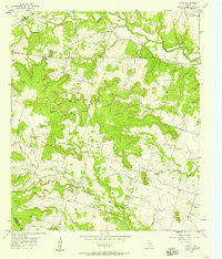 1954 Pearl1957 Print · USGSCentral Texas ranching country in the mid-1950s reveals a network of isolated settlements and vital water sources. Genealogists and historians can trace family-named landmarks like Wayback Mountain and Fletchers Point or locate the communities of Pearl and Bee House.
 - 1954 Map of Dallas, 1963 Print
 1954 Dallas1963 Print · USGSNorth Texas in the mid-fifties and early sixties reveals a landscape of rapid urban growth and water management. Genealogists and historians can trace the evolution of the metroplex through landmarks like Hensley Field, Boles Orphan Home, and the Texas & Pacific RR.4 unique versions available
 - 1954 Map of Waco, 1964 Print
 1954 Waco1964 Print · USGSCentral Texas during the mid-fifties shows a landscape defined by the expansion of Fort Hood Military Reservation and the Brazos river system. Trace the rail lines and early airfields like James Connally Air Force Base and settlements like Temple or McGregor.2 unique versions available
 - 1954 Map of Abilene, 1966 Print
 1954 Abilene1966 Print · USGSThe Texas Big Country comes into focus in the mid-1950s as petroleum and new water projects reshape the landscape. Local historians can trace the Butterfield Trail, find the Fort Phantom Hill Ruins, and locate numerous small communities along the Texas & Pacific line.2 unique versions available
 - 1955 Map of Waco
 1955 Waco1955 Print · USGSCentral Texas at the peak of the Cold War reveals a landscape defined by military expansion and major water projects. Researchers can trace the footprints of Fort Hood, the waters of Lake Waco, and regional hubs like Temple or Mexia.
 - 1955 Map of Ater, 1956 Print
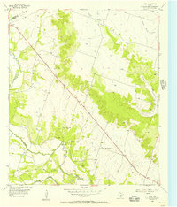 1955 Ater1956 Print · USGSCoryell County in the mid-1950s shows a rural landscape where the Leon River and 36th Division Memorial Highway meet. Researchers can trace family history at Weaver Chapel Cem or locate the Old Railroad Grade near Ater.2 unique versions available
 - 1956 Map of Gustine
 1956 Gustine1956 Print · USGSMid-century Comanche County is seen here just as the highway network was being formalized around the Leon River valley. Genealogists can trace family names through numerous rural sites like Graham Chapel Cem, Energy Sch, and the town of Gustine.
 - 1956 Map of Jonesboro
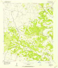 1956 Jonesboro1956 Print · USGSCoryell and Hamilton counties appear in the mid-1950s as a landscape of small farming hubs and disappearing rail lines. Researchers can trace family history at Willy Grubb Cemetery and follow the path of the Old Railroad Grade through Ireland.
 - 1956 Map of Cranfills Gap, 1957 Print
 1956 Cranfills Gap1957 Print · USGSThe mid-century landscape around Cranfills Gap was a mosaic of family-named peaks and small rural cemeteries. Researchers can trace local heritage through landmarks like The Rock Ch, the Cox-Burton Graves, and the curiously named The Baptism Hole.3 unique versions available
 - 1956 Map of Gentrys Mill, 1957 Print
 1956 Gentrys Mill1957 Print · USGSHamilton and Comanche counties appear in the mid-fifties as a landscape of established family farms and transitioning transit lines. Researchers can locate several remote burial sites like Toliver Cem and trace the path of the Old Railroad Grade past Springtown (Aband).2 unique versions available
 - 1956 Map of German Valley, 1957 Print
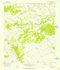 1956 German Valley1957 Print · USGSThe Texas Hill Country crossroads where Hamilton, Bosque, and Coryell Counties meet are shown here in the mid-1950s. Genealogists can trace family landmarks like German Valley Cem, Boggy Cem, and the Goar Valley Polling Booth.
 - 1956 Map of Pottsville, 1957 Print
 1956 Pottsville1957 Print · USGSHamilton County ranching and rural life are preserved here in the mid-1950s, showing the landscape before modern consolidation. Researchers can trace family sites like the Cottage Hill Cem, locate the Indian Cave, or find the now-abandoned McGirk Sch.
 - 1956 Map of Ohio, 1957 Print
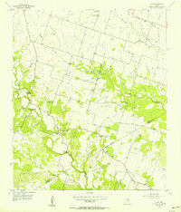 1956 Ohio1957 Print · USGSHamilton County ranchlands and rural settlements are caught mid-century, just as local schoolhouses and rail lines began to fade from the landscape. Genealogists and historians can trace the family-named Parsley Ford Crossing and Jeffries Bridge or locate the Live Oak Ch and Ohio settlement.2 unique versions available
 - 1956 Map of Hico, 1957 Print
 1956 Hico1957 Print · USGSThe Bosque River valley and the railroad town of Hico are shown here in the mid-fifties, capturing a landscape of small farming communities and historic routes. Genealogists can locate numerous rural burial sites like Tillinghouse Cem and the Springtown (Site of).2 unique versions available
 - 1956 Map of Hamilton, 1957 Print
 1956 Hamilton1957 Print · USGSHamilton and the surrounding Texas countryside are captured here in the mid-fifties as modern highways began to replace the older rail lines. Genealogists and local historians can trace family-named sites like Jeffries Bridge, West Point Cem, and the Rock House Sch (Historical).
 - 1956 Map of Hamilton West, 1957 Print
 1956 Hamilton West1957 Print · USGSHamilton was transitioning from rail to road dominance during the mid-fifties as rural life centered around small communities like Midway. Genealogists and historians can trace family roots at the Center Valley Cemetery or explore local landmarks like the Lund Valley Ch and the Old Railroad Grade.
 - 1956 Map of Fairy, 1957 Print
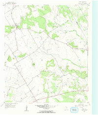 1956 Fairy1957 Print · USGSHamilton County ranching country is documented here in the mid-fifties, showing the quiet transition between the Cross Timbers and the hill country. Researchers can locate the Agee Ch, trace the old roads through Martin Gap, and find family landmarks like Stroud Mountain.2 unique versions available
 - 1956 Map of Caradan, 1957 Print
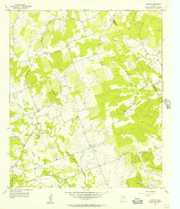 1956 Caradan1957 Print · USGSThe rural borderlands between Mills and Hamilton counties come to life in this mid-fifties survey of the Lampasas River valley. Genealogists can locate family landmarks such as the Pecan Wells Cem, Bethel Ch, and the site of the Midway Sch (Aband).
 - 1956 Map of Shive, 1957 Print
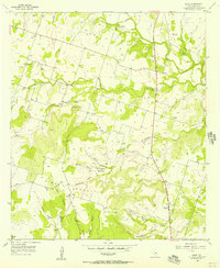 1956 Shive1957 Print · USGSHamilton County in the mid-fifties is captured here as a landscape of rural settlements and hilltop landmarks. Researchers can trace family roots at St Pauls Ch and several burial grounds, including New Hope Cemetery and Font Cemetery.
 - 1956 Map of Eidson Lake, 1957 Print
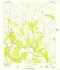 1956 Eidson Lake1957 Print · USGSCentral Texas river country is documented here in the mid-fifties as the Leon River passes by Eidson Lake. Genealogists can trace family names at Gentry Cem and Massingill Cem or locate the old Providence Ch.2 unique versions available
 - 1956 Map of Lamkin, 1957 Print
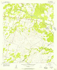 1956 Lamkin1957 Print · USGSThe Leon River valley at the Comanche and Hamilton county line reveals a quiet ranching landscape in the mid-fifties. Genealogists can trace the rural communities of Lamkin and Energy, locating landmarks like the Energy Cemetery and the Community Tabernacle.2 unique versions available
 - 1956 Map of Cutoff Mtn, 1957 Print
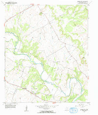 1956 Cutoff Mtn1957 Print · USGSHamilton County's river-bottom land and limestone hills are captured here in the mid-1950s as rural life centered on the Leon River. Genealogists and local historians can trace family ties at Evergreen Cem, Viertel Cem, or the namesake Cutoff Mountain.2 unique versions available
Showing maps 1-25 of 38
Top cities of Hamilton County
Frequently asked questions
- What are the different types of historical maps available for Hamilton County?
- What is the oldest map of Hamilton County?
- Where can I purchase historical maps of Hamilton County for my home or office?
- Where can I download high-res historical maps of Hamilton County?
- Are there historical topographic maps available for Hamilton County?
- Is there historical aerial imagery available for Hamilton County?
- Where are historical maps of Hamilton County sourced from?