1940s Maps of Harrison County, Texas
Explore 6 historic maps of Harrison County from the 1940s. These maps offer a rare glimpse into what life looked like during the 1940s — showing old roads, neighborhoods, homes, and landmarks that have changed or disappeared over time.
Whether you're researching your family's past, planning a metal detecting trip, or studying how Harrison County's landscape evolved across the 1940s, these high-resolution maps are a powerful tool for exploring the history of this region.
- Focus on a specific era: All maps on this page are from the 1940s, giving you a focused view of this time period.
- See what’s changed: Compare century-old streets, trails, and buildings to today's modern landscape using overlays and satellite layers.
- Research with precision: Use these maps for genealogy, historical research, land use analysis, or educational projects.
- View, download, or print: Maps are fully viewable online in high resolution, and can be downloaded or printed for your own records.
Start exploring Harrison County's history through authentic maps from the 1940s. This is your window into the past.
Harrison County, TX maps
(6)- 1943 Map of Waskom, 1954 Print
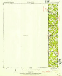 1943 Waskom1954 Print · USGSThe Texas-Louisiana borderlands in the 1940s were a network of rural schools and rail-side settlements. Genealogists can trace family footprints through numerous sites like Union Chapel, Richmond Sch, and Forest Park Cem along the interstate line.
 - 1944 Map of Kildare, 1954 Print
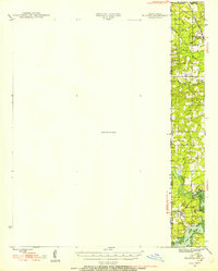 1944 Kildare1954 Print · USGSThe tri-state border region of Texas, Louisiana, and Arkansas comes alive in this mid-century survey of the bayou country. Genealogists and researchers can trace local landmarks like Mission Chapel, the settlement of Trees, and the rail stops of the Kansas City Southern.
 - 1944 Map of Caddo Lake, 1954 Print
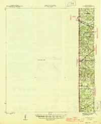
 1944 Caddo Lake1954 Print · USGSThe Texas-Louisiana borderlands come into focus in the 1940s, showing the intricate bayou networks and rural communities along the state line. Genealogists can locate family landmarks like Jefferson Forks, Shiloh Sch, and the McDonald Cem tucked between the waters of James Bayou.
 - 1945 Map of Waskom
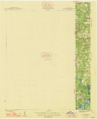
 1945 Waskom1945 Print · USGSThe Texas-Louisiana borderlands come into focus during the mid-1940s as rail and road networks began to reshape rural Harrison and Panola counties. Genealogists can trace family landmarks like Forest Park Cem, Union Chapel, and numerous schools including Waco Sch and Liberty Sch.
 - 1946 Map of Caddo Lake
 1946 Caddo Lake1946 Print · USGSThe Texas-Louisiana borderlands come into focus in the mid-1940s, showing a landscape shaped by the waters of Caddo Lake. Genealogists and local historians can trace the foundations of rural communities through sites like Latex, Republican Ch, and Shiloh Sch.
 - 1948 Map of Kildare
 1948 Kildare1948 Print · USGSThe Texas-Louisiana borderlands in the late 1940s reveal a landscape of rail-driven settlements and bayou wetlands. Genealogists and historians can trace old landmarks such as Bonham Landing, the village of Trees, and the Mission Chapel near the Caddo Parish line.
End of results
Showing maps 1-6 of 6
Top cities of Harrison County
- Marshall historical maps
- Hallsville historical maps
- Waskom historical maps
- Scottsville historical maps
- Uncertain historical maps
Frequently asked questions
- What are the different types of historical maps available for Harrison County?
- What is the oldest map of Harrison County?
- Where can I purchase historical maps of Harrison County for my home or office?
- Where can I download high-res historical maps of Harrison County?
- Are there historical topographic maps available for Harrison County?
- Is there historical aerial imagery available for Harrison County?
- Where are historical maps of Harrison County sourced from?