1980s Maps of Harrison County, Texas
Explore 9 historic maps of Harrison County from the 1980s. These maps offer a rare glimpse into what life looked like during the 1980s — showing old roads, neighborhoods, homes, and landmarks that have changed or disappeared over time.
Whether you're researching your family's past, planning a metal detecting trip, or studying how Harrison County's landscape evolved across the 1980s, these high-resolution maps are a powerful tool for exploring the history of this region.
- Focus on a specific era: All maps on this page are from the 1980s, giving you a focused view of this time period.
- See what’s changed: Compare century-old streets, trails, and buildings to today's modern landscape using overlays and satellite layers.
- Research with precision: Use these maps for genealogy, historical research, land use analysis, or educational projects.
- View, download, or print: Maps are fully viewable online in high resolution, and can be downloaded or printed for your own records.
Start exploring Harrison County's history through authentic maps from the 1980s. This is your window into the past.
Harrison County, TX maps
(9)- 1983 Map of Grand Bluff
 1983 Grand Bluff1983 Print · USGSPanola County bottomlands come into focus in the early 1980s as the Sabine River meanders through a landscape of sloughs and bluffs. Researchers can trace the river's winding course through Watt Shoals and identify local landmarks like Grand Bluff and Alligator Lake.
 - 1983 Map of Harris Chapel
 1983 Harris Chapel1983 Print · USGSPanola County in the early eighties shows a landscape defined by the winding Sabine River and its many oxbow lakes. You can trace the rural layout of Harris Chapel and Beckville, or locate landmarks like Sterrett Hill and The Sandy Hills.
 - 1983 Map of Easton
 1983 Easton1983 Print · USGSEast Texas river life and rural settlement are captured in the early eighties as the Sabine River flows through Harrison and Gregg counties. Genealogists and local historians can trace the bottomland sloughs and landmarks like Easton, Hallsville, and the Hut Horton Duck Pond.
 - 1983 Map of Lakeport
 1983 Lakeport1983 Print · USGSGregg and Harrison Counties are captured in the early eighties as the urban footprint of Longview meets the winding Sabine River. Researchers can trace the original campus of Le Tourneau College or locate family sites near Lakeport, Gum Springs, and Lake Cherokee.2 unique versions available
 - 1983 Map of Darco
 1983 Darco1983 Print · USGSHarrison County industry and river geography meet in the early eighties at the Sabine River. Researchers can trace the massive Strip Mines near Darco or locate old community landmarks like Roseborough Springs.2 unique versions available
 - 1983 Map of Colliers Creek, 1985 Print
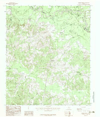
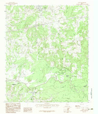
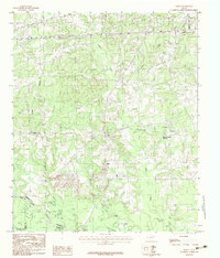
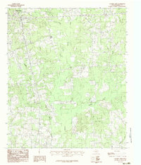 1983 Colliers Creek1985 Print · USGSHarrison County's rolling Piney Woods landscape is captured here in the early eighties as the outskirts of the county seat expand. Researchers can trace the rural communities of Gill and Five Notch and follow the winding courses of Colliers Creek and Quapaw Creek.
 - 1984 Map of Tyler
 1984 Tyler1984 Print · USGSEast Texas at the peak of its reservoir-building era shows a landscape defined by new lakes and established rail corridors. Trace the path of the St Louis Southwestern RR or locate industrial sites like the Longhorn Ordnance Works.3 unique versions available
 - 1986 Map of Marshall
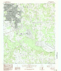
 1986 Marshall1986 Print · USGSEast Texas and the Louisiana borderlands are shown in the mid-1980s during a period of sustained industrial and energy production. Researchers can trace family roots through settlements like Ebenezer or study the impact of the Longhorn Army Ammunition Plant and Rodessa Oil Field.2 unique versions available
 - 1986 Map of Henderson
 1986 Henderson1986 Print · USGSEast Texas and the Louisiana borderlands come into focus in the 1980s as industrial energy production meets quiet rural townships. Researchers can trace family sites and local landmarks from Elysian Fields to Old Panola, alongside major features like the Strip Mine and Martin Lake State Park.2 unique versions available
End of results
Showing maps 1-9 of 9
Top cities of Harrison County
- Marshall historical maps
- Hallsville historical maps
- Waskom historical maps
- Scottsville historical maps
- Uncertain historical maps
Frequently asked questions
- What are the different types of historical maps available for Harrison County?
- What is the oldest map of Harrison County?
- Where can I purchase historical maps of Harrison County for my home or office?
- Where can I download high-res historical maps of Harrison County?
- Are there historical topographic maps available for Harrison County?
- Is there historical aerial imagery available for Harrison County?
- Where are historical maps of Harrison County sourced from?