Old Maps of Harrison County, Texas for Metal Detecting
Plan your next treasure hunt with 162 historic maps of Harrison County. Find old homesites, ghost towns, trails, and gathering spots that may be lost to time — perfect for identifying promising metal detecting locations.
- Locate forgotten sites: Uncover places like long-lost settlements, abandoned rail lines, or gathering spots.
- Plan better hunts: Use map overlays combined with LiDAR or satellite views to narrow in on historically rich areas.
- Made for detectorists: Thousands of hobbyists use these maps to discover relics, coins, and hidden history.
Use these historic maps to boost your research and find new opportunities beneath the surface of Harrison County.
Harrison County, TX maps
(162)- 1943 Map of Waskom, 1954 Print
 1943 Waskom1954 Print · USGSThe Texas-Louisiana borderlands in the 1940s were a network of rural schools and rail-side settlements. Genealogists can trace family footprints through numerous sites like Union Chapel, Richmond Sch, and Forest Park Cem along the interstate line.
 - 1944 Map of Kildare, 1954 Print
 1944 Kildare1954 Print · USGSThe tri-state border region of Texas, Louisiana, and Arkansas comes alive in this mid-century survey of the bayou country. Genealogists and researchers can trace local landmarks like Mission Chapel, the settlement of Trees, and the rail stops of the Kansas City Southern.
 - 1944 Map of Caddo Lake, 1954 Print
 1944 Caddo Lake1954 Print · USGSThe Texas-Louisiana borderlands come into focus in the 1940s, showing the intricate bayou networks and rural communities along the state line. Genealogists can locate family landmarks like Jefferson Forks, Shiloh Sch, and the McDonald Cem tucked between the waters of James Bayou.
 - 1945 Map of Waskom
 1945 Waskom1945 Print · USGSThe Texas-Louisiana borderlands come into focus during the mid-1940s as rail and road networks began to reshape rural Harrison and Panola counties. Genealogists can trace family landmarks like Forest Park Cem, Union Chapel, and numerous schools including Waco Sch and Liberty Sch.
 - 1946 Map of Caddo Lake
 1946 Caddo Lake1946 Print · USGSThe Texas-Louisiana borderlands come into focus in the mid-1940s, showing a landscape shaped by the waters of Caddo Lake. Genealogists and local historians can trace the foundations of rural communities through sites like Latex, Republican Ch, and Shiloh Sch.
 - 1948 Map of Kildare
 1948 Kildare1948 Print · USGSThe Texas-Louisiana borderlands in the late 1940s reveal a landscape of rail-driven settlements and bayou wetlands. Genealogists and historians can trace old landmarks such as Bonham Landing, the village of Trees, and the Mission Chapel near the Caddo Parish line.
 - 1956 Map of Tyler
 1956 Tyler1956 Print · USGSEast Texas was a powerhouse of oil production and rail transport during the mid-fifties, centered on the sprawling East Texas Oil Field. Researchers can trace the heritage of industrial hubs like Kilgore, military sites such as the Longhorn Ordnance Works, and many rural landmarks like Mount Enterprise.5 unique versions available
 - 1958 Map of Darco, 1960 Print
 1958 Darco1960 Print · USGSThe Sabine River bottomlands of East Texas are captured here in the late fifties, showing a landscape defined by gas fields and lignite mining. Genealogists can locate family landmarks like the Rosenwald Vocational and Agriculture Sch, Harris Chapel, and the historical Boards Ferry.2 unique versions available
 - 1958 Map of Tatum, 1960 Print
 1958 Tatum1960 Print · USGSEast Texas in the late fifties is captured here as the industrial reach of Longview meets the rural landscapes of Rusk and Harrison counties. Genealogists and historians can trace the foundations of local communities at Lake Cherokee, Sweet Home Ch, and the Tatum Gas Field.4 unique versions available
 - 1961 Map of Hallsville, 1964 Print
 1961 Hallsville1964 Print · USGSHarrison County settlement in the early sixties is anchored by the rail town of Hallsville and several rural church-centered communities. Genealogists can trace family landmarks like Springhill Cem, Antioch Ch, and the site of Walkers Mill.3 unique versions available
 - 1961 Map of Lassater, 1964 Print
 1961 Lassater1964 Print · USGSEast Texas oil and water interests converge in the early sixties as the Lake O' the Pines fills the valley. Genealogists and locals can trace the Louisiana and Arkansas rail line through Lassater or locate Pyland Cem and Mims Chapel.
 - 1961 Map of Harleton, 1964 Print
 1961 Harleton1964 Print · USGSHarrison County settlement patterns in the early sixties reveal a landscape of rural churches and family cemeteries just as Lake O' the Pines began reshaping the terrain. Genealogists and local historians can trace legacy landmarks like Harleton, Liberty Cem, and the community life centered around Piney Ch.3 unique versions available
 - 1962 Map of Marshall NW, 1963 Print
 1962 Marshall NW1963 Print · USGSEast Texas oil and timber lands come alive in the early sixties near the Marion and Harrison county line. Researchers can trace rural community life through landmarks like Woodlawn, Brantly Cem, and the Vickie Oil Field.2 unique versions available
 - 1962 Map of Marshall West, 1963 Print
 1962 Marshall West1963 Print · USGSHarrison County in the early sixties showcases the expansion of Marshall along the Texas and Pacific rail lines. Researchers can trace historic local landmarks like Wiley College, the Woodlawn Oil Field, and Grover Cem.2 unique versions available
 - 1962 Map of Woodlawn, 1963 Print
 1962 Woodlawn1963 Print · USGSHarrison County was a landscape of bayous and rail lines in the early sixties, centered on the community of Woodlawn. Local historians can trace the foundations of the area through Woodlawn Cem, Pope City, and the rural Cypress River Airfield.3 unique versions available
 - 1962 Map of Smithland, 1963 Print
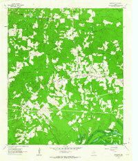 1962 Smithland1963 Print · USGSMarion County in the early sixties reveals a landscape of deep piney woods and the intricate wetlands of Caddo Lake. Genealogists and local historians can trace family ties through sites like Whalley Cem, Moseley Cem, and the rural Logan Chapel.3 unique versions available
 - 1962 Map of Jefferson, 1963 Print
 1962 Jefferson1963 Print · USGSJefferson and the surrounding bayous are shown at a peak of mid-century industrial and rail activity. Researchers can trace the legacy of East Texas through sites like Old Foundry Cem, the Refinery, and the crossing of the Texas and Pacific railroad.2 unique versions available
 - 1962 Map of Potters Point, 1964 Print
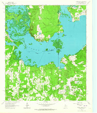 1962 Potters Point1964 Print · USGSCaddo Lake and the borderlands of Texas and Louisiana appear here in the early sixties, showing a landscape defined by its bayous and early industry. Trace the historic landings and settlements of Uncertain, Swansons Landing, and the riverside Elizabeth Ch.3 unique versions available
 - 1962 Map of Karnack, 1964 Print
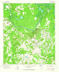 1962 Karnack1964 Print · USGSHarrison County in the early sixties reveals a landscape shaped by military industry and the winding waters of the Cypress Bayou. Researchers can trace the sprawling Longhorn Ordnance Works and the homes of Karnack and Baldwin.2 unique versions available
 - 1962 Map of Ashland, 1964 Print
 1962 Ashland1964 Print · USGSNortheast Texas in the early sixties shows a landscape of timber and rising industry as new reservoirs took shape. Genealogists and historians can locate rural hubs like Ashland and Old Diana, along with several family landmarks including Jones Cem and Shady Grove Ch.2 unique versions available
 - 1962 Map of Stricklin Springs, 1964 Print
 1962 Stricklin Springs1964 Print · USGSEast Texas energy and rural life converge in the early sixties as the Elysian Gas Field expands through Harrison County. Genealogists and local historians can trace community roots at the Elysian Fields Sch, Granbury Cem, and Stricklin Springs.2 unique versions available
 - 1962 Map of Longview Heights, 1964 Print
 1962 Longview Heights1964 Print · USGSEastern Harrison County is captured here during the early sixties as the city of Longview pushed into new residential additions. Researchers can trace the mid-century layout of Longview Heights, find old rural landmarks like Harleton Junction Station, or locate family sites at Grace Hill Cemetery.3 unique versions available
 - 1962 Map of Ore City, 1964 Print
 1962 Ore City1964 Print · USGSThe development of East Texas lakefront culture is in full swing during the early sixties as Lake O' the Pines reshapes the landscape near Ore City. Genealogists and historians can trace community roots at Cedar Grove Cem or locate old landmarks like the Mims Chapel Lookout Tower.3 unique versions available
 - 1962 Map of De Berry, 1964 Print
 1962 De Berry1964 Print · USGSPanola and Harrison counties at the dawn of the 1960s reveal a landscape of rural congregations and a growing energy sector. Genealogists can trace family sites at Evergreen Cem and Woodley Cem or locate the old Mims Chapel and Wayside Ch.
 - 1962 Map of Waskom, 1964 Print
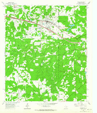 1962 Waskom1964 Print · USGSThe borderlands of East Texas and Western Louisiana were a hub of railroad and petroleum activity in the early sixties. Genealogists and historians can trace the foundations of Waskom through local landmarks like Union Chapel and the Abney High Sch.4 unique versions available
Showing maps 1-25 of 162
Top cities of Harrison County
- Marshall historical maps
- Hallsville historical maps
- Waskom historical maps
- Scottsville historical maps
- Uncertain historical maps
Frequently asked questions
- What are the different types of historical maps available for Harrison County?
- What is the oldest map of Harrison County?
- Where can I purchase historical maps of Harrison County for my home or office?
- Where can I download high-res historical maps of Harrison County?
- Are there historical topographic maps available for Harrison County?
- Is there historical aerial imagery available for Harrison County?
- Where are historical maps of Harrison County sourced from?