Old Maps of Eustace, Texas for Genealogy
Trace your family roots with 23 historic maps of Eustace. These high-res maps reveal old neighborhoods, homesites, landmarks, and streets — helping you uncover where your ancestors lived and how the area evolved over time.
- Explore historic neighborhoods: Identify where your relatives may have lived in the 1800s or 1900s.
- Compare maps over time: Trace the changes in streets, buildings, and landmarks for multi-generational research.
- Perfect for genealogy & ancestry research: Used by family historians and researchers to map out lineage and migration.
These maps are an incredible resource for exploring your personal connection to Eustace's past.
Eustace, TX maps
(23)- 1920 Map of Kemp
 1920 Kemp1920 Print · USGSNortheast Texas at the start of the 1920s reveals a landscape of railroad towns and rural post offices at the junction of three counties. Genealogists can trace early homesteads and schoolhouses near Mabank, Prairieville, and Ansley.
 - 1948 Map of Martins Mill, 1974 Print
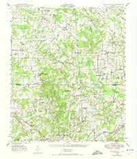 1948 Martins Mill1974 Print · USGSVan Zandt and Henderson counties are shown here in the late 1940s, revealing a landscape of small agricultural settlements and rural school districts. Genealogists can trace family roots through numerous sites like Liberty Cem, Walnut Sch, and the St Louis Southwestern Railroad corridor.
 - 1949 Map of Martins Mill
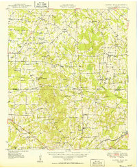 1949 Martins Mill1949 Print · USGSEast Texas rural life is preserved here in the late 1940s as farm-to-market roads linked the communities of Martins Mills and Murchison. Genealogists can trace family names through dozens of landmarks like Cool Springs Ch, Lone Star Sch, and Carter Cem.
 - 1954 Map of Dallas, 1963 Print
 1954 Dallas1963 Print · USGSNorth Texas in the mid-fifties and early sixties reveals a landscape of rapid urban growth and water management. Genealogists and historians can trace the evolution of the metroplex through landmarks like Hensley Field, Boles Orphan Home, and the Texas & Pacific RR.4 unique versions available
 - 1956 Map of Tyler
 1956 Tyler1956 Print · USGSEast Texas was a powerhouse of oil production and rail transport during the mid-fifties, centered on the sprawling East Texas Oil Field. Researchers can trace the heritage of industrial hubs like Kilgore, military sites such as the Longhorn Ordnance Works, and many rural landmarks like Mount Enterprise.5 unique versions available
 - 1957 Map of Kemp
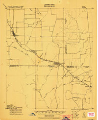
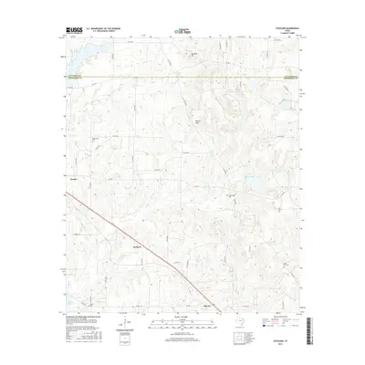
 1957 Kemp1957 Print · USGSThe rural borders of Kaufman and Henderson counties come alive in this early twentieth-century survey of the Texas and New Orleans Railroad corridor. Researchers can trace defunct post offices and local landmarks like Ansley and the remote settlement at Prairieville.
 - 1958 Map of Dallas
 1958 Dallas1958 Print · USGSNorth Texas in the late fifties shows the dramatic expansion of the Metroplex as it absorbs surrounding farm towns. Genealogists and historians can trace old rail lines like the Missouri-Kansas-Texas and locate early lakefront developments at Eagle Mountain Lake and Lake Worth Village.
 - 1960 Map of Mabank, 1961 Print
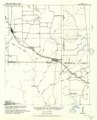
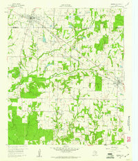 1960 Mabank1961 Print · USGSThe crossroads of Henderson, Kaufman, and Van Zandt counties are captured here in the early sixties, showing a landscape defined by small-town life and the railroad. Genealogists can trace family roots through landmarks like Elam Grove Ch, Mabank Cem, and rural outposts such as Payne Springs.5 unique versions available
 - 1984 Map of Tyler
 1984 Tyler1984 Print · USGSEast Texas at the peak of its reservoir-building era shows a landscape defined by new lakes and established rail corridors. Trace the path of the St Louis Southwestern RR or locate industrial sites like the Longhorn Ordnance Works.3 unique versions available
 - 1984 Map of Stockard
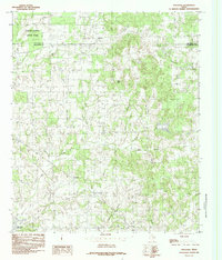 1984 Stockard1984 Print · USGSHenderson County's rural landscape is captured in the mid-eighties, showing the transition from traditional farmsteads to recreational spaces. Genealogists and researchers can trace local landmarks like Stockard, Pickens, and the early footprint of Purtis Creek State Park.
 - 1985 Map of Tyler
 1985 Tyler1985 Print · USGSEast Texas in the mid-eighties centers on the growth of Tyler and the expansive waters of Lake Palestine. Genealogists and researchers can trace family landmarks like Henry's Chapel and Browning Cem alongside the routes of the Southern Pacific RR.
 - 1985 Map of Corsicana, 1986 Print
 1985 Corsicana1986 Print · USGSNorth Central Texas was defined by its expanding water reservoirs and deep-rooted rail corridors in the mid-eighties. Researchers can trace the heritage of local communities through landmarks like Southwestern Bible Institute, Navarro College, and rural markers such as Derrs Chapel.2 unique versions available
 - 1991 Map of Tyler
 1991 Tyler1991 Print · USGSEast Texas in the early nineties centered on the expansion of Tyler and the recreational draw of Lake Palestine. Researchers can trace the layout of smaller communities like Ben Wheeler, Frankston, and Troup as they existed before modern suburban growth.
 - 2010 Map of Mabank, 2010 Print
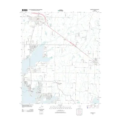
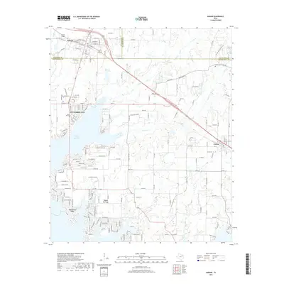
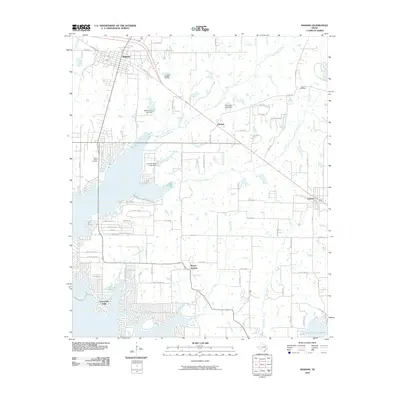 2010 Mabank2010 Print · USGSCovers Eustace, including Gun Barrel City, Mabank, and other nearby areas
 - 2010 Map of Stockard, 2010 Print
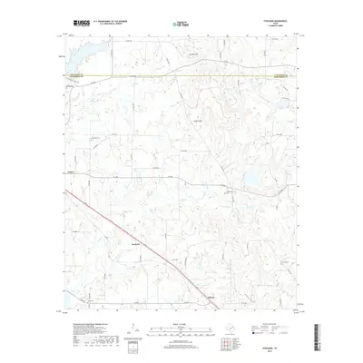
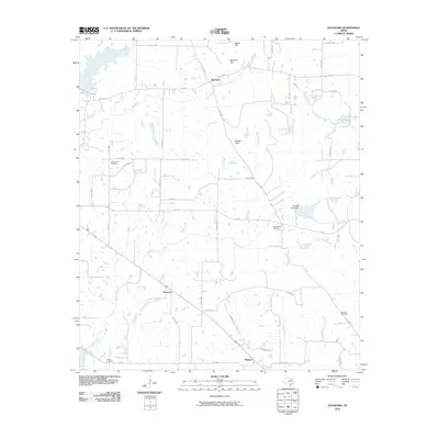 2010 Stockard2010 Print · USGSCovers Eustace, including Pickens, Stockard, and other nearby areas
 - 2012 Map of Mabank, 2012 Print
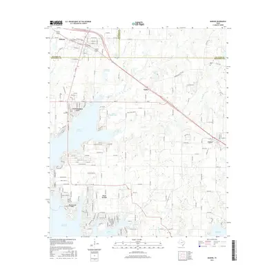
 2012 Mabank2012 Print · USGSCovers Eustace, including Gun Barrel City, Mabank, and other nearby areas
 - 2013 Map of Stockard, 2013 Print
 2013 Stockard2013 Print · USGSCovers Eustace, including Pickens, Stockard, and other nearby areas
 - 2016 Map of Stockard, 2016 Print
 2016 Stockard2016 Print · USGSCovers Eustace, including Pickens, Stockard, and other nearby areas
 - 2016 Map of Mabank, 2016 Print
 2016 Mabank2016 Print · USGSCovers Eustace, including Gun Barrel City, Mabank, and other nearby areas
 - 2019 Map of Mabank, 2019 Print
 2019 Mabank2019 Print · USGSCovers Eustace, including Gun Barrel City, Mabank, and other nearby areas
 - 2019 Map of Stockard, 2019 Print
 2019 Stockard2019 Print · USGSCovers Eustace, including Pickens, Stockard, and other nearby areas
 - 2022 Map of Mabank, 2022 Print
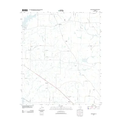
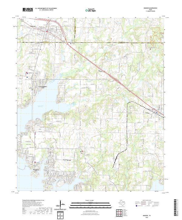 2022 Mabank2022 Print · USGSMabank and the northern shores of the Cedar Creek Reservoir are shown in the early 2020s as residential growth meets rural Texas history. Researchers can locate local landmarks like the Oaklawn Cem of Mabank and settlements like Pauline and Eustace.
 - 2022 Map of Stockard, 2022 Print
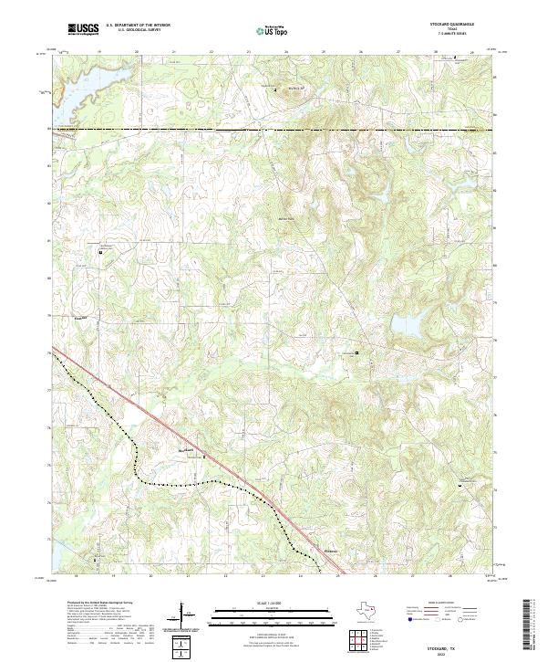 2022 Stockard2022 Print · USGSHenderson and Van Zandt counties are mapped here during a period of rural continuity and community preservation. Genealogists can trace family-named sites like Moorehead-Melton Cem, Stockard Cem, and landmarks such as Big Rock Top.
End of results
Showing maps 1-23 of 23
Top cities near Eustace
- Athens historical maps
- Gun Barrel City historical maps
- Mabank historical maps
- Tool historical maps
- Malakoff historical maps
- Kerens historical maps
See more
Frequently asked questions
- What are the different types of historical maps available for Eustace?
- What is the oldest map of Eustace?
- Where can I purchase historical maps of Eustace for my home or office?
- Where can I download high-res historical maps of Eustace?
- Are there historical topographic maps available for Eustace?
- Is there historical aerial imagery available for Eustace?
- Where are historical maps of Eustace sourced from?