2020s Maps of Malakoff, Texas
Explore 2 historic maps of Malakoff from the 2020s. These maps offer a rare glimpse into what life looked like during the 2020s — showing old roads, neighborhoods, homes, and landmarks that have changed or disappeared over time.
Whether you're researching your family's past, planning a metal detecting trip, or studying how Malakoff's landscape evolved across the 2020s, these high-resolution maps are a powerful tool for exploring the history of this region.
- Focus on a specific era: All maps on this page are from the 2020s, giving you a focused view of this time period.
- See what’s changed: Compare century-old streets, trails, and buildings to today's modern landscape using overlays and satellite layers.
- Research with precision: Use these maps for genealogy, historical research, land use analysis, or educational projects.
- View, download, or print: Maps are fully viewable online in high resolution, and can be downloaded or printed for your own records.
Start exploring Malakoff's history through authentic maps from the 2020s. This is your window into the past.
Malakoff, TX maps
(2)- 2022 Map of Malakoff, 2022 Print
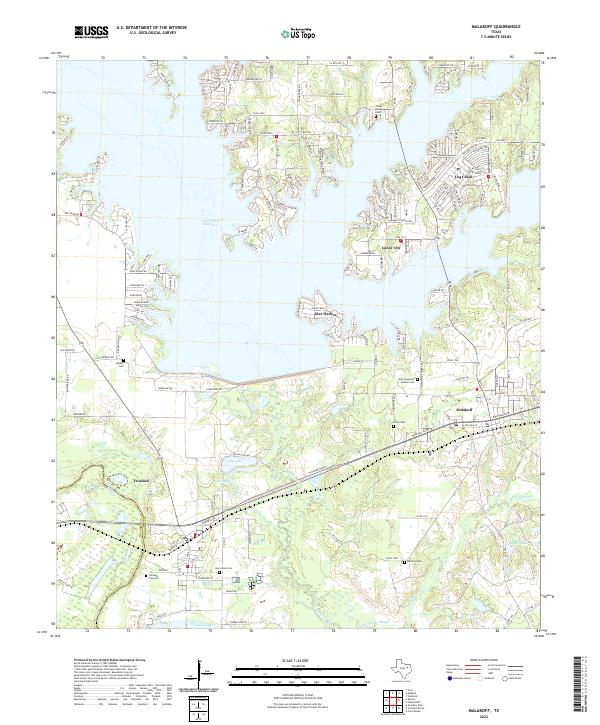 2022 Malakoff2022 Print · USGSHenderson County's lakefront and river bottomlands are captured here during the 2020s, showing the intersection of recreation and industry. Researchers can locate family sites at Antioch Cem, trace the shoreline of Cedar Creek Reservoir, or explore the rail-and-river hub of Trinidad.
 - 2022 Map of Mallard Hill, 2022 Print
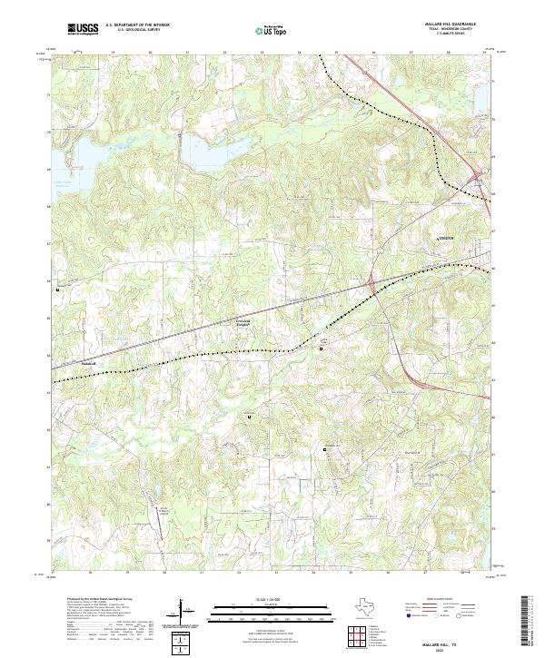 2022 Mallard Hill2022 Print · USGSHenderson County near the turn of the decade shows the continued evolution of East Texas settlements between Malakoff and Athens. Genealogists and historians can trace local heritage through Walnut Creek Cem, Smith Cem, and the Circle R Ranch Airport.
End of results
Showing maps 1-2 of 2
Top cities near Malakoff
- Athens historical maps
- Gun Barrel City historical maps
- Mabank historical maps
- Tool historical maps
- Kerens historical maps
- Seven Points historical maps
See more
Frequently asked questions
- What are the different types of historical maps available for Malakoff?
- What is the oldest map of Malakoff?
- Where can I purchase historical maps of Malakoff for my home or office?
- Where can I download high-res historical maps of Malakoff?
- Are there historical topographic maps available for Malakoff?
- Is there historical aerial imagery available for Malakoff?
- Where are historical maps of Malakoff sourced from?