1950s Maps of Weslaco, Texas
Explore 7 historic maps of Weslaco from the 1950s. These maps offer a rare glimpse into what life looked like during the 1950s — showing old roads, neighborhoods, homes, and landmarks that have changed or disappeared over time.
Whether you're researching your family's past, planning a metal detecting trip, or studying how Weslaco's landscape evolved across the 1950s, these high-resolution maps are a powerful tool for exploring the history of this region.
- Focus on a specific era: All maps on this page are from the 1950s, giving you a focused view of this time period.
- See what’s changed: Compare century-old streets, trails, and buildings to today's modern landscape using overlays and satellite layers.
- Research with precision: Use these maps for genealogy, historical research, land use analysis, or educational projects.
- View, download, or print: Maps are fully viewable online in high resolution, and can be downloaded or printed for your own records.
Start exploring Weslaco's history through authentic maps from the 1950s. This is your window into the past.
Weslaco, TX maps
(7)- 1953 Map of Brownsville
 1953 Brownsville1953 Print · USGSSouth Texas ranchlands and the Lower Rio Grande Valley are captured here in the early fifties as the region's irrigation and shipping networks expanded. Genealogists and historians can trace family landholdings like Tecolote Ranch or follow the route of the St Louis Brownsville and Mexico rail line through Sebastian and Yturria.
 - 1954 Map of McAllen
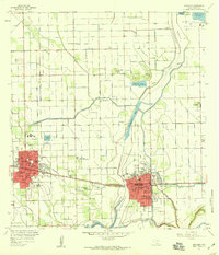
 1954 McAllen1954 Print · USGSCovers Weslaco, including Reynosa, McAllen, and other nearby areas
 - 1956 Map of Mercedes, 1959 Print
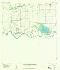
 1956 Mercedes1959 Print · USGSThe Rio Grande Valley thrives in the mid-fifties as irrigation networks and the Missouri Pacific railroad drive the expansion of Weslaco and Mercedes. Researchers can trace old school sites like South Palm Gardens School or locate family plots at Highland Memorial Cemetery.3 unique versions available
 - 1956 Map of Progreso, 1959 Print
 1956 Progreso1959 Print · USGSThe Lower Rio Grande Valley in the late fifties was a landscape of intensive irrigation and river-driven commerce. Genealogists and historians can trace family landholdings at San Pedro Ranch, the international crossing at Progreso, and early industry at the Brick Kilns.4 unique versions available
 - 1956 Map of Brownsville, 1969 Print
 1956 Brownsville1969 Print · USGSThe Texas-Mexico borderlands and the Gulf coast come alive in this mid-century survey of the Rio Grande Valley. Genealogists and historians can trace the reach of the Missouri Pacific rail lines through citrus country to schools like Las Yescas and Palm Grove.2 unique versions available
 - 1956 Map of Port Isabel, 1983 Print
 1956 Port Isabel1983 Print · USGSCoastal Texas and the Rio Grande Valley are shown here in the mid-twentieth century as the region balanced intensive agriculture with maritime trade. Researchers can trace historic rail lines like the SOUTHERN PACIFIC and locate rural landmarks such as Las Yescas Sch or the Armstrong Ranch.
 - 1957 Map of Mc Allen, 1962 Print
 1957 Mc Allen1962 Print · USGSThe South Texas borderlands emerge in the late fifties as a hub of energy production and military activity. Researchers can trace the river economy through Rio Grande City, find the Brewster School, and locate the Moore Air Force Base.2 unique versions available
End of results
Showing maps 1-7 of 7
Top cities near Weslaco
- McAllen historical maps
- Edinburg historical maps
- Harlingen historical maps
- Pharr historical maps
- San Juan historical maps
- Alamo historical maps
See more
Top neighborhoods of Weslaco
- Anaqua Addition Colonia historical maps
- Bellaire Colonia historical maps
- West Highway Colonia historical maps
- Citrus Retreat Colonia historical maps
- Westgate Estates Colonia historical maps
- Olivarez Number 1 Colonia historical maps
See more
Frequently asked questions
- What are the different types of historical maps available for Weslaco?
- What is the oldest map of Weslaco?
- Where can I purchase historical maps of Weslaco for my home or office?
- Where can I download high-res historical maps of Weslaco?
- Are there historical topographic maps available for Weslaco?
- Is there historical aerial imagery available for Weslaco?
- Where are historical maps of Weslaco sourced from?