Old Maps of Hill County, Texas for Hiking & Exploration
Hike through history with 193 historic maps of Hill County. Explore old trails, ghost towns, and forgotten backroads — perfect for outdoor adventurers and local explorers.
- Rediscover forgotten places: Map out old mining camps, roads, and footpaths that no longer exist on modern maps.
- Layer with modern tools: Combine with LiDAR or satellite views to plan hikes through historical terrain.
- Made for exploration: Popular among hikers, overlanders, and local history lovers.
Use these maps to find adventure and explore the hidden past of Hill County.
Hill County, TX maps
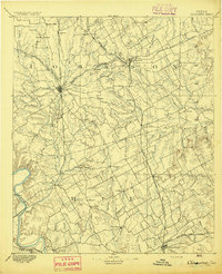
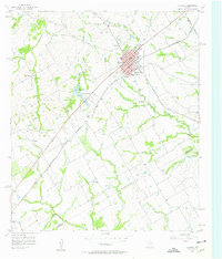
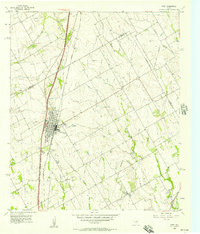
(193)- 1891 Map of Cleburne
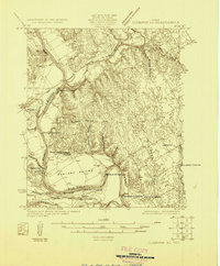
 1891 Cleburne1891 Print · USGSNorth Texas in the late nineteenth century was a land transformed by new iron rails and established river crossings. Genealogists and researchers can trace the early footprints of Cleburne and Hillsboro alongside vanished stops like Port Graham and Files Valley.
 - 1892 Map of Waco
 1892 Waco1892 Print · USGSCentral Texas was rapidly expanding during the 1890s as a rail and river commerce hub. Genealogists and researchers can trace the early footprints of Waco and its surrounding communities like China Springs, Valley Mills, and West along five distinct railway lines.6 unique versions available
 - 1894 Map of Cleburne
 1894 Cleburne1894 Print · USGSNorth Central Texas was a burgeoning rail and cattle hub in the late nineteenth century. Genealogists and historians can trace the growth of Cleburne and Hillsboro alongside vanished river landings like Fort Graham and Kimball on the Brazos River.5 unique versions available
 - 1920 Map of Waco
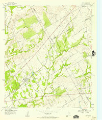
 1920 Waco1920 Print · USGSWaco and its surrounding rail corridors are captured in high detail shortly after the first World War. Researchers can trace the legacy of Rifle Range Camp MacArthur and vanished river crossings like Greenwoods Ferry and Old Towash.
 - 1920 Map of Mart
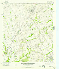
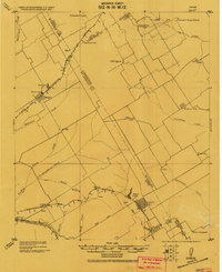 1920 Mart1920 Print · USGSCentral Texas at the dawn of the 1920s shows a landscape of busy rail junctions and small post office hubs. Researchers can trace rural lineages through William's School, the community at Axtell P.O., and the Navasota River bottomlands.
 - 1924 Map of Cleburne 3-B
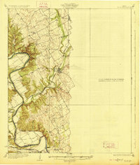
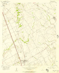
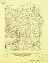 1924 Cleburne 3-B1924 Print · USGSNorth of the Brazos River in the mid-1920s, this area shows a landscape of rural schools and winding creek hollows. Genealogists and historians can trace the early rail influence through Rio Vista and Blum or find family-named landmarks like Klondike Ranch and Plain View School.
 - 1924 Map of Waco 2-b
 1924 Waco 2-b1924 Print · USGSBosque and Hill Counties appear here in the mid-twenties, centered on the winding Brazos River before later landscape changes. Researchers can trace rural life through numerous sites like Towash, Crackerbox School, and the White Ranch.
 - 1924 Map of Cleburne 3-C
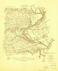
 1924 Cleburne 3-C1924 Print · USGSThe Brazos River valley at the Bosque and Hill County line is shown here in the mid-1920s when river crossings still defined local travel. Researchers can locate the site of Fort Graham, the Steiner Valley School, and family landmarks like the Heath Cem.
 - 1927 Map of Blum
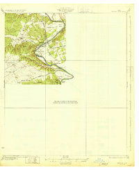
 1927 Blum1927 Print · USGSThe Brazos River valley and the rail towns of Hill and Bosque Counties are captured here in the mid-twenties. Genealogists can trace rural landmarks like Plainview School, Heath Cem, and historic river fords like Ft Graham Crossing.2 unique versions available
 - 1931 Map of Whitney
 1931 Whitney1931 Print · USGSCentral Texas river life in the early twenties centers on the winding Brazos River before the era of modern dams. Genealogists can trace local school districts like Crackerbox Sch and river crossings such as Greenwade Bridge.2 unique versions available
 - 1931 Map of Valley Mills
 1931 Valley Mills1931 Print · USGSCentral Texas river valleys define the landscape in the mid-1920s, showing a rural network of farm-to-market crossings. Genealogists can trace family footprints near Speegleville or old meeting spots like Shiloh Ch and Caldwell Crossing.2 unique versions available
 - 1954 Map of Dallas, 1963 Print
 1954 Dallas1963 Print · USGSNorth Texas in the mid-fifties and early sixties reveals a landscape of rapid urban growth and water management. Genealogists and historians can trace the evolution of the metroplex through landmarks like Hensley Field, Boles Orphan Home, and the Texas & Pacific RR.4 unique versions available
 - 1954 Map of Waco, 1964 Print
 1954 Waco1964 Print · USGSCentral Texas during the mid-fifties shows a landscape defined by the expansion of Fort Hood Military Reservation and the Brazos river system. Trace the rail lines and early airfields like James Connally Air Force Base and settlements like Temple or McGregor.2 unique versions available
 - 1955 Map of Waco
 1955 Waco1955 Print · USGSCentral Texas at the peak of the Cold War reveals a landscape defined by military expansion and major water projects. Researchers can trace the footprints of Fort Hood, the waters of Lake Waco, and regional hubs like Temple or Mexia.
 - 1956 Map of Hubbard
 1956 Hubbard1956 Print · USGSHubbard and the surrounding Blackland Prairie country are captured here in the mid-1950s as a vital railroad and farming hub. Genealogists can locate several rural burial grounds, including Fairview Cemetery and Valley View Cem, alongside the Phyllis Wheatly Sch.3 unique versions available
 - 1956 Map of Penelope, 1957 Print
 1956 Penelope1957 Print · USGSThe Blackland Prairie of Hill and McLennan Counties was deeply tied to the Missouri Pacific railroad in the mid-fifties. Genealogists can trace family footprints through numerous rural burial sites like the Czech National Cem, Tabola Cem, and George Newton Cem.2 unique versions available
 - 1956 Map of Axtell, 1957 Print
 1956 Axtell1957 Print · USGSMid-century McLennan and Hill counties appear here at a busy rail-and-creek intersection just before significant modernization. Genealogists can trace rural family roots at TK Cem or Shead Cem, and follow the St Louis Southwestern rail line through Axtell.2 unique versions available
 - 1956 Map of Abbott, 1957 Print
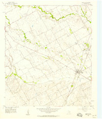
 1956 Abbott1957 Print · USGSHill County agricultural life and infrastructure are captured in the mid-fifties, just as highway expansion began to reshape the landscape. Researchers can locate family roots at Jessie Cem or trace the early rail economy through the Abbott and Winslow depots.2 unique versions available
 - 1956 Map of West, 1957 Print
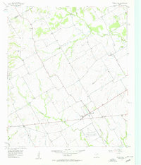
 1956 West1957 Print · USGSWest and the McLennan-Hill county line are captured here in the mid-1950s at a peak of rail and road connectivity. Researchers can trace family roots at National Cem or locate community hubs like the St Martins Sch and the local Rodeo Stadium.2 unique versions available
 - 1957 Map of Irene
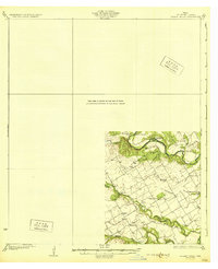
 1957 Irene1957 Print · USGSCentral Texas prairie life is captured here in the late fifties, showing a landscape defined by managed waterways and small rail-side communities. Genealogists can locate family landmarks like Salem Cem, the Antioch Ch, and the town of Pelham.3 unique versions available
 - 1957 Map of Aquilla
 1957 Aquilla1957 Print · USGSThe borderlands of Hill and McLennan counties come into focus during the late 1950s as a landscape of creekside farms and rail-side towns. Genealogists and local historians can pinpoint the Stotts Chapel Ch, Patten Lake, and the town of Aquilla.3 unique versions available
 - 1957 Map of Peoria
 1957 Peoria1957 Print · USGSHill County is shown in the mid-1950s as a landscape of rural communities and evolving infrastructure just west of the county seat. Researchers can locate local landmarks like Peoria, Vaughan, and several family burial grounds including Hickey Cem and Odom Cem.2 unique versions available
 - 1957 Map of Prairie Hill
 1957 Prairie Hill1957 Print · USGSLimestone County in the late fifties remains a landscape of quiet creek-side communities and aviation history. Researchers can trace rural lineages through Mt Antioch Cem or locate the site of the Prairie Hill Air Force Auxiliary Airfield.2 unique versions available
 - 1957 Map of Malone, 1958 Print
 1957 Malone1958 Print · USGSHill County in the mid-fifties shows a landscape of rail-connected towns and rural community centers. Genealogists can locate several family landmarks and burial sites, including Salem Cem, Burross Cem, and the Salem Sch near Malone.2 unique versions available
 - 1957 Map of China Springs, 1958 Print
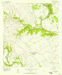 1957 China Springs1958 Print · USGSCentral Texas farmland meets the winding Brazos River in the late fifties, showcasing a rural landscape defined by river bends and creek valleys. Genealogists can locate family landmarks like Patrick Cem, Oak Grove Ch, and the settlement of Erath.4 unique versions available
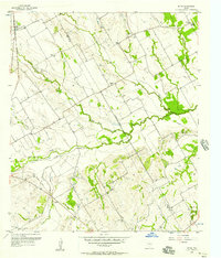
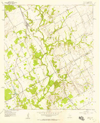
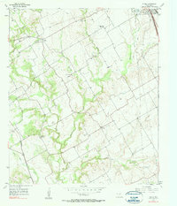
Showing maps 1-25 of 193
Top cities of Hill County
- Hillsboro historical maps
- Whitney historical maps
- Itasca historical maps
- Hubbard historical maps
- Blum historical maps
- Abbott historical maps
See more
Frequently asked questions
- What are the different types of historical maps available for Hill County?
- What is the oldest map of Hill County?
- Where can I purchase historical maps of Hill County for my home or office?
- Where can I download high-res historical maps of Hill County?
- Are there historical topographic maps available for Hill County?
- Is there historical aerial imagery available for Hill County?
- Where are historical maps of Hill County sourced from?