1900s (20th Century) Maps of Hillsboro, Texas
Explore 11 historic maps of Hillsboro from the 1900s (20th Century). These maps offer a rare glimpse into what life looked like during the 1900s — showing old roads, neighborhoods, homes, and landmarks that have changed or disappeared over time.
Whether you're researching your family's past, planning a metal detecting trip, or studying how Hillsboro's landscape evolved across the 1900s, these high-resolution maps are a powerful tool for exploring the history of this region.
- Focus on a specific era: All maps on this page are from the 1900s, giving you a focused view of this time period.
- See what’s changed: Compare century-old streets, trails, and buildings to today's modern landscape using overlays and satellite layers.
- Research with precision: Use these maps for genealogy, historical research, land use analysis, or educational projects.
- View, download, or print: Maps are fully viewable online in high resolution, and can be downloaded or printed for your own records.
Start exploring Hillsboro's history through authentic maps from the 1900s. This is your window into the past.
Hillsboro, TX maps
(11)- 1920 Map of Waco
 1920 Waco1920 Print · USGSWaco and its surrounding rail corridors are captured in high detail shortly after the first World War. Researchers can trace the legacy of Rifle Range Camp MacArthur and vanished river crossings like Greenwoods Ferry and Old Towash.
 - 1954 Map of Dallas, 1963 Print
 1954 Dallas1963 Print · USGSNorth Texas in the mid-fifties and early sixties reveals a landscape of rapid urban growth and water management. Genealogists and historians can trace the evolution of the metroplex through landmarks like Hensley Field, Boles Orphan Home, and the Texas & Pacific RR.4 unique versions available
 - 1954 Map of Waco, 1964 Print
 1954 Waco1964 Print · USGSCentral Texas during the mid-fifties shows a landscape defined by the expansion of Fort Hood Military Reservation and the Brazos river system. Trace the rail lines and early airfields like James Connally Air Force Base and settlements like Temple or McGregor.2 unique versions available
 - 1955 Map of Waco
 1955 Waco1955 Print · USGSCentral Texas at the peak of the Cold War reveals a landscape defined by military expansion and major water projects. Researchers can trace the footprints of Fort Hood, the waters of Lake Waco, and regional hubs like Temple or Mexia.
 - 1956 Map of Abbott, 1957 Print
 1956 Abbott1957 Print · USGSHill County agricultural life and infrastructure are captured in the mid-fifties, just as highway expansion began to reshape the landscape. Researchers can locate family roots at Jessie Cem or trace the early rail economy through the Abbott and Winslow depots.2 unique versions available
 - 1957 Map of Peoria
 1957 Peoria1957 Print · USGSHill County is shown in the mid-1950s as a landscape of rural communities and evolving infrastructure just west of the county seat. Researchers can locate local landmarks like Peoria, Vaughan, and several family burial grounds including Hickey Cem and Odom Cem.2 unique versions available
 - 1958 Map of Dallas
 1958 Dallas1958 Print · USGSNorth Texas in the late fifties shows the dramatic expansion of the Metroplex as it absorbs surrounding farm towns. Genealogists and historians can trace old rail lines like the Missouri-Kansas-Texas and locate early lakefront developments at Eagle Mountain Lake and Lake Worth Village.
 - 1966 Map of Hillsboro West, 1968 Print
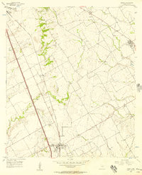
 1966 Hillsboro West1968 Print · USGSHill County is captured in the mid-sixties as the local rail and agricultural networks still defined the landscape. Genealogists and historians can trace family locations near Mayfield, locate the Woodbury Cem, or follow the Old Railroad Grade through the countryside.2 unique versions available
 - 1966 Map of Hillsboro East, 1968 Print
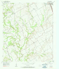
 1966 Hillsboro East1968 Print · USGSHillsboro was transitioning into a modern regional hub in the mid-1960s, balanced between its rail-road heritage and new educational institutions. Trace the development of Hill Jr College and Katy Lake, or locate family sites near Park Ridge Cem and Love View Ch.2 unique versions available
 - 1985 Map of Cleburne
 1985 Cleburne1985 Print · USGSThe Brazos River valley and its major mid-century reservoirs dominate this North Central Texas landscape during the 1980s. Local researchers can trace family roots through sites like Mt Carmel Ch, Oak Hill Sch, and the unique river bends near Glen Rose.2 unique versions available
 - 1985 Map of Waco
 1985 Waco1985 Print · USGSCentral Texas in the mid-eighties shows a landscape of river-fed lakes and bustling transit hubs as the region expanded. Genealogists and historians can trace rail lines like the Missouri Kansas Texas or locate sites such as Rosemound Cem and Meridian State Park.2 unique versions available
End of results
Showing maps 1-11 of 11
Top cities near Hillsboro
- West historical maps
- Italy historical maps
- Whitney historical maps
- Itasca historical maps
- Milford historical maps
- Abbott historical maps
See more
Top neighborhoods of Hillsboro
Frequently asked questions
- What are the different types of historical maps available for Hillsboro?
- What is the oldest map of Hillsboro?
- Where can I purchase historical maps of Hillsboro for my home or office?
- Where can I download high-res historical maps of Hillsboro?
- Are there historical topographic maps available for Hillsboro?
- Is there historical aerial imagery available for Hillsboro?
- Where are historical maps of Hillsboro sourced from?