1900s (20th Century) Maps of Hockley County, Texas
Explore 36 historic maps of Hockley County from the 1900s (20th Century). These maps offer a rare glimpse into what life looked like during the 1900s — showing old roads, neighborhoods, homes, and landmarks that have changed or disappeared over time.
Whether you're researching your family's past, planning a metal detecting trip, or studying how Hockley County's landscape evolved across the 1900s, these high-resolution maps are a powerful tool for exploring the history of this region.
- Focus on a specific era: All maps on this page are from the 1900s, giving you a focused view of this time period.
- See what’s changed: Compare century-old streets, trails, and buildings to today's modern landscape using overlays and satellite layers.
- Research with precision: Use these maps for genealogy, historical research, land use analysis, or educational projects.
- View, download, or print: Maps are fully viewable online in high resolution, and can be downloaded or printed for your own records.
Start exploring Hockley County's history through authentic maps from the 1900s. This is your window into the past.
Hockley County, TX maps
(36)- 1954 Map of Brownfield, 1975 Print
 1954 Brownfield1975 Print · USGSThe High Plains of the Texas-New Mexico border are captured here in the mid-twentieth century, as ranching and oil extraction shaped the Llano Estacado. Genealogists and historians can trace small rural centers like Lums Chapel, Hillburn City, and the Friendship Sch amid a landscape of windmills.2 unique versions available
 - 1957 Map of Anton, 1958 Print
 1957 Anton1958 Print · USGSThe South Plains of Texas come alive in the late fifties, showcasing the intersection of ranching and oil production. Trace family roots and vanished infrastructure through the Anton-Irish Oil Field, the Hardy Sch, and the depot at Anton.
 - 1957 Map of Meadow, 1958 Print
 1957 Meadow1958 Print · USGSThe West Texas cotton and rail corridor comes alive in this mid-century survey of the High Plains. Genealogists and local historians can trace the foundations of Meadow and Ropesville or locate family sites near Lakeview Ch and the Meadow Cem.
 - 1957 Map of Wolfforth, 1958 Print
 1957 Wolfforth1958 Print · USGSThe High Plains of West Texas are captured here in the late fifties as military and oil interests expanded. Researchers can trace the layout of Reese Air Force Base, find the Smyer Oil Field, and locate the Bradford Sch.
 - 1958 Map of Brownfield
 1958 Brownfield1958 Print · USGSThe High Plains of the Texas-New Mexico border are captured here during a mid-century oil boom. Genealogists and historians can trace old community sites like Lums Chapel and Tokio alongside the vast Levelland and Slaughter Oil and Gas Field.
 - 1962 Map of Brownfield
 1962 Brownfield1962 Print · USGSThe High Plains of Texas and New Mexico are captured in the early sixties as a thriving hub of oil production and ranching. Researchers can trace the industrial footprint of the Levelland and Slaughter Oil and Gas Field or locate smaller towns like Sundown and Littlefield.
 - 1964 Map of Oklahoma Flat, 1966 Print
 1964 Oklahoma Flat1966 Print · USGSThe Texas Panhandle ranching country is captured here in the early sixties, showing the intersection of cattle country and oil production. Researchers can locate the historic Yellow House Ranch and trace the drainage of Yellow House Draw past Oklahoma Flat.2 unique versions available
 - 1964 Map of Pep, 1966 Print
 1964 Pep1966 Print · USGSThe rural community of Pep sits at the four-county junction of the High Plains during the mid-sixties. Local researchers can trace family landmarks like St Philips Cem, find numerous Wells, and follow the seasonal path of Yellow House Draw.
 - 1964 Map of Lums Chapel, 1966 Print
 1964 Lums Chapel1966 Print · USGSHockley and Lamb County at the mid-sixties show a landscape of oil production and high plains agriculture. Trace the Panhandle and Santa Fe rail line or locate the Anton West Oil Field and the rural center of Lums Chapel.
 - 1964 Map of Whitharral, 1968 Print
 1964 Whitharral1968 Print · USGSHockley County agriculture and oil production are in focus here during the mid-sixties. Researchers can trace rural community foundations at Whitharral, locating family roots near Whitharral Cem and the local Hodges Ch.
 - 1965 Map of Levelland West, 1966 Print
 1965 Levelland West1966 Print · USGSLevelland and the surrounding High Plains are shown here at the height of the mid-century oil boom. Genealogists and historians can trace the town grid out to the Slaughter and Levelland Oil Field, locating the Fairview Ch, Cem, and Houston Hospital.
 - 1965 Map of Sundown, 1966 Print
 1965 Sundown1966 Print · USGSThe Texas High Plains oil economy is on full display in the mid-1960s as extraction grids define the landscape around the town of Sundown. Researchers can trace the massive Slaughter and Levelland Gas and Oil Field and the rural settlement at Clauene.
 - 1965 Map of Levelland East, 1966 Print
 1965 Levelland East1966 Print · USGSHockley County at the height of the 1960s reveals a thriving hub of education and oil-field activity. Local researchers can trace the early layout of South Plains Jr College and locate vanished landmarks like the Drive-in Theater and Carver Sch.2 unique versions available
 - 1965 Map of Plains 1 NE, 1966 Print
 1965 Plains 1 NE1966 Print · USGSMid-century West Texas comes into focus as a center of petroleum and rail activity on the high plains. Researchers can trace the sprawling Levelland and Slaughter Oil and Gas Field, the Girls Town USA settlement, and the Atchison Topeka and Santa Fe line.2 unique versions available
 - 1965 Map of Hester Ranch, 1966 Print
 1965 Hester Ranch1966 Print · USGSHockley County was a hub of energy production and ranching in the mid-1960s. Researchers can trace the layout of the Levelland and Slaughter Oil and Gas Field and find local landmarks like the Hester Ranch and Center Point Cotton Gin.
 - 1965 Map of Pettit, 1966 Print
 1965 Pettit1966 Print · USGSThe High Plains of West Texas are captured in the mid-1960s as petroleum production transformed the rural landscape. Researchers can trace the extensive Levelland and Slaughter Oil and Gas Field and local landmarks like Pettit and Whiteface Farms.2 unique versions available
 - 1965 Map of Lockettville, 1966 Print
 1965 Lockettville1966 Print · USGSThe High Plains of West Texas are captured here in the mid-1960s, a period of booming petroleum production and agricultural development. Researchers can locate specific industrial landmarks like the Cotton Gin and trace the extent of the West Ropes Oil Field near Lockettville.
 - 1965 Map of Whiteface, 1966 Print
 1965 Whiteface1966 Print · USGSThe High Plains of West Texas are captured in the mid-sixties, dominated by the vast Levelland and Slaughter Oil and Gas Field. Trace the industrial development of Whiteface along the Atchison Topeka and Santa Fe railroad.
 - 1976 Map of Anton SW, 1978 Print
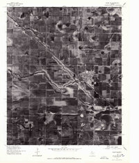 1976 Anton SW1978 Print · USGSThe High Plains of West Texas are shown in the mid-1970s, characterized by vast agricultural grids and unique playa lake formations. Genealogists and local historians can trace the development of Anton and the smaller site at Bainer along the primary transportation corridor.
 - 1976 Map of Wolfforth NW, 1978 Print
 1976 Wolfforth NW1978 Print · USGSCovers Hockley County, including United States, Texas, and other nearby areas
 - 1976 Map of Wolfforth SE, 1978 Print
 1976 Wolfforth SE1978 Print · USGSLubbock County agricultural and military life are preserved in this 1970s aerial survey. Trace the layout of the airfield at Reese Village and see the early development of Wolfforth amidst a patchwork of center-pivot irrigation fields.
 - 1976 Map of Meadow NE, 1978 Print
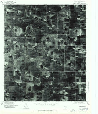 1976 Meadow NE1978 Print · USGSAgricultural patterns dominate the Lubbock County landscape in the mid-seventies, showing the precise grid of West Texas farming. Researchers can locate family operations like the Mc Nabb Farm Airport and trace the evolution of local irrigation systems.
 - 1976 Map of Wolfforth NE, 1978 Print
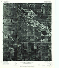 1976 Wolfforth NE1978 Print · USGSThe High Plains of West Texas appear in detail in this mid-seventies orthophoto, showing the intensive agricultural grid near Lubbock. Researchers can trace the meandering path of Yellow House Draw as it cuts through a landscape defined by circular irrigation patterns and section lines.
 - 1976 Map of Meadow NW, 1978 Print
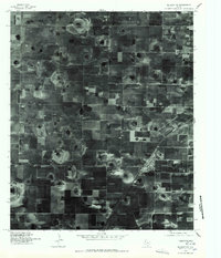 1976 Meadow NW1978 Print · USGSHockley County agriculture is captured in great detail during the mid-seventies, showing the intersection of industrial farming and small-town life. Researchers can trace the street grid and rail siding of Ropesville alongside the distinct circular patterns of High Plains irrigation.
 - 1976 Map of Anton SE, 1978 Print
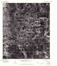 1976 Anton SE1978 Print · USGSThe Lubbock plains in the mid-1970s show a highly organized landscape of industrial agriculture and rural roads. Historians and researchers can locate the settlement of Roundup and trace the administrative COUNTY LINE through the meticulously gridded farmsteads.2 unique versions available
Showing maps 1-25 of 36
Top cities of Hockley County
- Levelland historical maps
- Sundown historical maps
- Anton historical maps
- Smyer historical maps
- Ropesville historical maps
- Whitharral historical maps
See more
Frequently asked questions
- What are the different types of historical maps available for Hockley County?
- What is the oldest map of Hockley County?
- Where can I purchase historical maps of Hockley County for my home or office?
- Where can I download high-res historical maps of Hockley County?
- Are there historical topographic maps available for Hockley County?
- Is there historical aerial imagery available for Hockley County?
- Where are historical maps of Hockley County sourced from?