Old Maps of Greenville, Texas for Academic Research
Study the evolution of Greenville with 11 high-resolution historic maps. Whether you're teaching, researching, or modeling changes in land use, these maps provide essential visual documentation of urban, environmental, and geographic change.
- Analyze long-term change: Track patterns in development, transportation, and natural features.
- Ideal for environmental or urban studies: Support academic projects with primary historical map data.
- Use in the classroom or lab: Educators and researchers rely on these maps to bring historical context to life.
These maps are a powerful tool for teaching, research, and visualizing how Greenville has changed over the decades.
Greenville, TX maps
(11)- 1954 Map of Sherman, 1964 Print
 1954 Sherman1964 Print · USGSThe Red River valley and North Texas plains are captured here in the mid-fifties, showing the region as new reservoirs like Lake Texoma and Lavon Reservoir reshaped the land. Genealogists can trace family roots through specific local landmarks like Courtney P O, Pilot Grove Sch, and New Hope Ch.2 unique versions available
 - 1958 Map of Sherman, 1959 Print
 1958 Sherman1959 Print · USGSNorth Texas and Southern Oklahoma were undergoing significant development in the late fifties as the Red River Valley transit networks matured. Researchers can trace historic family-named locations such as Saddler Bend, the grounds of Perrin AFB, and early shoreline developments at Lake Texoma.
 - 1962 Map of Greenville NW, 1964 Print
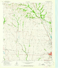 1962 Greenville NW1964 Print · USGSHunt County, Texas, was a crossroads of the rail industry in the early sixties, defined by three major intersecting lines. Genealogists can trace family roots through the Barnett Boles Cem, McWright Cem, and rural centers like Floyd and Kingston.2 unique versions available
 - 1962 Map of Greenville SW, 1964 Print
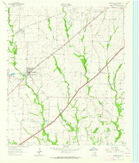 1962 Greenville SW1964 Print · USGSHunt County, Texas, was a landscape of rail-driven towns and small agricultural communities in the early sixties. Genealogists can trace family footprints at the IOOF Cem, Paradise Ch, and the rural crossroads of Clinton or Hendrix.
 - 1962 Map of Greenville SE, 1964 Print
 1962 Greenville SE1964 Print · USGSIn the early sixties, the area southeast of Greenville was a landscape of aviation, oil exploration, and rural family settlements. Researchers can trace landownership through landmarks like Majors Field, Weiland Oil Field, and several country churches including Rattle Ax Ch.
 - 1963 Map of Greenville NE, 1964 Print
 1963 Greenville NE1964 Print · USGSHunt County in the early sixties is captured here as a critical rail hub where three major lines meet. Researchers can trace family history through sites like Old Concord Ch, Hopkins No 1 Cem, and the community of Neylandville.3 unique versions available
 - 1985 Map of McKinney
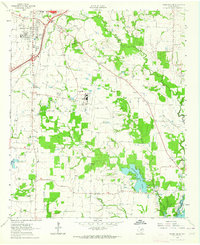
 1985 McKinney1985 Print · USGSNorth Texas in the mid-1980s was a landscape of rural communities connected by a complex web of railroads and creek systems. Researchers can trace family roots through settlements like Westminster, find local landmarks like Henslee Chapel, or map the industrial activity at various Gravel Pits.2 unique versions available
 - 2022 Map of Greenville NE, 2022 Print
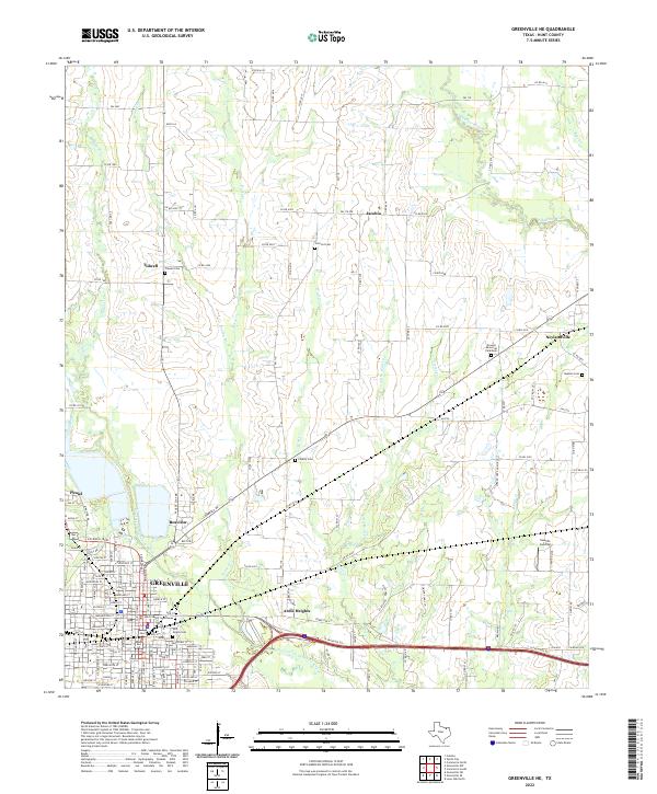 2022 Greenville NE2022 Print · USGSHunt County at the dawn of the 2020s shows the continued growth of Greenville alongside its enduring rural roots. Researchers can trace family history through sites like Hunt County Courthouse, East Mount Cem, and the outlying settlement of Neylandville.
 - 2022 Map of Greenville SW, 2022 Print
 2022 Greenville SW2022 Print · USGSHunt County at the start of the 2020s reveals the continued growth of Greenville and Caddo Mills along the Caddo Creek watershed. Researchers can trace family history across several legacy sites, including Stone Cem, Dugan Cem, and Clinton Cem.
 - 2022 Map of Greenville NW, 2022 Print
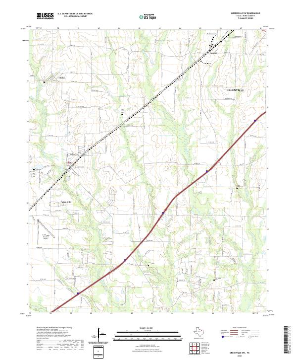
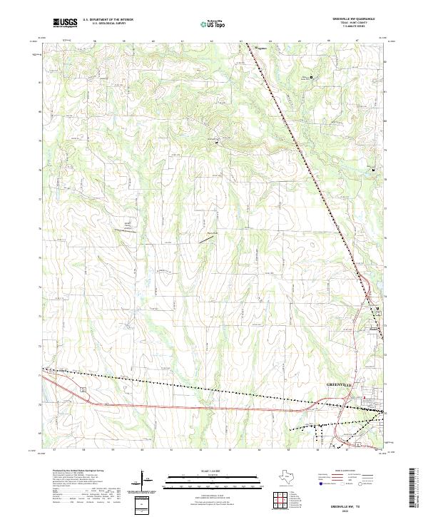 2022 Greenville NW2022 Print · USGSHunt County in the early 2020s shows the continued growth of Greenville and Kingston amidst a network of Sabine River tributaries. Researchers can locate family landmarks like McWright Cem and local flight strips like Flyers Field.
 - 2022 Map of Greenville SE, 2022 Print
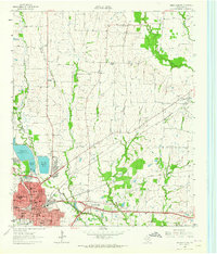
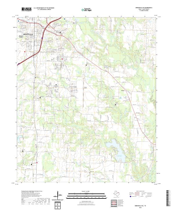 2022 Greenville SE2022 Print · USGSSoutheast Hunt County in the early twenty-first century is a landscape where urban expansion meets established rural traditions. Genealogists and historians can trace local heritage through several burial grounds like Etter Lake Cem and Simmons Cem, or explore landmarks such as Majors Airport.
End of results
Showing maps 1-11 of 11
Top cities near Greenville
- Royse City historical maps
- Commerce historical maps
- Josephine historical maps
- Caddo Mills historical maps
- West Tawakoni historical maps
- West Tawakoni historical maps
See more
Top neighborhoods of Greenville
- Ardis Heights historical maps
- Mineral Heights historical maps
- Peniel historical maps
- Reavilon historical maps
Frequently asked questions
- What are the different types of historical maps available for Greenville?
- What is the oldest map of Greenville?
- Where can I purchase historical maps of Greenville for my home or office?
- Where can I download high-res historical maps of Greenville?
- Are there historical topographic maps available for Greenville?
- Is there historical aerial imagery available for Greenville?
- Where are historical maps of Greenville sourced from?