Old Maps of Jackson County, Texas for Genealogy
Trace your family roots with 164 historic maps of Jackson County. These high-res maps reveal old neighborhoods, homesites, landmarks, and streets — helping you uncover where your ancestors lived and how the area evolved over time.
- Explore historic neighborhoods: Identify where your relatives may have lived in the 1800s or 1900s.
- Compare maps over time: Trace the changes in streets, buildings, and landmarks for multi-generational research.
- Perfect for genealogy & ancestry research: Used by family historians and researchers to map out lineage and migration.
These maps are an incredible resource for exploring your personal connection to Jackson County's past.
Jackson County, TX maps
(164)- 1951 Map of Inez, 1953 Print
 1951 Inez1953 Print · USGSThe South Texas coastal prairie comes into focus in the early 1950s, centered on the railroad town of Inez. Genealogists and researchers can trace local family landmarks like Hirchhauser Cem and Arenosa Sch along the winding Arenosa Creek.2 unique versions available
 - 1952 Map of Francitas NW, 1953 Print
 1952 Francitas NW1953 Print · USGSCoastal Texas industry and water management are on full display in Jackson County during the early fifties. Genealogists and researchers can trace the footprint of petroleum history through numerous wells and the Oil Field, alongside the extensive Levee systems near West Carancahua Creek.
 - 1952 Map of Manson, 1953 Print
 1952 Manson1953 Print · USGSCoastal Texas prairie meets industrial growth in the early fifties as the oil economy reshaped Jackson County. Trace family roots at Red Bluff Cem or follow the Southern Pacific rail lines through Manson to the Texana Oil Field.3 unique versions available
 - 1952 Map of Point Comfort, 1953 Print
 1952 Point Comfort1953 Print · USGSExperience the Texas coast in the early fifties as the industrial footprint at Point Comfort expanded alongside the Lavaca River. Local researchers can trace the oil wells of Lake Field and maritime landmarks like Gallinipper Reef.4 unique versions available
 - 1952 Map of Olivia, 1953 Print
 1952 Olivia1953 Print · USGSCoastal Calhoun and Jackson counties are captured in the early fifties as these bayfront communities thrived on the Gulf. Genealogists and historians can trace the foundations of Olivia, find the Olivia Eden Ch, and locate old landmarks like Port Alto and Weedhaven.2 unique versions available
 - 1952 Map of Edna, 1953 Print
 1952 Edna1953 Print · USGSEdna and the surrounding Texas coastal prairie are captured here in the early fifties during a period of steady civic growth. Local researchers can trace family landmarks like Gideon Ch, locate the historic Site of Camp Independence, and follow the Southern Pacific rail line through El Toro.4 unique versions available
 - 1952 Map of Kamey, 1953 Print
 1952 Kamey1953 Print · USGSAlong the edges of Lavaca Bay in the early fifties, the coastal prairie was a landscape of tide-water marshes and rising energy infrastructure. Researchers can trace the Southern Pacific rail line to Kamey or locate Sixmile Sch and dozens of flowing wells.3 unique versions available
 - 1952 Map of Turtle Bay, 1953 Print
 1952 Turtle Bay1953 Print · USGSThe Matagorda County coastline during the early fifties reveals a landscape of coastal defenses and aviation infrastructure. Researchers can locate Camp Hulen, the Palacios Municipal Airport, and rural landmarks like Carancahua Ch.3 unique versions available
 - 1952 Map of Francitas, 1953 Print
 1952 Francitas1953 Print · USGSThe coastal prairies of Jackson and Matagorda counties come to life in the early 1950s, showing a landscape defined by ranching and the oil industry. Researchers can trace the Missouri Pacific rail line, the Deutschburg Sch, and industrial sites like Francitas Field.2 unique versions available
 - 1952 Map of La Salle, 1953 Print
 1952 La Salle1953 Print · USGSThe Texas coastal plains in the early fifties are defined here by the crossing of the Missouri Pacific and the winding Garcitas Creek. Genealogists and researchers can trace the settlement at La Salle and locate numerous family-scale Windmills and Flowing Wells dotting the local Oil Field.3 unique versions available
 - 1952 Map of Francitas NE, 1953 Print
 1952 Francitas NE1953 Print · USGSThe coastal plains of Jackson and Matagorda Counties come alive in the early fifties as the petroleum industry reshapes the landscape. Genealogists and industrial historians can trace the early footprints of the North Francitas Oil Field, Little Kentucky Field, and the Indefinite Boundary Survey of 1907.2 unique versions available
 - 1952 Map of La Ward, 1953 Print
 1952 La Ward1953 Print · USGSThe coastal prairies of Jackson County come alive in this mid-century survey of the La Ward area. Genealogists and historians can trace the Missouri Pacific rail line, locate a traditional Ferry crossing, and identify scattered Oil Wells.2 unique versions available
 - 1952 Map of Lolita, 1953 Print
 1952 Lolita1953 Print · USGSCoastal Jackson County in the early fifties shows a landscape of river confluences and emerging oil production. Genealogists and industrial historians can trace the rail junction near Lolita and Vanderbilt, or locate family sites near Lolita Cem and the extensive Oil Field.3 unique versions available
 - 1953 Map of Beeville
 1953 Beeville1953 Print · USGSThe Texas Coastal Bend in the early fifties shows a landscape of growing regional hubs and vital maritime corridors. Trace the rail-and-river economy through Goliad, locate the Matagorda Lighthouse, and explore the sprawling Aransas National Wildlife Refuge.
 - 1953 Map of Seguin, 1965 Print
 1953 Seguin1965 Print · USGSSouth Texas in the early fifties shows a thriving river-and-rail economy across the Guadalupe and Colorado basins. Genealogists and historians can trace rail routes like the Southern Pacific through Seguin, locate oil wells, or find the Gary AAF near San Marcos.4 unique versions available
 - 1956 Map of Beeville
 1956 Beeville1956 Print · USGSCoastal Texas and the brush country interior are shown in the mid-fifties, from the coastal bays to the inland oil fields. Trace the old rail lines of the Southern Pacific RR or locate the historic Matagorda Lighthouse and the Aransas National Wildlife Refuge.2 unique versions available
 - 1958 Map of Seguin
 1958 Seguin1958 Print · USGSSouth Texas in the late fifties was a network of river-valley settlements and active oilfields tied together by major rail lines. Genealogists and historians can trace family-named sites across Rabb Prairie, locate the Behring Store, or follow the Southern Pacific through Schulenburg.
 - 1960 Map of Beeville
 1960 Beeville1960 Print · USGSCoastal Texas in the mid-fifties reveals a landscape of growing towns and vital military outposts like Foster AFB. Researchers can trace old rail lines including the Missouri Pacific and explore the vast Aransas National Wildlife Refuge.
 - 1963 Map of Ganado, 1965 Print
 1963 Ganado1965 Print · USGSJackson County in the early sixties reveals a landscape transitioning between traditional ranching and a booming petroleum economy. Genealogists can locate family sites near Ganado and trace the lines of the SOUTHERN PACIFIC railroad or the CORDELE OIL FIELD.2 unique versions available
 - 1963 Map of Mount Olive, 1965 Print
 1963 Mount Olive1965 Print · USGSThe confluence of the Navidad River and Lavaca River in the early 1960s reveals a landscape shaped by petroleum and early Texas heritage. Researchers can locate numerous family burial grounds like Strane Cem and Manly Cem alongside the infrastructure of the Cordele Oil Field.2 unique versions available
 - 1964 Map of Cordele, 1966 Print
 1964 Cordele1966 Print · USGSIn the mid-1960s, the Jackson County prairie near the Lavaca line was a landscape of cattle, cotton, and the rising energy industry. Local historians can trace family burial sites at Gandy Cem and Flourney Cem or explore the early development of the Morales Gas Field.2 unique versions available
 - 1964 Map of Morales, 1966 Print
 1964 Morales1966 Print · USGSThe river bottomlands near the Lavaca and Jackson county line were a hub of resource extraction and ranching in the 1960s. Researchers can trace family history at Partridge Cem or explore the industrial footprint of the Gas Field and the northern Refinery.2 unique versions available
 - 1964 Map of Speaks, 1966 Print
 1964 Speaks1966 Print · USGSCoastal plains and petroleum fields define this pocket of Lavaca County in the 1960s. Researchers can trace the industrial layout of the Wilcox Refinery or locate remote burial sites like Bright Cem and the small settlement of Seclusion.2 unique versions available
 - 1964 Map of Navidad, 1966 Print
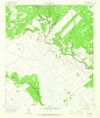 1964 Navidad1966 Print · USGSCoastal Texas ranching and energy production intersect in the mid-1960s as the Lavaca River winds through the Jackson and Lavaca county lines. Researchers can trace rural family sites like Knopp Cem or explore the mid-century infrastructure of the Navidad Gas Field.2 unique versions available
 - 1965 Map of Ganado NE, 1967 Print
 1965 Ganado NE1967 Print · USGSCoastal Texas ranching and oil country come to life in the mid-sixties at the junction of Wharton and Jackson Counties. Researchers can trace rural landmarks like Sandies Church, numerous Wells, and the branching waters of Goldenrod Creek and Lost River.2 unique versions available
Showing maps 1-25 of 164
Top cities of Jackson County
Frequently asked questions
- What are the different types of historical maps available for Jackson County?
- What is the oldest map of Jackson County?
- Where can I purchase historical maps of Jackson County for my home or office?
- Where can I download high-res historical maps of Jackson County?
- Are there historical topographic maps available for Jackson County?
- Is there historical aerial imagery available for Jackson County?
- Where are historical maps of Jackson County sourced from?