Old Maps of Orange Grove, Texas for Genealogy
Trace your family roots with 13 historic maps of Orange Grove. These high-res maps reveal old neighborhoods, homesites, landmarks, and streets — helping you uncover where your ancestors lived and how the area evolved over time.
- Explore historic neighborhoods: Identify where your relatives may have lived in the 1800s or 1900s.
- Compare maps over time: Trace the changes in streets, buildings, and landmarks for multi-generational research.
- Perfect for genealogy & ancestry research: Used by family historians and researchers to map out lineage and migration.
These maps are an incredible resource for exploring your personal connection to Orange Grove's past.
Orange Grove, TX maps
(13)- 1950 Map of Corpus Christi, 1953 Print
 1950 Corpus Christi1953 Print · USGSThe South Texas coast comes into focus during the early fifties, showing the interplay between booming oil fields and expansive ranching operations. Genealogists and historians can trace the Texas Mexican rail line through Kingsville or locate heritage sites like Chapman Ranch and Riviera Beach.
 - 1954 Map of Orange Grove, 1956 Print
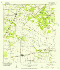 1954 Orange Grove1956 Print · USGSSouth Texas at the height of the mid-century oil boom reveals a landscape defined by ranching heritage and energy extraction. Genealogists and historians can trace family-named sites and vanished landmarks like Leona Sch, Fort Lipantitlan, and the Old San Patricio Cemetery.
 - 1956 Map of Corpus Christi
 1956 Corpus Christi1956 Print · USGSThe South Texas coast and the burgeoning port of Corpus Christi are captured here during the mid-fifties. Genealogists and historians can trace the rail-and-oil economy through labels like Robstown Airpark, Chapman Ranch, and the Missouri Pacific railroad.
 - 1960 Map of Corpus Christi
 1960 Corpus Christi1960 Print · USGSCoastal South Texas and the Nueces County hinterlands are detailed in this mid-century survey. Genealogists and historians can trace early settlement patterns and rural landmarks like Casa Blanca during a period of steady regional growth.
 - 1966 Map of Corpus Christi
 1966 Corpus Christi1966 Print · USGSThe Texas Coastal Bend in the mid-1960s reveals a landscape where massive cattle empires and strategic military bases meet the Gulf. Trace the vast reaches of King Ranch or locate aviation history at the Corpus Christi Air Station and Kingsville Air Station.
 - 1979 Map of Orange Grove, 1991 Print
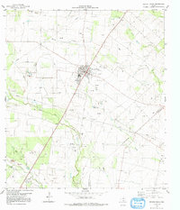 1979 Orange Grove1991 Print · USGSOrange Grove and the Jim Wells County hinterlands are documented here in the late seventies as the regional oil and gas industry expanded. Genealogists can trace family landmarks like Mc Neill Cem and Reynolds Cem or the settlement of Alfred.
 - 1984 Map of Corpus Christi
 1984 Corpus Christi1984 Print · USGSThe Texas Coastal Bend in the 1980s reveals a landscape defined by deep-water ports and sprawling ranchlands. Researchers can trace the rail lines of the Texas Mexican railroad or locate historical landmarks like the Chapman Ranch and Seaside Memorial Cem.
 - 1989 Map of Corpus Christi, 1991 Print
 1989 Corpus Christi1991 Print · USGSCoastal South Texas and its deep bays are captured here in the late eighties, showcasing a landscape of military aviation and barrier island preservation. Researchers can trace family roots in Petronila or Vattmannville and locate landmarks like Cabaniss Field and Baffin.
 - 2010 Map of Orange Grove, 2010 Print
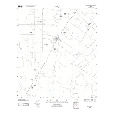 2010 Orange Grove2010 Print · USGSCovers Orange Grove, including Yucca Acres Colonia, Orange Grove Villa Colonia, and other nearby areas
 - 2013 Map of Orange Grove, 2013 Print
 2013 Orange Grove2013 Print · USGSCovers Orange Grove, including Yucca Acres Colonia, Orange Grove Villa Colonia, and other nearby areas
 - 2016 Map of Orange Grove, 2016 Print
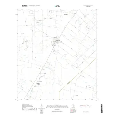
 2016 Orange Grove2016 Print · USGSCovers Orange Grove, including Yucca Acres Colonia, Orange Grove Villa Colonia, and other nearby areas
 - 2019 Map of Orange Grove, 2019 Print
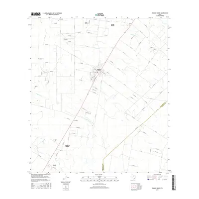
 2019 Orange Grove2019 Print · USGSCovers Orange Grove, including Yucca Acres Colonia, Orange Grove Villa Colonia, and other nearby areas
 - 2022 Map of Orange Grove, 2022 Print
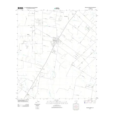
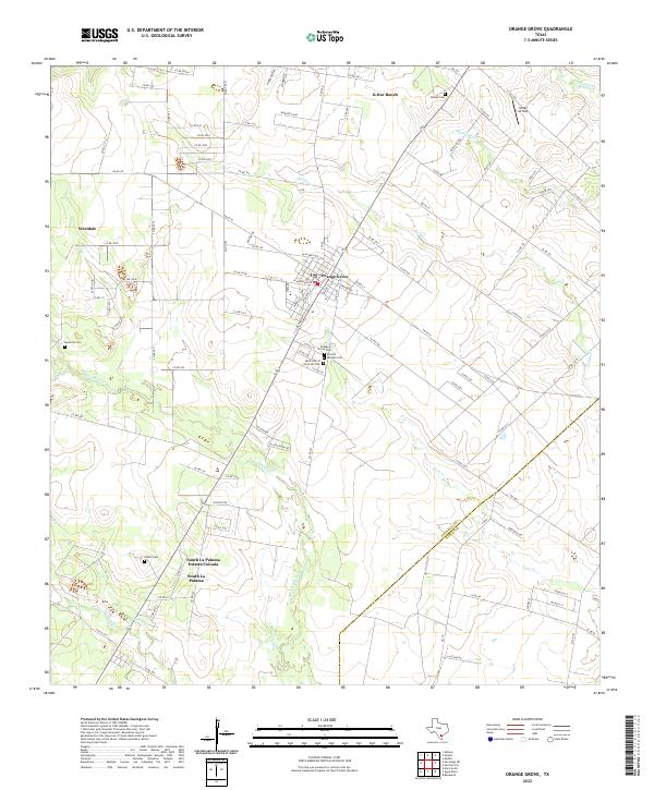 2022 Orange Grove2022 Print · USGSCoastal Bend ranching and residential growth intersect at Orange Grove in this early twenty-first-century record. Genealogists can locate family-named sites like McNeil Cem and Adams Cem, or trace the course of Agua Dulce Cr.
End of results
Showing maps 1-13 of 13
Top cities near Orange Grove
- Alice historical maps
- Robstown historical maps
- Mathis historical maps
- Agua Dulce historical maps
- Lake City historical maps
Frequently asked questions
- What are the different types of historical maps available for Orange Grove?
- What is the oldest map of Orange Grove?
- Where can I purchase historical maps of Orange Grove for my home or office?
- Where can I download high-res historical maps of Orange Grove?
- Are there historical topographic maps available for Orange Grove?
- Is there historical aerial imagery available for Orange Grove?
- Where are historical maps of Orange Grove sourced from?