Old Maps of Kaufman County, Texas for Academic Research
Study the evolution of Kaufman County with 160 high-resolution historic maps. Whether you're teaching, researching, or modeling changes in land use, these maps provide essential visual documentation of urban, environmental, and geographic change.
- Analyze long-term change: Track patterns in development, transportation, and natural features.
- Ideal for environmental or urban studies: Support academic projects with primary historical map data.
- Use in the classroom or lab: Educators and researchers rely on these maps to bring historical context to life.
These maps are a powerful tool for teaching, research, and visualizing how Kaufman County has changed over the decades.
Kaufman County, TX maps
(160)- 1891 Map of Dallas
 1891 Dallas1891 Print · USGSThe Dallas area during the late nineteenth century was a rapidly growing rail hub still defined by its river crossings and rural outposts. Genealogists and historians can trace the foundations of the metroplex through early landmarks like Oak Cliff, Doddy's Ferry, and Haughts Store.
 - 1893 Map of Dallas
 1893 Dallas1893 Print · USGSDallas was a rising railroad power in the 1890s, when iron rails and river crossings dictated the growth of North Texas. Genealogists can locate vanished landmarks and rural hubs like Oak Cliff, Doddy's Ferry, and Haught's Store before the city's modern sprawl.5 unique versions available
 - 1919 Map of Royse City
 1919 Royse City1919 Print · USGSThe agricultural heart of Northeast Texas is captured here just after the Great War, as the Blackland Prairie was crisscrossed by essential rail lines. Trace the locations of early rural landmarks like Locust Grove School, the Randle Ranch, and the vanished stop at Rockwall Station.
 - 1920 Map of Kemp
 1920 Kemp1920 Print · USGSNortheast Texas at the start of the 1920s reveals a landscape of railroad towns and rural post offices at the junction of three counties. Genealogists can trace early homesteads and schoolhouses near Mabank, Prairieville, and Ansley.
 - 1954 Map of Dallas, 1963 Print
 1954 Dallas1963 Print · USGSNorth Texas in the mid-fifties and early sixties reveals a landscape of rapid urban growth and water management. Genealogists and historians can trace the evolution of the metroplex through landmarks like Hensley Field, Boles Orphan Home, and the Texas & Pacific RR.4 unique versions available
 - 1956 Map of Ennis
 1956 Ennis1956 Print · USGSEllis County agricultural life is captured here in the years following the first World War, centered on the rail crossroads at Ennis P.O. Genealogists can locate family landmarks like Ghost School, Antioch Church, and the settlement of Boyce (Cottonwood).
 - 1956 Map of Kaufman
 1956 Kaufman1956 Print · USGSTexas cotton and rail country come alive in this survey of the northern Trinity River basin. Genealogists can trace family roots through specific landmarks like Convent Hall, the Negro School, and rural communities such as Scurry, Talty, and Gastonia.
 - 1956 Map of Quinlan, 1957 Print
 1956 Quinlan1957 Print · USGSNortheast Texas at the height of the post-war era is depicted here through its network of small crossroads communities and family farms. Researchers can trace rural lineages through local landmarks like Union Valley Sch, the Boys Home (Orphanage), and the Masonic Cem near Quinlan.3 unique versions available
 - 1957 Map of Kemp
 1957 Kemp1957 Print · USGSThe rural borders of Kaufman and Henderson counties come alive in this early twentieth-century survey of the Texas and New Orleans Railroad corridor. Researchers can trace defunct post offices and local landmarks like Ansley and the remote settlement at Prairieville.
 - 1958 Map of Dallas
 1958 Dallas1958 Print · USGSNorth Texas in the late fifties shows the dramatic expansion of the Metroplex as it absorbs surrounding farm towns. Genealogists and historians can trace old rail lines like the Missouri-Kansas-Texas and locate early lakefront developments at Eagle Mountain Lake and Lake Worth Village.
 - 1959 Map of Mesquite, 1960 Print
 1959 Mesquite1960 Print · USGSMesquite and Sunnyvale are documented during a period of rapid suburbanization as residential grids began to meet rural bottomlands. Genealogists can trace family footprints at Macedonia Ch, Tripp, and the Florence Black Sch.4 unique versions available
 - 1959 Map of Seagoville, 1960 Print
 1959 Seagoville1960 Print · USGSSoutheast of Dallas in the late fifties, this area shows the growth of Seagoville and Balch Springs near the East Fork Trinity River. Genealogists can locate several family burial grounds like Potter Cem and community landmarks such as the Seagoville Federal Correctional Institution.4 unique versions available
 - 1959 Map of India, 1960 Print
 1959 India1960 Print · USGSThe Trinity River floodplain at the junction of Dallas, Ellis, and Kaufman Counties is shown here in the late fifties during a period of active rural industry. Genealogists can trace family landmarks like Pruitt Cem, Grange Hall, and the settlement of India.4 unique versions available
 - 1959 Map of Seagoville, 1962 Print
 1959 Seagoville1962 Print · USGSSoutheast of Dallas in the late fifties, the Trinity River valley served as a busy corridor of railroads and growing townships. Trace family roots at Sand Branch Cem, locate the Hutchins Boys Industrial Sch, and explore the winding Parsons Slough.
 - 1959 Map of Garland, 1963 Print
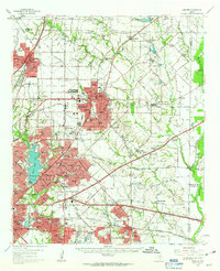 1959 Garland1963 Print · USGSEastern Dallas County is captured in the late fifties as small towns begin to merge into a growing suburban landscape. Genealogists and historians can trace local family roots at Blewett Cem and see the early footprints of Richardson, Sunnyvale, and the White Rock Airport.
 - 1960 Map of Tool, 1961 Print
 1960 Tool1961 Print · USGSThe rural Henderson County landscape of the early 1960s is preserved here, centered on the creek-fed agricultural lands near the Trinity River. Genealogists and local historians can trace the foundations of Tool, Tolosa, and Aley, alongside family landmarks like Baker Cem and King Cem.3 unique versions available
 - 1960 Map of Mabank, 1961 Print
 1960 Mabank1961 Print · USGSThe crossroads of Henderson, Kaufman, and Van Zandt counties are captured here in the early sixties, showing a landscape defined by small-town life and the railroad. Genealogists can trace family roots through landmarks like Elam Grove Ch, Mabank Cem, and rural outposts such as Payne Springs.5 unique versions available
 - 1960 Map of Grays Prairie, 1962 Print
 1960 Grays Prairie1962 Print · USGSKaufman County's rural landscape is preserved here during the early sixties, showing a world of small farm communities and creek-bottom timber. Researchers can locate family landmarks like Pyles Prairie Cem, the village of Lively, and the Coney Shilo Ch.3 unique versions available
 - 1961 Map of Kemp, 1962 Print
 1961 Kemp1962 Print · USGSKaufman County's agricultural and rail landscape is captured here in the early 1960s as infrastructure begins to modernize. Researchers can trace the rail corridors of the Southern Pacific and locate local landmarks like the Cemetery and the small community of Gossett.4 unique versions available
 - 1962 Map of Prairieville, 1965 Print
 1962 Prairieville1965 Print · USGSThe Van Zandt County countryside comes into focus in the early sixties, showing the rural crossroads and creek-fed farms of the Texas interior. Trace family landmarks like the Aanonsen Cem, Fourmile Ch, and the small settlement at Prairieville.2 unique versions available
 - 1962 Map of Elmo, 1965 Print
 1962 Elmo1965 Print · USGSKaufman County's rural landscape is captured here in the early sixties as a major new highway was being carved through the countryside. Genealogists can locate family landmarks like Elmo Cem, College Mound, and the rural Black Jack Ch.2 unique versions available
 - 1962 Map of Cedarvale, 1965 Print
 1962 Cedarvale1965 Print · USGSVan Zandt County was a landscape of small farming communities and emerging oil fields in the early sixties. Researchers can trace family sites near North Bouie Ch, the Fairview Community Center, and the Fair Oil Field.2 unique versions available
 - 1962 Map of Wills Point, 1965 Print
 1962 Wills Point1965 Print · USGSWills Point and the surrounding Van Zandt County countryside are shown here in the early 1960s, centered on the Texas and Pacific rail line. Genealogists can trace family landmarks like Union Grove Cem, Allen Cem, and the small settlement of Hiram.2 unique versions available
 - 1962 Map of Rosser SW, 1965 Print
 1962 Rosser SW1965 Print · USGSNavarro County in the early 1960s was a landscape of rural family farms and emerging water management systems along the Trinity River. Local researchers can locate Rice Cem, the Hopewell Ch, and several named reservoirs along Grays Creek.
 - 1962 Map of Styx, 1965 Print
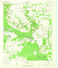 1962 Styx1965 Print · USGSHenderson and Kaufman Counties in the early 1960s were defined by the deep bends of the Trinity River and small rural outposts. Researchers can trace family history at Timothy Cem, locate the old Finch Sch, or find the crossroads at Styx.2 unique versions available
Showing maps 1-25 of 160
Top cities of Kaufman County
- Forney historical maps
- Terrell historical maps
- Heartland historical maps
- Kaufman historical maps
- Crandall historical maps
- Talty historical maps
See more
Frequently asked questions
- What are the different types of historical maps available for Kaufman County?
- What is the oldest map of Kaufman County?
- Where can I purchase historical maps of Kaufman County for my home or office?
- Where can I download high-res historical maps of Kaufman County?
- Are there historical topographic maps available for Kaufman County?
- Is there historical aerial imagery available for Kaufman County?
- Where are historical maps of Kaufman County sourced from?