1900s (20th Century) Maps of Kenedy County, Texas
Explore 65 historic maps of Kenedy County from the 1900s (20th Century). These maps offer a rare glimpse into what life looked like during the 1900s — showing old roads, neighborhoods, homes, and landmarks that have changed or disappeared over time.
Whether you're researching your family's past, planning a metal detecting trip, or studying how Kenedy County's landscape evolved across the 1900s, these high-resolution maps are a powerful tool for exploring the history of this region.
- Focus on a specific era: All maps on this page are from the 1900s, giving you a focused view of this time period.
- See what’s changed: Compare century-old streets, trails, and buildings to today's modern landscape using overlays and satellite layers.
- Research with precision: Use these maps for genealogy, historical research, land use analysis, or educational projects.
- View, download, or print: Maps are fully viewable online in high resolution, and can be downloaded or printed for your own records.
Start exploring Kenedy County's history through authentic maps from the 1900s. This is your window into the past.
Kenedy County, TX maps
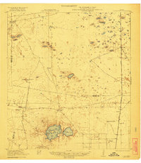
(65)- 1921 Map of Tarida Ranch
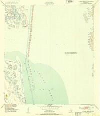
 1921 Tarida Ranch1921 Print · USGSSouth Texas ranching culture is captured here in the early twentieth century, showing a landscape of sprawling family estates and isolated outposts. Researchers can trace the heritage of historic properties like Tarida Ranch, Punta del Monte Ranch, and the remote Santa Margarita School.2 unique versions available
 - 1922 Map of La Sal Vieja
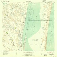
 1922 La Sal Vieja1922 Print · USGSCoastal South Texas ranchlands appear here in the early twenties, centered on the salt lakes and the railroad. Genealogists can trace family outposts like San Juan Ranch and Andres Ranch or follow the St Louis Brownsville and Mexico rail line.3 unique versions available
 - 1923 Map of Armstrong
 1923 Armstrong1923 Print · USGSSouth Texas cattle country in the early twenties is defined by isolated ranching outposts and the vital rail corridor. Researchers can trace the early footprints of Armstrong and Norias or locate remote landmarks like Lorita Ranch and Chaparrazo Well.
 - 1923 Map of Lopena Island
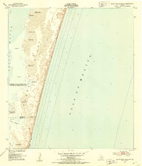
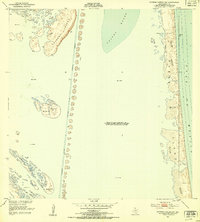
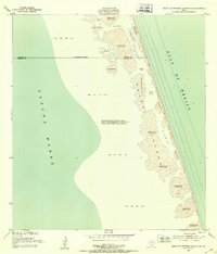
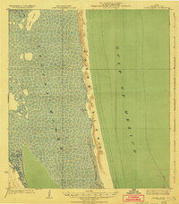 1923 Lopena Island1923 Print · USGSCoastal Texas was a wilderness of sand and salt in the early twenties, defined by the long barrier of Padre Island. Researchers can trace the original shoreline and shifting sands of Laguna Madre and find the location of Lopena Island.2 unique versions available
 - 1923 Map of Saltillo Ranch
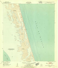
 1923 Saltillo Ranch1923 Print · USGSCoastal Kenedy County is shown here in the 1920s as a landscape of isolated cattle outposts and critical water wells. Genealogists and researchers can trace the historic boundaries of Saltillo Ranch, Los Tajos Ranch, and the remote Soldado Well along the Laguna Madre shoreline.2 unique versions available
 - 1928 Map of Sarita
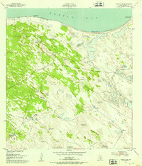
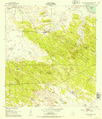
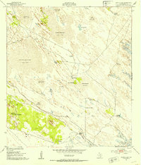
 1928 Sarita1928 Print · USGSSouth Texas ranching country and the coastal prairies are shown here during the early twentieth century. Researchers can trace family-named holdings like Kennedy Farm, ranch outposts at Novillos Mott, and rail sidings at Mifflin.
 - 1950 Map of Corpus Christi, 1953 Print
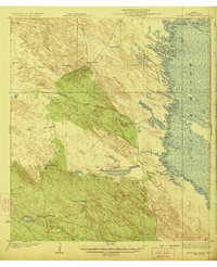
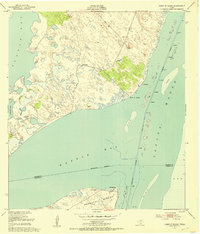
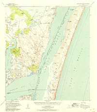
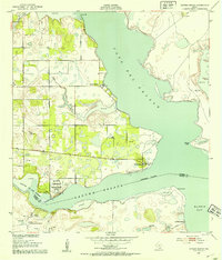
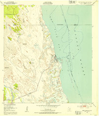
 1950 Corpus Christi1953 Print · USGSThe South Texas coast comes into focus during the early fifties, showing the interplay between booming oil fields and expansive ranching operations. Genealogists and historians can trace the Texas Mexican rail line through Kingsville or locate heritage sites like Chapman Ranch and Riviera Beach.
 - 1951 Map of South Bird Island SE, 1953 Print
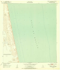
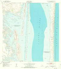
 1951 South Bird Island SE1953 Print · USGSCoastal Texas in the early fifties is mapped here along the shifting sands of Padre Island and Laguna Madre. Researchers can trace the precise contours of Green Hill and Big Ball Hill or find the county line at Boggy Slough.3 unique versions available
 - 1951 Map of South of Potrero Lopeno NE, 1953 Print
 1951 South of Potrero Lopeno NE1953 Print · USGSCoastal Texas in the early fifties is defined by the shifting sands and open waters of the Gulf coast. Researchers can trace the mid-century shoreline of Padre Island and locate maritime landmarks like Boiler and Bianco amidst the shifting sand dunes.2 unique versions available
 - 1951 Map of Point Of Rocks, 1953 Print
 1951 Point Of Rocks1953 Print · USGSThe Kleberg and Kenedy county line runs through the coastal waters of the mid-century Texas Gulf. Researchers can trace the early dredging of the Intracoastal Waterway and locate remote outposts like El Martillo and Griffins Point.2 unique versions available
 - 1951 Map of Kleberg Point, 1953 Print
 1951 Kleberg Point1953 Print · USGSCoastal Texas at the midpoint of the century is captured here in this survey of the Baffin Bay shoreline. Researchers can trace the exact locations of remote water sources like Aceitera Artesian Well and Viboras Well along the edge of Alazan Bay.2 unique versions available
 - 1951 Map of Potrero Lopeno NW, 1953 Print
 1951 Potrero Lopeno NW1953 Print · USGSThe South Texas coast comes into focus during the early fifties, showing the precarious balance of barrier islands and maritime trade. Researchers can trace the Intracoastal Waterway past remote camps like Lopeno (C), El Toro, and Peerless (C).3 unique versions available
 - 1951 Map of Sarita 4 NE, 1953 Print
 1951 Sarita 4 NE1953 Print · USGSCoastal Kenedy County was a landscape of shifting sands and critical water points in the early fifties. Researchers can trace the ranching infrastructure of the era through named features like Pasadizo Artesian Well, Mota Negra Artesian Well, and Tio Chon Well.3 unique versions available
 - 1951 Map of South Bird Island, 1957 Print
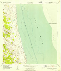
 1951 South Bird Island1957 Print · USGSThe Texas Gulf Coast in the early fifties shows a landscape of expansive cattle ranches and shifting dunes. Genealogists and historians can trace private ranch landmarks like Ojo de Agua, Becerra Wells, and the military footprint at Naval Outlying Field 42 (Practice).2 unique versions available
 - 1952 Map of Potrero Lopeno SE, 1953 Print
 1952 Potrero Lopeno SE1953 Print · USGSThe Texas coast near Kenedy County appears as a wild, shifting landscape of barrier islands and lagoons in the early fifties. Researchers can locate isolated Ruins, find the enigmatic Meteor site, and trace the Shifting Sand Dunes along Padre Island.3 unique versions available
 - 1952 Map of Potrero Cortado, 1953 Print
 1952 Potrero Cortado1953 Print · USGSCoastal Kenedy County in the early fifties is a landscape of shifting dunes and remote barrier islands before modern development took hold. Historians and beachcombers can trace the isolated Lopeño Artesian Well and early dredging work along the Intracoastal Waterway near Padre Island.3 unique versions available
 - 1952 Map of South of Potrero Lopeno NW, 1953 Print
 1952 South of Potrero Lopeno NW1953 Print · USGSKenedy County’s coastal dunes and waters are captured here in the early fifties, showing the isolated ranching and maritime landscape. Genealogists and researchers can trace local water sources like Golondrina Well and the Mujeres Well along the edge of Laguna Madre.3 unique versions available
 - 1952 Map of Riviera Beach, 1953 Print
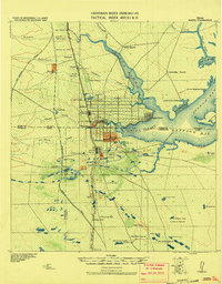
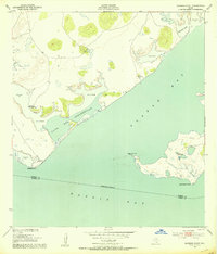
 1952 Riviera Beach1953 Print · USGSThe South Texas coast comes alive in the early fifties as coastal settlements like Loyola Beach and Riviera Beach began to take shape. Researchers can trace the military and industrial landscape through the Naval Reservation Auxiliary Field and isolated sites like Visnaga Well.4 unique versions available
 - 1952 Map of La Parra Ranch, 1953 Print
 1952 La Parra Ranch1953 Print · USGSIn the early fifties, the Kenedy County coastline was a remote expanse of dunes and artesian-fed ranch land. Genealogists and historians can trace the operations of La Parra Ranch and locate many family-named water sources like the Padre Alejos Artesian Well and Tomas Well.3 unique versions available
 - 1952 Map of South of Potrero Lopeno SE, 1953 Print
 1952 South of Potrero Lopeno SE1953 Print · USGSPadre Island remained a wild, shifting landscape of dunes and tides during the early fifties. Genealogists and coastal historians can trace the exact 1950 shoreline and survey markers like Harena among the Shifting Sand Dunes and Laguna Madre.3 unique versions available
 - 1952 Map of Yarborough Pass, 1953 Print
 1952 Yarborough Pass1953 Print · USGSThe Kenedy County coast in the early fifties reveals a landscape of isolated ranch outposts and deep artesian wells. Trace the remote Carnestolendas Ranch or follow the Intracoastal Waterway past Yarborough Pass.3 unique versions available
 - 1952 Map of Port Mansfield, 1953 Print
 1952 Port Mansfield1953 Print · USGSThe Texas coast near Port Mansfield is captured here in the early fifties, showing a landscape of maritime industry and ranching water sources. Researchers can locate named landmarks like the Landing Field, the Julian Well, and the Agua Gorda Well.2 unique versions available
 - 1952 Map of Sarita 4 SE, 1953 Print
 1952 Sarita 4 SE1953 Print · USGSCoastal Kenedy County was a landscape of moving sands and vital water outposts in the early fifties. Genealogists and historians can trace the ranching footprint of the era through sites like Los Indios Ranch, the Santa Elena Trap, and the Aguajon Well.3 unique versions available
 - 1952 Map of Potrero Lopeno SW, 1953 Print
 1952 Potrero Lopeno SW1953 Print · USGSThe Texas coastline south of Baffin Bay comes alive in the early fifties, showing a landscape defined by water and wind. Trace the dredging of the Intracoastal Waterway past the Verrendos Artesian Well and an offshore Oil Derrick.2 unique versions available
 - 1952 Map of Potrero Lopeno, 1956 Print
 1952 Potrero Lopeno1956 Print · USGSThe South Texas coast comes alive in the early fifties, showing the interplay between shifting barrier island dunes and maritime industry. Trace the Intracoastal Waterway past Banderia Pt, find Ruins, and locate an early Oil Derrick in the Laguna Madre.
Showing maps 1-25 of 65
Frequently asked questions
- What are the different types of historical maps available for Kenedy County?
- What is the oldest map of Kenedy County?
- Where can I purchase historical maps of Kenedy County for my home or office?
- Where can I download high-res historical maps of Kenedy County?
- Are there historical topographic maps available for Kenedy County?
- Is there historical aerial imagery available for Kenedy County?
- Where are historical maps of Kenedy County sourced from?