2000s (21st Century) Maps of Kenedy County, Texas
Explore 214 historic maps of Kenedy County from the 2000s (21st Century). These maps offer a rare glimpse into what life looked like during the 2000s — showing old roads, neighborhoods, homes, and landmarks that have changed or disappeared over time.
Whether you're researching your family's past, planning a metal detecting trip, or studying how Kenedy County's landscape evolved across the 2000s, these high-resolution maps are a powerful tool for exploring the history of this region.
- Focus on a specific era: All maps on this page are from the 2000s, giving you a focused view of this time period.
- See what’s changed: Compare century-old streets, trails, and buildings to today's modern landscape using overlays and satellite layers.
- Research with precision: Use these maps for genealogy, historical research, land use analysis, or educational projects.
- View, download, or print: Maps are fully viewable online in high resolution, and can be downloaded or printed for your own records.
Start exploring Kenedy County's history through authentic maps from the 2000s. This is your window into the past.
Kenedy County, TX maps
(214)- 2010 Map of Norias, 2010 Print
 2010 Norias2010 Print · USGSCovers Kenedy County, including United States, Texas, and other nearby areas
 - 2010 Map of La Parra Ranch SE, 2010 Print
 2010 La Parra Ranch SE2010 Print · USGSCovers Kenedy County, including Los Indios Ranch, United States, and other nearby areas
 - 2010 Map of Rosita Lake, 2010 Print
 2010 Rosita Lake2010 Print · USGSCovers Kenedy County, including United States, Texas, and other nearby areas
 - 2010 Map of Yturria, 2010 Print
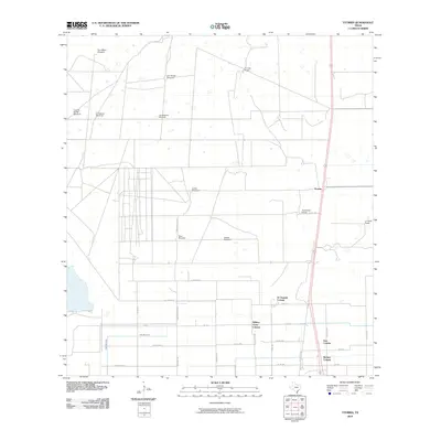 2010 Yturria2010 Print · USGSCovers Kenedy County, including Benitez Colonia, El Chapote Colonia, and other nearby areas
 - 2010 Map of Point of Rocks, 2010 Print
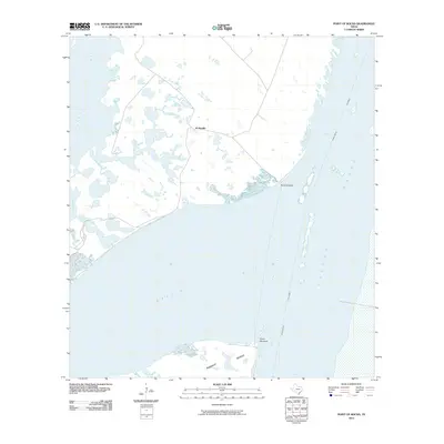 2010 Point of Rocks2010 Print · USGSCovers Kenedy County, including Kleberg County, United States, and other nearby areas
 - 2010 Map of Saltillo Well, 2010 Print
 2010 Saltillo Well2010 Print · USGSCovers Kenedy County, including United States, Texas, and other nearby areas
 - 2010 Map of Sarita SW, 2010 Print
 2010 Sarita SW2010 Print · USGSCovers Kenedy County, including Brooks County, United States, and other nearby areas
 - 2010 Map of Rosita Lake NE, 2010 Print
 2010 Rosita Lake NE2010 Print · USGSCovers Kenedy County, including United States, Texas, and other nearby areas
 - 2010 Map of Turcotte, 2010 Print
 2010 Turcotte2010 Print · USGSCovers Kenedy County, including Mifflin, United States, and other nearby areas
 - 2010 Map of South Bird Island SE, 2010 Print
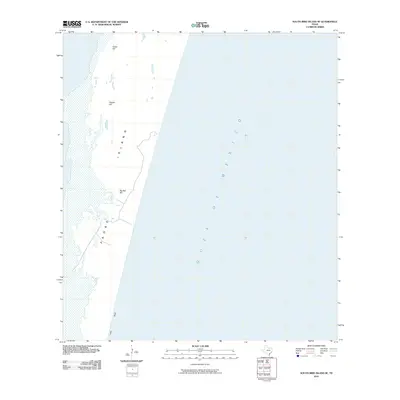 2010 South Bird Island SE2010 Print · USGSCovers Kenedy County, including Kleberg County, United States, and other nearby areas
 - 2010 Map of La Parra Ranch SW, 2010 Print
 2010 La Parra Ranch SW2010 Print · USGSCovers Kenedy County, including United States, Texas, and other nearby areas
 - 2010 Map of South of Potrero Lopeno NE, 2010 Print
 2010 South of Potrero Lopeno NE2010 Print · USGSCovers Kenedy County, including United States, Texas, and other nearby areas
 - 2010 Map of Armstrong, 2010 Print
 2010 Armstrong2010 Print · USGSCovers Kenedy County, including United States, Texas, and other nearby areas
 - 2010 Map of San Pedro Ranch, 2010 Print
 2010 San Pedro Ranch2010 Print · USGSCovers Kenedy County, including United States, Texas, and other nearby areas
 - 2010 Map of Pita Camp, 2010 Print
 2010 Pita Camp2010 Print · USGSCovers Kenedy County, including Brooks County, United States, and other nearby areas
 - 2010 Map of Andrea Ranch, 2010 Print
 2010 Andrea Ranch2010 Print · USGSCovers Kenedy County, including Hidalgo County, United States, and other nearby areas
 - 2010 Map of Potrero Lopeno NW OE E, 2010 Print
 2010 Potrero Lopeno NW OE E2010 Print · USGSCovers Kenedy County, including United States, Texas, and other nearby areas
 - 2010 Map of La Sal Vieja, 2010 Print
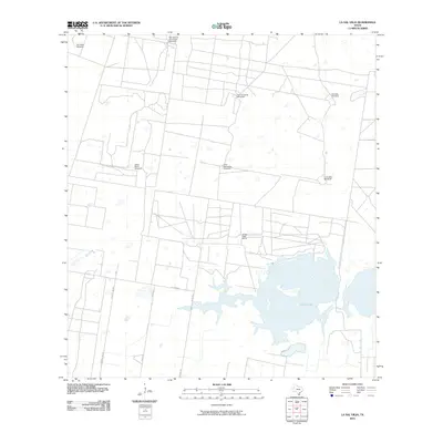 2010 La Sal Vieja2010 Print · USGSCovers Kenedy County, including Hidalgo County, Willacy County, and other nearby areas
 - 2010 Map of Rudolph, 2010 Print
 2010 Rudolph2010 Print · USGSCovers Kenedy County, including Rudolph, United States, and other nearby areas
 - 2010 Map of La Paloma Ranch, 2010 Print
 2010 La Paloma Ranch2010 Print · USGSCovers Kenedy County, including Kleberg County, Brooks County, and other nearby areas
 - 2010 Map of Potrero Lopeno SE, 2010 Print
 2010 Potrero Lopeno SE2010 Print · USGSCovers Kenedy County, including United States, Texas, and other nearby areas
 - 2010 Map of Port Mansfield, 2010 Print
 2010 Port Mansfield2010 Print · USGSCovers Kenedy County, including Port Mansfield, Willacy County, and other nearby areas
 - 2010 Map of Julian, 2010 Print
 2010 Julian2010 Print · USGSCovers Kenedy County, including Julian, Hidalgo County, and other nearby areas
 - 2010 Map of Potrero Cortado, 2010 Print
 2010 Potrero Cortado2010 Print · USGSCovers Kenedy County, including United States, Texas, and other nearby areas
 - 2010 Map of South of Potrero Lopeno NW, 2010 Print
 2010 South of Potrero Lopeno NW2010 Print · USGSCovers Kenedy County, including United States, Texas, and other nearby areas
Showing maps 1-25 of 214
Frequently asked questions
- What are the different types of historical maps available for Kenedy County?
- What is the oldest map of Kenedy County?
- Where can I purchase historical maps of Kenedy County for my home or office?
- Where can I download high-res historical maps of Kenedy County?
- Are there historical topographic maps available for Kenedy County?
- Is there historical aerial imagery available for Kenedy County?
- Where are historical maps of Kenedy County sourced from?