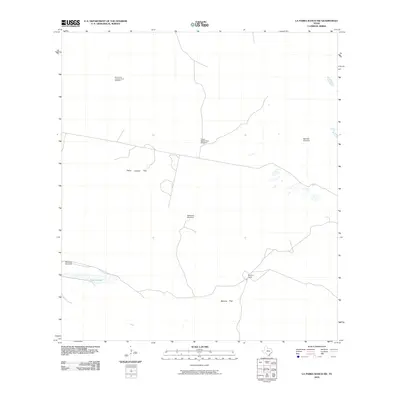
2010 Map of La Parra Ranch SW
USGS Topo · Published 2010About this map
The vast coastal ranching lands of Kenedy County, Texas, are characterized by a network of isolated camps and essential water sources. Marana Camp serves as a focal point in the lower southern reach of the quadrangle, connected to the wider landscape by local ranch roads and specialized enclosure sites like Padre Juanito Trap and Marana Trap. The infrastructure for cattle and energy is prominently marked, including the Humble Oil Company Hub Number 1 and a series of named water stations such as Motaralla Windmill and Marcello Windmill. These features reflect the long-standing land-use patterns of the South Texas brush country, where livestock management depends on these specific, named locations. To the west, the water feature Cayo Grande breaks the arid terrain, illustrating the critical intersection of natural hydrology and man-made improvements in this sparsely populated region.
Find a feature on this map
9 named features on this map. Tap any name to fly to it.
Don’t see what you’re looking for? This feature index may not catch every label — zoom into the map to look around manually.
Map Details
Editions of this 2010 La Parra Ranch SW Map
This is the sole edition of this map. No revisions or reprints were ever made.
Other maps of this area

1923 · Armstrong
USGS Topo · 1:62,500

1923 · Saltillo Ranch
USGS Topo · 1:62,500

1928 · Sarita
USGS Topo · 1:125,000

1950 · Corpus Christi
USGS Topo · 1:250,000

1951 · Sarita 4 NE
USGS Topo · 1:24,000

1952 · La Parra Ranch
USGS Topo · 1:24,000

1952 · Sarita 4 SE
USGS Topo · 1:24,000

1953 · Brownsville
USGS Topo · 1:250,000

1954 · La Parra Ranch SW
USGS Topo · 1:24,000

1954 · Sarita
USGS Topo · 1:62,500