
1951 Map of Sarita 4 NE
USGS Topo · Published 1953About this map
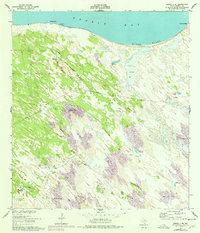
Baffin Bay dominates the northern reaches of this coastal landscape, where the shifting shoreline meets the distinct Black Bluff. The terrain is defined by a dynamic system of sand dunes, often reaching elevations over fifty feet, such as the Shifting Sand Dunes located toward the western interior. This arid environment is punctuated by a network of critical water sources, evidenced by numerous named wells that served the local ranching economy. Many of these, including the Pasadizo Artesian Well and Mota Negra Artesian Well, appear alongside extensive fence lines, indicating a highly managed pastoral landscape despite the moving sands. The presence of these named wells, like Tio Chon Well and Gansos Artesian Well, suggests a reliance on groundwater in a region where the surface is otherwise characterized by sand and mud and transient coastal features like Pie de Gallo.
Find a feature on this map
33 named features on this map. Tap any name to fly to it.
Don’t see what you’re looking for? This feature index may not catch every label — zoom into the map to look around manually.
Map Details
Editions of this 1951 Sarita 4 NE Map
3 editions found
Other maps of this area

1928 · Sarita
USGS Topo · 1:125,000

1950 · Corpus Christi
USGS Topo · 1:250,000

1951 · Point Of Rocks
USGS Topo · 1:24,000

1951 · Kleberg Point
USGS Topo · 1:24,000

1951 · South Bird Island
USGS Topo · 1:62,500

1952 · Potrero Cortado
USGS Topo · 1:24,000

1952 · Riviera Beach
USGS Topo · 1:24,000

1952 · La Parra Ranch
USGS Topo · 1:24,000

1952 · Yarborough Pass
USGS Topo · 1:24,000

1952 · Sarita 4 SE
USGS Topo · 1:24,000