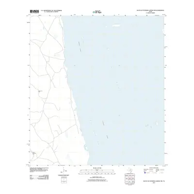
2010 Map of South of Potrero Lopeno NW
USGS Topo · Published 2010About this map
Laguna Madre dominates this coastal Texas landscape, separated from the open waters by the dredging and infrastructure of the Intracoastal Waterway. This environment is characterized by the intersection of salt-marsh hydrology and ranchland industry. To the south, the waters of Red Fish Bay meet a coastline marked by isolated industrial infrastructure on the Kenedy County mainland. Moving inland from the shore, the topography is defined by thin tracks and named groundwater sources like Golondrina Well and Mota Mesquite Well. These features represent the critical water infrastructure necessary for land use in this specific part of the Texas coast, where natural freshwater is scarce despite the proximity to the bay.
Find a feature on this map
5 named features on this map. Tap any name to fly to it.
Don’t see what you’re looking for? This feature index may not catch every label — zoom into the map to look around manually.
Map Details
Editions of this 2010 South of Potrero Lopeno NW Map
This is the sole edition of this map. No revisions or reprints were ever made.
Other maps of this area

1921 · Tarida Ranch
USGS Topo · 1:62,500

1923 · Lopena Island
USGS Topo · 1:62,500

1923 · Saltillo Ranch
USGS Topo · 1:62,500

1951 · South of Potrero Lopeno NE
USGS Topo · 1:24,000

1952 · Potrero Lopeno SE
USGS Topo · 1:24,000

1952 · South of Potrero Lopeno NW
USGS Topo · 1:24,000

1952 · South of Potrero Lopeno SE
USGS Topo · 1:24,000

1952 · Port Mansfield
USGS Topo · 1:24,000

1952 · Potrero Lopeno SW
USGS Topo · 1:24,000

1952 · Potrero Lopeno
USGS Topo · 1:62,500