
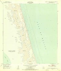
1951 Map of South of Potrero Lopeno NE
USGS Topo · Published 1953About this map
Padre Island dominates this mid-century survey, appearing as a dynamic barrier of shifting sand dunes and expansive sand flats situated between the Gulf of Mexico and the Laguna Madre. The map details the intricate topography of the coastline in the early 1950s, recording specific elevations for various dune fields such as the Shifting Sand Dunes Elevs 5 to 27 feet. Two notable markers, Bianco and Boiler, sit along the Gulf beach, serving as essential reference points in an otherwise fluid and changing landscape. The landform's edge along the Laguna Madre is notably irregular, reflecting the tidal and meteorological influences on water levels in this coastal environment. This document preserves the exact shoreline and hydrography as they existed before decades of coastal erosion and weather events reshaped the Texas barrier islands.
Find a feature on this map
13 named features on this map. Tap any name to fly to it.
Don’t see what you’re looking for? This feature index may not catch every label — zoom into the map to look around manually.
Map Details
Editions of this 1951 South of Potrero Lopeno NE Map
2 editions found
Other maps of this area

1923 · Lopena Island
USGS Topo · 1:62,500

1952 · Potrero Lopeno SE
USGS Topo · 1:24,000

1952 · South of Potrero Lopeno NW
USGS Topo · 1:24,000

1952 · South of Potrero Lopeno SE
USGS Topo · 1:24,000

1952 · Port Mansfield
USGS Topo · 1:24,000

1952 · Potrero Lopeno SW
USGS Topo · 1:24,000

1952 · Potrero Lopeno
USGS Topo · 1:62,500

1952 · South of Potrero Lopeno
USGS Topo · 1:62,500

1953 · Brownsville
USGS Topo · 1:250,000

1956 · Brownsville
USGS Topo · 1:250,000