
1952 Map of South of Potrero Lopeno NW
USGS Topo · Published 1953About this map
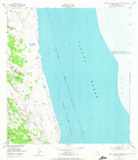
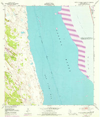
Laguna Madre and Red Fish Bay dominate this coastal survey along the Texas shoreline in Kenedy County. The landscape is defined by a series of Shifting Sand Dunes that range in height from 12 to 58 feet, creating a dynamic barrier between the mainland and the Gulf. Running through the center of the bays is the Intracoastal Waterway, noted with a project depth of 12 feet and lined with numerous Piles to guide maritime traffic.
Find a feature on this map
22 named features on this map. Tap any name to fly to it.
Don’t see what you’re looking for? This feature index may not catch every label — zoom into the map to look around manually.
Map Details
Editions of this 1952 South of Potrero Lopeno NW Map
3 editions found
Other maps of this area

1921 · Tarida Ranch
USGS Topo · 1:62,500

1923 · Lopena Island
USGS Topo · 1:62,500

1923 · Saltillo Ranch
USGS Topo · 1:62,500

1951 · South of Potrero Lopeno NE
USGS Topo · 1:24,000

1952 · Potrero Lopeno SE
USGS Topo · 1:24,000

1952 · South of Potrero Lopeno SE
USGS Topo · 1:24,000

1952 · Port Mansfield
USGS Topo · 1:24,000

1952 · Potrero Lopeno SW
USGS Topo · 1:24,000

1952 · Potrero Lopeno
USGS Topo · 1:62,500

1952 · South of Potrero Lopeno
USGS Topo · 1:62,500