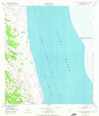
1952 Map of South of Potrero Lopeno NW
USGS Topo · Published 1972About this map
The shifting sands of the Kenedy County coast define this 1952 landscape, where the ephemeral boundary between the Texas mainland and the Gulf of Mexico is constantly reshaped. Along the western edge, a series of essential water sources including Don Triste Artesian Well and Golondrina Well supported local ranching and survival in an otherwise arid environment. These features are interspersed among dynamic Shifting Sand Dunes, some reaching heights of fifty-six feet, illustrating the volatile nature of the shoreline before modern stabilization. To the east, the deep channel of the Intracoastal Waterway cuts through Laguna Madre and Red Fish Bay, marked by maritime aids and piles. This survey documents a critical maritime corridor and the isolated coastal wells like Mujeres Well and Mescal Artesian Well that once served as vital landmarks for those traversing the sandy plains.
Find a feature on this map
24 named features on this map. Tap any name to fly to it.
Don’t see what you’re looking for? This feature index may not catch every label — zoom into the map to look around manually.
Map Details
Editions of this 1952 South of Potrero Lopeno NW Map
3 editions found
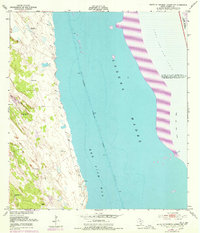
Other maps of this area

1921 · Tarida Ranch
USGS Topo · 1:62,500

1923 · Lopena Island
USGS Topo · 1:62,500

1923 · Saltillo Ranch
USGS Topo · 1:62,500

1951 · South of Potrero Lopeno NE
USGS Topo · 1:24,000

1952 · Potrero Lopeno SE
USGS Topo · 1:24,000

1952 · South of Potrero Lopeno NW
USGS Topo · 1:24,000

1952 · South of Potrero Lopeno SE
USGS Topo · 1:24,000

1952 · Port Mansfield
USGS Topo · 1:24,000

1952 · Potrero Lopeno SW
USGS Topo · 1:24,000

1952 · Potrero Lopeno
USGS Topo · 1:62,500