
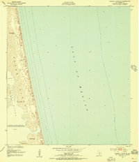
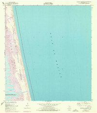
1952 Map of Potrero Lopeno SE
USGS Topo · Published 1953About this map
Padre Island serves as the dominant landform on this mid-century coastal survey, separating the open Gulf of Mexico from the shallow reaches of Laguna Madre. The landscape is defined by dynamic coastal processes, specifically Shifting Sand Dunes that reach elevations of up to 26 feet. Such height on a barrier island suggests a highly active aeolian environment during the early 1950s. Traces of human presence and geological curiosities appear amidst the sand, including unidentified Ruins and a label for Meteor. These specific markers, combined with notes on the variable water stages and occasional inundation, highlight the ephemeral nature of the Texas coast before modern development stabilized much of the island's geography. The map captures a moment when the shoreline was documented through a combination of 1948 aerial photography and 1949 ground surveys.
Find a feature on this map
9 named features on this map. Tap any name to fly to it.
Don’t see what you’re looking for? This feature index may not catch every label — zoom into the map to look around manually.
Map Details
Editions of this 1952 Potrero Lopeno SE Map
3 editions found
Other maps of this area

1923 · Lopena Island
USGS Topo · 1:62,500

1951 · South of Potrero Lopeno NE
USGS Topo · 1:24,000

1951 · Potrero Lopeno NW
USGS Topo · 1:24,000

1952 · South of Potrero Lopeno NW
USGS Topo · 1:24,000

1952 · Potrero Lopeno SW
USGS Topo · 1:24,000

1952 · Potrero Lopeno
USGS Topo · 1:62,500

1952 · South of Potrero Lopeno
USGS Topo · 1:62,500

1953 · Brownsville
USGS Topo · 1:250,000

1956 · Brownsville
USGS Topo · 1:250,000

1956 · Port Isabel
USGS Topo · 1:250,000