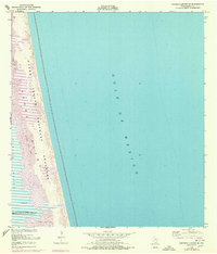
1952 Map of Potrero Lopeno SE
USGS Topo · Published 1978About this map
Padre Island National Seashore dominates this narrow coastal strip, positioned between the expansive Gulf of Mexico and the shallow waters of Laguna Madre. The land is characterized by dynamic natural forces, marked by extensive shifting sand dunes and coastal flats of sand and mud. A notable human element on this otherwise sparsely inhabited coast includes ruins found north of a landmark labeled Meteor, suggesting past structures that have weathered the gulf conditions. This 1950s era survey, with revisions from 1975, tracks the shoreline before significant modern development, showing the barrier island's primitive state when navigation was guided by simple coastal landmarks and the natural topography of the Texas coast in Kenedy County.
Find a feature on this map
9 named features on this map. Tap any name to fly to it.
Don’t see what you’re looking for? This feature index may not catch every label — zoom into the map to look around manually.
Map Details
Editions of this 1952 Potrero Lopeno SE Map
3 editions found
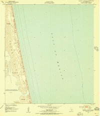
Other maps of this area

1923 · Lopena Island
USGS Topo · 1:62,500

1951 · South of Potrero Lopeno NE
USGS Topo · 1:24,000

1951 · Potrero Lopeno NW
USGS Topo · 1:24,000

1952 · Potrero Lopeno SE
USGS Topo · 1:24,000

1952 · South of Potrero Lopeno NW
USGS Topo · 1:24,000

1952 · Potrero Lopeno SW
USGS Topo · 1:24,000

1952 · Potrero Lopeno
USGS Topo · 1:62,500

1952 · South of Potrero Lopeno
USGS Topo · 1:62,500

1953 · Brownsville
USGS Topo · 1:250,000

1956 · Brownsville
USGS Topo · 1:250,000