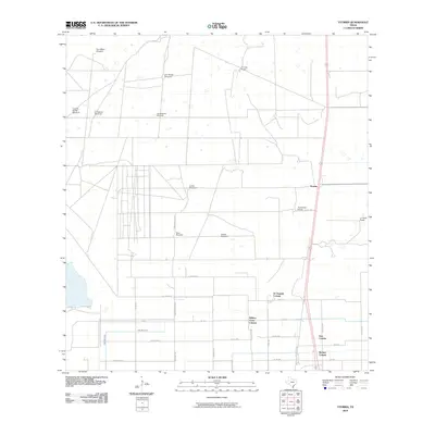
2010 Map of Yturria
USGS Topo · Published 2010About this map
Benitez Colonia and several neighboring residential developments define the southern portion of this landscape, reflecting the modern growth of colonias in South Texas. These settlements, including Lisa Colonia and Willacy Acres Colonia, are situated along a grid of farm-to-market roads like FM 1761 and various county routes. The northern expanse of the area transitions into large pastoral tracts and ranch lands, characterized by family-named landmarks such as Thomas Ranch and Esperanza Ranch. This portion of the quadrangle is dotted with numerous water-pumping points essential for livestock, including Toro Melon Windmill, Ano Nuevo Windmill, and El Ebanito Windmill. The presence of the West Main Drain indicates the regional infrastructure required for water management in this agricultural and ranching environment. The settlement at Yturria serves as a central point along the main north-south transportation corridor, where US Highway 77 Business and rural county roads converge.
Find a feature on this map
37 named features on this map. Tap any name to fly to it.
Don’t see what you’re looking for? This feature index may not catch every label — zoom into the map to look around manually.
Map Details
Editions of this 2010 Yturria Map
This is the sole edition of this map. No revisions or reprints were ever made.
Other maps of this area

1921 · Tarida Ranch
USGS Topo · 1:62,500

1922 · La Sal Vieja
USGS Topo · 1:62,500

1953 · Brownsville
USGS Topo · 1:250,000

1956 · Rudolph
USGS Topo · 1:24,000

1956 · Andrea Ranch
USGS Topo · 1:24,000

1956 · San Perlita South
USGS Topo · 1:24,000

1956 · Rosita Lake
USGS Topo · 1:24,000

1956 · La Sal Vieja
USGS Topo · 1:24,000

1956 · San Perlita North
USGS Topo · 1:24,000

1956 · Yturria
USGS Topo · 1:24,000