
1956 Map of Rosita Lake
USGS Topo · Published 1958About this map
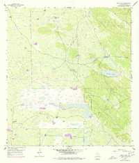
The arid landscape of Kenedy County in the mid-1950s is defined by a sparse but vital network of water sources essential for cattle ranching. Rosita Lake serves as a primary hydrological focal point, surrounded by a series of named water improvements that suggest a landscape partitioned into large ranching tracts. The prevalence of artesian wells, such as the Burro Pinto Artesian Well and Caldero Artesian Well, highlights the reliance on groundwater in this coastal prairie region. Dozens of windmills are mapped across the terrain, including El Florido Windmill and Tres Esquinas Windmill, each serving as a critical landmark in an otherwise open and undeveloped expanse. The mapping of these specific improvements provides a record of the infrastructure supporting South Texas ranching families and operations during this era.
Find a feature on this map
13 named features on this map. Tap any name to fly to it.
Don’t see what you’re looking for? This feature index may not catch every label — zoom into the map to look around manually.
Map Details
Editions of this 1956 Rosita Lake Map
2 editions found
Other maps of this area

1921 · Tarida Ranch
USGS Topo · 1:62,500

1922 · La Sal Vieja
USGS Topo · 1:62,500

1923 · Armstrong
USGS Topo · 1:62,500

1923 · Saltillo Ranch
USGS Topo · 1:62,500

1953 · Brownsville
USGS Topo · 1:250,000

1956 · Saltillo Well
USGS Topo · 1:24,000

1956 · Rudolph
USGS Topo · 1:24,000
1956 · Los Amigos Windmill
USGS Topo · 1:24,000

1956 · San Perlita North
USGS Topo · 1:24,000
1956 · Norias
USGS Topo · 1:24,000