
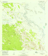
1956 Map of Saltillo Well
USGS Topo · Published 1957About this map
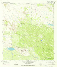
Norias Headquarters King Ranch serves as the central focal point of this arid South Texas landscape during the mid-1950s. The map illustrates a vast ranching infrastructure dependent on a network of named water sources across the sandy terrain, including the Chicago Windmill, Salvador Windmill, and Borrego Windmill. These scattered wells and windmills are vital lifelines in a region where surface water is scarce, save for features like Cayo Soledad. The presence of the Norias Sch and a Silo near the headquarters suggests a self-contained community structured around the operations of the King Ranch. Remote outposts such as San Ignacio Artesian Well and La Fortuna Artesian Well mark the expansive reach of the pastoral economy. Transportation and logistics are represented by a private Airstrip (Private), highlighting the scale and necessity of aerial access for managing such a significant landholding.
Find a feature on this map
21 named features on this map. Tap any name to fly to it.
Don’t see what you’re looking for? This feature index may not catch every label — zoom into the map to look around manually.
Map Details
Editions of this 1956 Saltillo Well Map
2 editions found
Other maps of this area

1921 · Tarida Ranch
USGS Topo · 1:62,500

1922 · La Sal Vieja
USGS Topo · 1:62,500

1923 · Armstrong
USGS Topo · 1:62,500

1923 · Saltillo Ranch
USGS Topo · 1:62,500

1953 · Brownsville
USGS Topo · 1:250,000
1956 · Armstrong
USGS Topo · 1:24,000
1956 · San Pedro Ranch
USGS Topo · 1:24,000
1956 · Maria Estella Well
USGS Topo · 1:24,000

1956 · Rudolph
USGS Topo · 1:24,000
1956 · Los Amigos Windmill
USGS Topo · 1:24,000