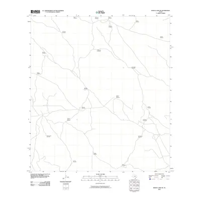
2010 Map of Rosita Lake NE
USGS Topo · Published 2010About this map
Windmill outposts and scattered water sources define this arid stretch of Kenedy County, Texas. This 2010 survey illustrates a landscape primarily organized around cattle ranching infrastructure, where named landmarks often center on essential wells. The map reveals a network of unpaved local roads and 4WD tracks connecting these remote points, including San Jose Windmill and Mesquite Windmill. Named features such as Colorado Windmill and Charco Blanco Windmill reflect the necessity of water management in this South Texas environment. For historians and genealogists, these family and location-specific names like Teodoro Windmill, San Luis Windmill, and Alto Blanco Windmill provide a rare record of the specific waypoints used to navigate and manage large ranching tracts in the early 21st century.
Find a feature on this map
22 named features on this map. Tap any name to fly to it.
Don’t see what you’re looking for? This feature index may not catch every label — zoom into the map to look around manually.
Map Details
Editions of this 2010 Rosita Lake NE Map
This is the sole edition of this map. No revisions or reprints were ever made.
Other maps of this area

1921 · Tarida Ranch
USGS Topo · 1:62,500

1923 · Lopena Island
USGS Topo · 1:62,500

1923 · Saltillo Ranch
USGS Topo · 1:62,500

1952 · South of Potrero Lopeno NW
USGS Topo · 1:24,000

1952 · Port Mansfield
USGS Topo · 1:24,000

1952 · Potrero Lopeno SW
USGS Topo · 1:24,000

1952 · Potrero Lopeno
USGS Topo · 1:62,500

1952 · South of Potrero Lopeno
USGS Topo · 1:62,500

1953 · Brownsville
USGS Topo · 1:250,000

1956 · Saltillo Well
USGS Topo · 1:24,000