Old Maps of Los Indios Ranch, Texas for Academic Research
Study the evolution of Los Indios Ranch with 14 high-resolution historic maps. Whether you're teaching, researching, or modeling changes in land use, these maps provide essential visual documentation of urban, environmental, and geographic change.
- Analyze long-term change: Track patterns in development, transportation, and natural features.
- Ideal for environmental or urban studies: Support academic projects with primary historical map data.
- Use in the classroom or lab: Educators and researchers rely on these maps to bring historical context to life.
These maps are a powerful tool for teaching, research, and visualizing how Los Indios Ranch has changed over the decades.
Los Indios Ranch, TX maps
(14)- 1928 Map of Sarita
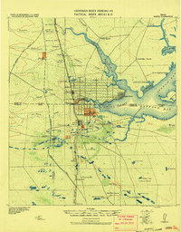 1928 Sarita1928 Print · USGSSouth Texas ranching country and the coastal prairies are shown here during the early twentieth century. Researchers can trace family-named holdings like Kennedy Farm, ranch outposts at Novillos Mott, and rail sidings at Mifflin.
 - 1950 Map of Corpus Christi, 1953 Print
 1950 Corpus Christi1953 Print · USGSThe South Texas coast comes into focus during the early fifties, showing the interplay between booming oil fields and expansive ranching operations. Genealogists and historians can trace the Texas Mexican rail line through Kingsville or locate heritage sites like Chapman Ranch and Riviera Beach.
 - 1952 Map of Sarita 4 SE, 1953 Print
 1952 Sarita 4 SE1953 Print · USGSCoastal Kenedy County was a landscape of moving sands and vital water outposts in the early fifties. Genealogists and historians can trace the ranching footprint of the era through sites like Los Indios Ranch, the Santa Elena Trap, and the Aguajon Well.3 unique versions available
 - 1955 Map of La Parra Ranch, 1956 Print
 1955 La Parra Ranch1956 Print · USGSCoastal Kenedy County in the mid-fifties is a landscape of vast ranching estates and early oil exploration along the shore of Baffin Bay. Genealogists and historians can trace the foundations of La Parra Ranch, identify remote cemeteries, and locate dozens of named artesian wells like Mota Negra Artesian Well and Santa Elena Artesian Well.
 - 1956 Map of Corpus Christi
 1956 Corpus Christi1956 Print · USGSThe South Texas coast and the burgeoning port of Corpus Christi are captured here during the mid-fifties. Genealogists and historians can trace the rail-and-oil economy through labels like Robstown Airpark, Chapman Ranch, and the Missouri Pacific railroad.
 - 1960 Map of Corpus Christi
 1960 Corpus Christi1960 Print · USGSCoastal South Texas and the Nueces County hinterlands are detailed in this mid-century survey. Genealogists and historians can trace early settlement patterns and rural landmarks like Casa Blanca during a period of steady regional growth.
 - 1966 Map of Corpus Christi
 1966 Corpus Christi1966 Print · USGSThe Texas Coastal Bend in the mid-1960s reveals a landscape where massive cattle empires and strategic military bases meet the Gulf. Trace the vast reaches of King Ranch or locate aviation history at the Corpus Christi Air Station and Kingsville Air Station.
 - 1984 Map of Baffin Bay
 1984 Baffin Bay1984 Print · USGSThe South Texas coast near Kingsville and the Kenedy County line comes into focus in the mid-1980s. Genealogists and historians can locate family landmarks like Chamberlain Cem, the community of Vattmannville, and the extensive grounds of La Parra Ranch.
 - 1989 Map of Corpus Christi, 1991 Print
 1989 Corpus Christi1991 Print · USGSCoastal South Texas and its deep bays are captured here in the late eighties, showcasing a landscape of military aviation and barrier island preservation. Researchers can trace family roots in Petronila or Vattmannville and locate landmarks like Cabaniss Field and Baffin.
 - 2010 Map of La Parra Ranch SE, 2010 Print
 2010 La Parra Ranch SE2010 Print · USGSCovers Los Indios Ranch, including Kenedy County, United States, and other nearby areas
 - 2013 Map of La Parra Ranch SE, 2013 Print
 2013 La Parra Ranch SE2013 Print · USGSCovers Los Indios Ranch, including Kenedy County, United States, and other nearby areas
 - 2016 Map of La Parra Ranch SE, 2016 Print
 2016 La Parra Ranch SE2016 Print · USGSCovers Los Indios Ranch, including Kenedy County, United States, and other nearby areas
 - 2019 Map of La Parra Ranch SE, 2019 Print
 2019 La Parra Ranch SE2019 Print · USGSCovers Los Indios Ranch, including Kenedy County, United States, and other nearby areas
 - 2022 Map of La Parra Ranch SE, 2022 Print
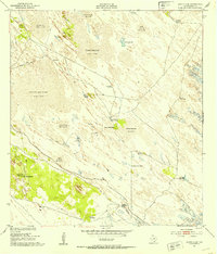
 2022 La Parra Ranch SE2022 Print · USGSCoastal Kenedy County ranchlands are documented in this recent survey of a largely private landscape. Researchers can locate the Santa Elena Trap and trace the route of Gulf Wind Rd through this area of specialized cattle ranching infrastructure.
End of results
Showing maps 1-14 of 14
Frequently asked questions
- What are the different types of historical maps available for Los Indios Ranch?
- What is the oldest map of Los Indios Ranch?
- Where can I purchase historical maps of Los Indios Ranch for my home or office?
- Where can I download high-res historical maps of Los Indios Ranch?
- Are there historical topographic maps available for Los Indios Ranch?
- Is there historical aerial imagery available for Los Indios Ranch?
- Where are historical maps of Los Indios Ranch sourced from?