Old Maps of Millett, Texas for Academic Research
Study the evolution of Millett with 13 high-resolution historic maps. Whether you're teaching, researching, or modeling changes in land use, these maps provide essential visual documentation of urban, environmental, and geographic change.
- Analyze long-term change: Track patterns in development, transportation, and natural features.
- Ideal for environmental or urban studies: Support academic projects with primary historical map data.
- Use in the classroom or lab: Educators and researchers rely on these maps to bring historical context to life.
These maps are a powerful tool for teaching, research, and visualizing how Millett has changed over the decades.
Millett, TX maps
(13)- 1942 Map of Dilley, 1956 Print
 1942 Dilley1956 Print · USGSSouth Texas ranching and rail infrastructure are on full display during the early 1940s at the Frio and La Salle county line. Genealogists and historians can trace family properties like Nagy Witherspoon Ranch and Julia Harris Ranch along the International and Great Northern railroad.
 - 1953 Map of Crystal City
 1953 Crystal City1953 Print · USGSSouth Texas in the early fifties was a landscape of expanding oil fields and vital rail connections. Genealogists and researchers can trace family lands along the Nueces River or locate heritage sites in Asherton, Big Wells, and Batesville.
 - 1955 Map of Crystal City, 1976 Print
 1955 Crystal City1976 Print · USGSSouth Texas ranching and oil country come into focus in the mid-fifties as the rail lines and rivers connect growing hubs. Researchers can trace the development of energy fields like Washburn Oil Field or locate historic settlements from Asherton to Three Rivers.
 - 1961 Map of Crystal City
 1961 Crystal City1961 Print · USGSSouth Texas in the early sixties reveals a landscape of massive cattle ranches and emerging oil fields. Genealogists and historians can trace the Missouri Pacific rail lines through Crystal City, or locate water features like Espantosa Lake and Boynton Reservoir.
 - 1968 Map of Crystal City
 1968 Crystal City1968 Print · USGSSouth Texas in the late sixties reveals a landscape shaped by ranching roots and the vital waters of the Nueces River. Researchers can trace the rail-driven growth of Crystal City or locate landmarks like Pilot Knob and Espantosa Lake.
 - 1974 Map of Millett, 1977 Print
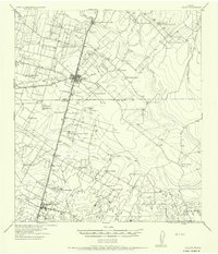
 1974 Millett1977 Print · USGSSouth Texas ranching and rail life are captured here in the mid-seventies, centered on the Missouri Pacific corridor. Genealogists can trace the footprint of Millett and Gardendale or locate the local Cem and Gravel Pit.
 - 1985 Map of Crystal City
 1985 Crystal City1985 Print · USGSThe Texas Winter Garden region comes into focus during the mid-1980s, detailing a landscape of irrigation, energy, and rail. Genealogists and researchers can trace lineage through rural centers like Big Wells, Winter Haven, and Loma Vista or locate early industrial sites such as the Big Wells Oil Field.2 unique versions available
 - 2002 Map of Dilley
 2002 Dilley2002 Print · USGSThe South Texas Brush Country around the turn of the millennium shows a landscape defined by ranching and the rail corridor. Researchers can locate the Dilley Cemetery, follow the Union Pacific Railroad through Millett, or trace the banks of Cibolo Creek.
 - 2010 Map of Millett, 2010 Print
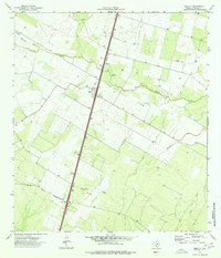
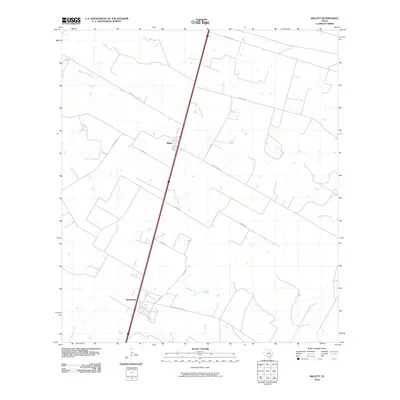 2010 Millett2010 Print · USGSCovers Millett, including Gardendale, La Salle County, and other nearby areas
 - 2013 Map of Millett, 2013 Print
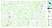
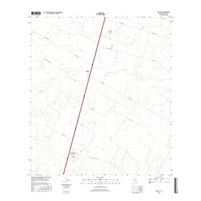
 2013 Millett2013 Print · USGSCovers Millett, including Gardendale, La Salle County, and other nearby areas
 - 2016 Map of Millett, 2016 Print
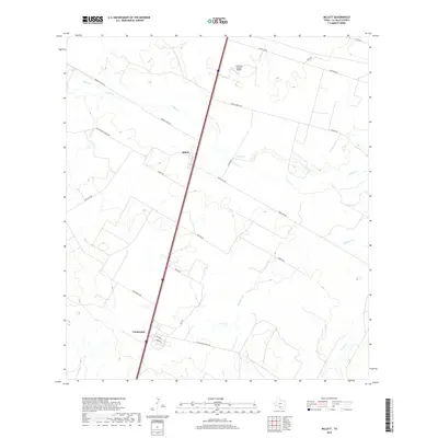
 2016 Millett2016 Print · USGSCovers Millett, including Gardendale, La Salle County, and other nearby areas
 - 2019 Map of Millett, 2019 Print
 2019 Millett2019 Print · USGSCovers Millett, including Gardendale, La Salle County, and other nearby areas
 - 2022 Map of Millett, 2022 Print
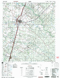
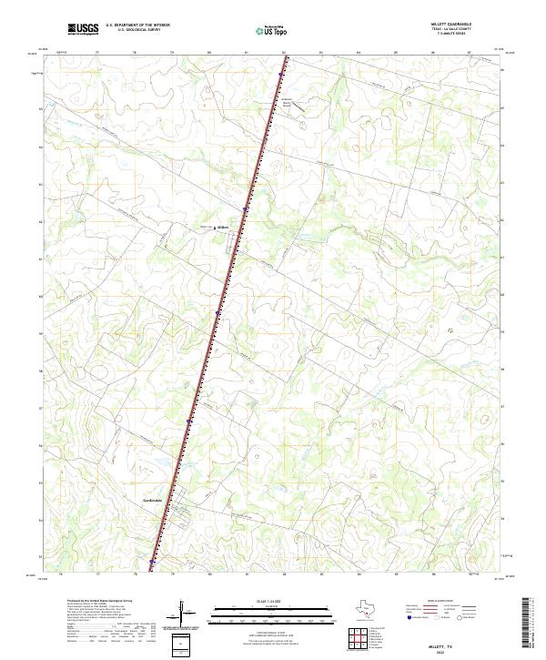 2022 Millett2022 Print · USGSLa Salle County ranching and rail history come into focus in this 2020s study of the South Texas brush country. Researchers can trace the Old Sausage RR Line and locate family sites near Millett Cem and Gardendale.
End of results
Showing maps 1-13 of 13
Top cities near Millett
Frequently asked questions
- What are the different types of historical maps available for Millett?
- What is the oldest map of Millett?
- Where can I purchase historical maps of Millett for my home or office?
- Where can I download high-res historical maps of Millett?
- Are there historical topographic maps available for Millett?
- Is there historical aerial imagery available for Millett?
- Where are historical maps of Millett sourced from?