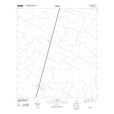
2010 Map of Millett
USGS Topo · Published 2010About this map
Millett and the nearby community of Gardendale anchor this 2010 survey of South Texas, where the landscape is defined by a sparse network of ranch roads and intermittent waterways. The topography is dominated by the drainages of Cibolo Creek, Slaughter Creek, and Mustang Creek, which carve subtle paths across the brush country of La Salle County. A notable historical remnant is the Old Sausage RR Line, which cuts across the southern portion of the quadrangle near Gardendale, suggesting a legacy of local agricultural transport. This modern survey illustrates the persistent rural character of the region, where long-established family routes like Matthews Rd, Ochoa Rd, and Freddie Copps Rd connect isolated ranching tracts to the primary north-south transit corridor.
Find a feature on this map
18 named features on this map. Tap any name to fly to it.
Don’t see what you’re looking for? This feature index may not catch every label — zoom into the map to look around manually.
Map Details
Editions of this 2010 Millett Map
This is the sole edition of this map. No revisions or reprints were ever made.
Other maps of this area

1927 · Bart
USGS Topo · 1:62,500

1929 · Cotulla
USGS Topo · 1:125,000

1940 · Cotulla
USGS Topo · 1:62,500

1940 · Artesia Wells
USGS Topo · 1:62,500

1942 · Dilley
USGS Topo · 1:62,500

1953 · Crystal City
USGS Topo · 1:250,000

1955 · Crystal City
USGS Topo · 1:250,000

1956 · Woodward
USGS Topo · 1:62,500

1961 · Crystal City
USGS Topo · 1:250,000

1968 · Crystal City
USGS Topo · 1:250,000