Old Maps of Emberson, Texas for Metal Detecting
Plan your next treasure hunt with 13 historic maps of Emberson. Find old homesites, ghost towns, trails, and gathering spots that may be lost to time — perfect for identifying promising metal detecting locations.
- Locate forgotten sites: Uncover places like long-lost settlements, abandoned rail lines, or gathering spots.
- Plan better hunts: Use map overlays combined with LiDAR or satellite views to narrow in on historically rich areas.
- Made for detectorists: Thousands of hobbyists use these maps to discover relics, coins, and hidden history.
Use these historic maps to boost your research and find new opportunities beneath the surface of Emberson.
Emberson, TX maps
(13)- 1903 Map of Paris
 1903 Paris1903 Print · USGSThe Red River borderlands of the Indian Territory and Texas are shown here at the start of the century. Genealogists and researchers can trace early settlements and social hubs like Grant, Oberlin, and the Camp Ground along the winding banks of the Red River.
 - 1948 Map of Grant, 1963 Print
 1948 Grant1963 Print · USGSThe Red River borderlands of Oklahoma and Texas are shown here in the late 1940s, featuring the extensive Camp Maxey Military Reservation. Researchers can trace the St Louis San Francisco Railway through Grant and locate dozens of local landmarks like Hills Chapel School and Goodland Cem.2 unique versions available
 - 1949 Map of Grant
 1949 Grant1949 Print · USGSThe Red River borderlands of Oklahoma and Texas are captured here just after the war, showing a rural landscape dominated by large river bends and military expansion. You can trace early community hubs like Grant and Arthur City or locate local landmarks like Hills Chapel School and Forest Chapel.2 unique versions available
 - 1953 Map of Texarkana, 1964 Print
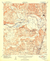
 1953 Texarkana1964 Print · USGSThe Texas-Arkansas borderlands are captured here in the mid-fifties, during a decade of massive military and hydraulic engineering projects. Genealogists and researchers can locate family landmarks like Old Boston Cem, Siloam Ch, and the vast Red River Arsenal.4 unique versions available
 - 1956 Map of Texarkana
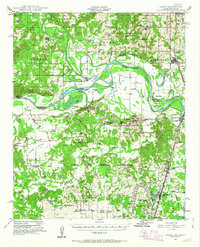
 1956 Texarkana1956 Print · USGSThe Ark-La-Tex borderlands come alive in the mid-fifties, showing the transition from a rail-dependent rural economy to a post-war industrial landscape. Researchers can trace the massive Red River Ordnance Depot and find towns like Talco, Bogata, and Naples.
 - 1980 Map of Pat Mayse Lake West, 1981 Print
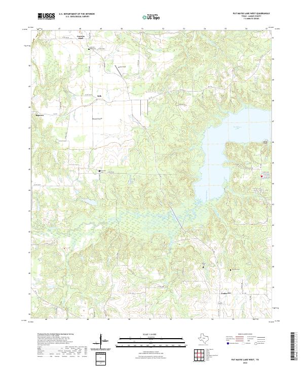
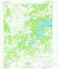 1980 Pat Mayse Lake West1981 Print · USGSLamar County in the early eighties shows a balance between established rural settlements and significant conservation efforts near Pat Mayse Lake. Genealogists and local historians can trace small communities like Garretts Bluff and Ragtown, or locate family sites at Sumner Cem and Caviness.
 - 1985 Map of Paris
 1985 Paris1985 Print · USGSThe Red River Valley in the mid-eighties shows a landscape of military training grounds and rail-connected agricultural towns. Genealogists and historians can trace local landmarks like Allens Chapel Cem, the grounds of Camp Maxey, and the early footprint of Paris Junior College.
 - 1991 Map of Paris
 1991 Paris1991 Print · USGSNorthern Texas and southern Oklahoma meet along the Red River valley during the early nineties. Researchers can trace the rail networks of the Texas and Pacific RR and visit rural communities like Manchester, Sylvan, and Arthur City.
 - 2011 Map of Pat Mayse Lake West, 2011 Print
 2011 Pat Mayse Lake West2011 Print · USGSCovers Emberson, including Belk, Ragtown, and other nearby areas
 - 2013 Map of Pat Mayse Lake West, 2013 Print
 2013 Pat Mayse Lake West2013 Print · USGSCovers Emberson, including Belk, Ragtown, and other nearby areas
 - 2016 Map of Pat Mayse Lake West, 2016 Print
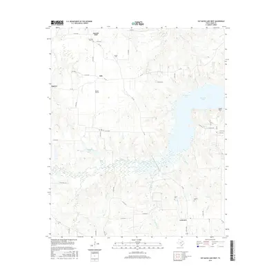 2016 Pat Mayse Lake West2016 Print · USGSCovers Emberson, including Belk, Ragtown, and other nearby areas
 - 2019 Map of Pat Mayse Lake West, 2019 Print
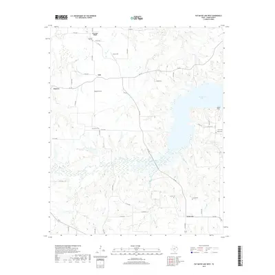 2019 Pat Mayse Lake West2019 Print · USGSCovers Emberson, including Belk, Ragtown, and other nearby areas
 - 2022 Map of Pat Mayse Lake West, 2022 Print
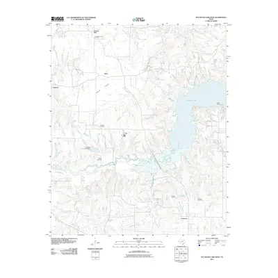
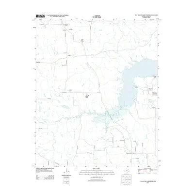
 2022 Pat Mayse Lake West2022 Print · USGSNorth Texas rural life and the waters of Pat Mayse Lake define this Lamar County landscape in the early twenty-first century. Researchers can trace ancestral roots and old homesteads near Garretts Bluff Cem and the communities of Belk and Emberson.
End of results
Showing maps 1-13 of 13
Top cities near Emberson
- Paris historical maps
- Reno historical maps
- Honey Grove historical maps
- Roxton historical maps
- Grant historical maps
- Toco historical maps
See more
Frequently asked questions
- What are the different types of historical maps available for Emberson?
- What is the oldest map of Emberson?
- Where can I purchase historical maps of Emberson for my home or office?
- Where can I download high-res historical maps of Emberson?
- Are there historical topographic maps available for Emberson?
- Is there historical aerial imagery available for Emberson?
- Where are historical maps of Emberson sourced from?