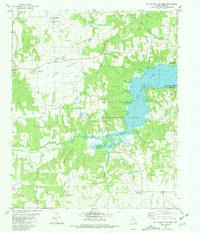
1980 Map of Pat Mayse Lake West
USGS Topo · Published 1981About this map
Garretts Bluff and Belk anchor this northern Lamar County landscape, where the sprawling waters of Pat Mayse Lake met the conserved lands of the Pat Mayse State Wildlife Management Area in 1980. The terrain transitions from the open stretches of Round Prairie to the intricate drainage networks of Stillhouse Creek and Sand Creek. This map is particularly valuable for genealogical research, capturing several rural burial grounds such as Sumner Cem, Post Oak Cem, and Caviness Cem, alongside local spiritual centers like Midway Ch and Bibleway Ch. In the south, the small settlement of Emberson sits near the winding Craddock Branch, while the western edge shows the interestingly named Ragtown, providing a detailed look at rural Texas life before further modern development.
Find a feature on this map
28 named features on this map. Tap any name to fly to it.
Don’t see what you’re looking for? This feature index may not catch every label — zoom into the map to look around manually.
Map Details
Editions of this 1980 Pat Mayse Lake West Map
This is the sole edition of this map. No revisions or reprints were ever made.
Other maps of this area

1903 · Paris
USGS Topo · 1:125,000

1947 · Honey Grove
USGS Topo · 1:62,500

1948 · Grant
USGS Topo · 1:62,500

1948 · Paris
USGS Topo · 1:62,500

1948 · Direct
USGS Topo · 1:62,500

1949 · Direct
USGS Topo · 1:62,500

1949 · Honey Grove
USGS Topo · 1:62,500

1949 · Grant
USGS Topo · 1:62,500

1949 · Paris
USGS Topo · 1:62,500

1953 · Texarkana
USGS Topo · 1:250,000