Old Maps of Nix, Texas for Hiking & Exploration
Hike through history with 11 historic maps of Nix. Explore old trails, ghost towns, and forgotten backroads — perfect for outdoor adventurers and local explorers.
- Rediscover forgotten places: Map out old mining camps, roads, and footpaths that no longer exist on modern maps.
- Layer with modern tools: Combine with LiDAR or satellite views to plan hikes through historical terrain.
- Made for exploration: Popular among hikers, overlanders, and local history lovers.
Use these maps to find adventure and explore the hidden past of Nix.
Nix, TX maps
(11)- 1887 Map of Lampasas
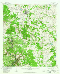
 1887 Lampasas1887 Print · USGSThe Lampasas region in the late 1880s shows the arrival of the Gulf Colorado and Santa Fe Railroad alongside early frontier settlements. Local historians can trace old post offices and milling sites like Townsen Mills, Wayback, and Senterfitt among the numerous gaps and peaks of the Hill Country.
 - 1894 Map of Lampasas
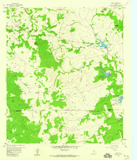
 1894 Lampasas1894 Print · USGSLampasas and the surrounding hill country are shown in the years following the arrival of the rail. Genealogists can trace family-named landmarks like Kinchelo Peak and old post offices at Senterfitt, Nix, and Wayback.4 unique versions available
 - 1954 Map of Brownwood, 1955 Print
 1954 Brownwood1955 Print · USGSCentral Texas in the early fifties shows a landscape of rail-linked cattle towns and winding river valleys before modern highway expansion. Genealogists and historians can trace family-named peaks and vanished rail stops like Trickham, Santa Anna, and the Brady Mountains.3 unique versions available
 - 1959 Map of Nix, 1960 Print
 1959 Nix1960 Print · USGSCentral Texas ranching country comes into focus in the late fifties, showing the rural community of Nix and its surrounding hills. Researchers can locate family landmarks like Nix Cem, the McCreaville Ch, and the rugged terrain of Graveyard Hollow.2 unique versions available
 - 1959 Map of Lometa, 1961 Print
 1959 Lometa1961 Print · USGSLometa and the surrounding Texas hill country are captured here in the late fifties as ranching and rail commerce shaped the land. Genealogists can locate family-named sites like Vann Ranch and Mc Creaville Ch, or trace the historic Senterfitt (Site).2 unique versions available
 - 1985 Map of San Saba
 1985 San Saba1985 Print · USGSCentral Texas in the mid-eighties was a landscape of river-valley ranching and quiet railroad towns. Researchers can trace family history through sites like San Saba Cem, follow the Atchison Topeka and Santa Fe line, or explore landmarks near Pecan Bayou.2 unique versions available
 - 2010 Map of Nix, 2010 Print
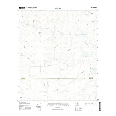
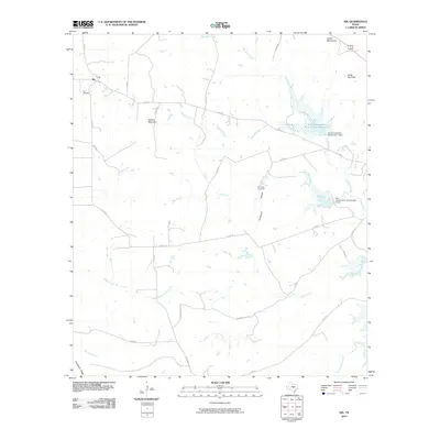 2010 Nix2010 Print · USGSCovers Nix, including Burnet County, Lampasas County, and other nearby areas
 - 2014 Map of Nix, 2014 Print
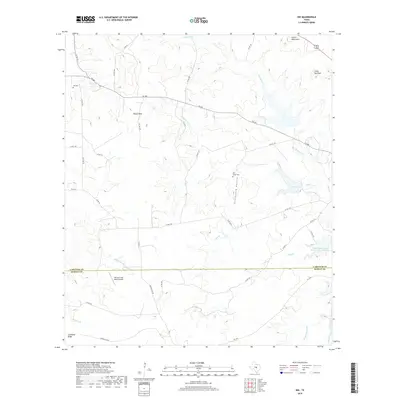
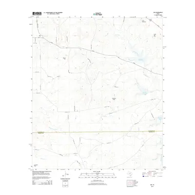 2014 Nix2014 Print · USGSCovers Nix, including Burnet County, Lampasas County, and other nearby areas
 - 2016 Map of Nix, 2016 Print
 2016 Nix2016 Print · USGSCovers Nix, including Burnet County, Lampasas County, and other nearby areas
 - 2019 Map of Nix, 2019 Print
 2019 Nix2019 Print · USGSCovers Nix, including Burnet County, Lampasas County, and other nearby areas
 - 2022 Map of Nix, 2022 Print
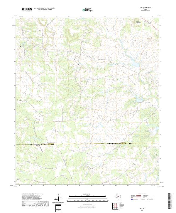 2022 Nix2022 Print · USGSThe Lampasas and Burnet county line comes alive in the early twenty-first century, showing a landscape of high ridges and deep creek hollows. Family historians can locate Nix Cem and Pitt Creek Cem or trace landmarks like Waters Mtn.
End of results
Showing maps 1-11 of 11
Top cities near Nix
Frequently asked questions
- What are the different types of historical maps available for Nix?
- What is the oldest map of Nix?
- Where can I purchase historical maps of Nix for my home or office?
- Where can I download high-res historical maps of Nix?
- Are there historical topographic maps available for Nix?
- Is there historical aerial imagery available for Nix?
- Where are historical maps of Nix sourced from?