Old Maps of Senterfitt, Texas for Academic Research
Study the evolution of Senterfitt with 11 high-resolution historic maps. Whether you're teaching, researching, or modeling changes in land use, these maps provide essential visual documentation of urban, environmental, and geographic change.
- Analyze long-term change: Track patterns in development, transportation, and natural features.
- Ideal for environmental or urban studies: Support academic projects with primary historical map data.
- Use in the classroom or lab: Educators and researchers rely on these maps to bring historical context to life.
These maps are a powerful tool for teaching, research, and visualizing how Senterfitt has changed over the decades.
Senterfitt, TX maps
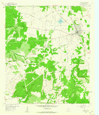
(11)- 1887 Map of Lampasas
 1887 Lampasas1887 Print · USGSThe Lampasas region in the late 1880s shows the arrival of the Gulf Colorado and Santa Fe Railroad alongside early frontier settlements. Local historians can trace old post offices and milling sites like Townsen Mills, Wayback, and Senterfitt among the numerous gaps and peaks of the Hill Country.
 - 1894 Map of Lampasas
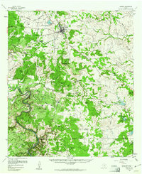
 1894 Lampasas1894 Print · USGSLampasas and the surrounding hill country are shown in the years following the arrival of the rail. Genealogists can trace family-named landmarks like Kinchelo Peak and old post offices at Senterfitt, Nix, and Wayback.4 unique versions available
 - 1954 Map of Brownwood, 1955 Print
 1954 Brownwood1955 Print · USGSCentral Texas in the early fifties shows a landscape of rail-linked cattle towns and winding river valleys before modern highway expansion. Genealogists and historians can trace family-named peaks and vanished rail stops like Trickham, Santa Anna, and the Brady Mountains.3 unique versions available
 - 1959 Map of Lometa, 1960 Print
 1959 Lometa1960 Print · USGSTexas ranching and rail history meet in the late fifties as the town of Lometa anchors the northern Lampasas County landscape. Researchers can locate the Senterfitt (Site), trace the Gulf Colorado and Santa Fe line, or find remote landmarks like Grassy Knob.
 - 1959 Map of Lometa, 1961 Print
 1959 Lometa1961 Print · USGSLometa and the surrounding Texas hill country are captured here in the late fifties as ranching and rail commerce shaped the land. Genealogists can locate family-named sites like Vann Ranch and Mc Creaville Ch, or trace the historic Senterfitt (Site).2 unique versions available
 - 1985 Map of San Saba
 1985 San Saba1985 Print · USGSCentral Texas in the mid-eighties was a landscape of river-valley ranching and quiet railroad towns. Researchers can trace family history through sites like San Saba Cem, follow the Atchison Topeka and Santa Fe line, or explore landmarks near Pecan Bayou.2 unique versions available
 - 2010 Map of Lometa, 2010 Print
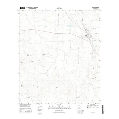
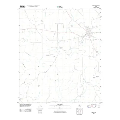 2010 Lometa2010 Print · USGSCovers Senterfitt, including Lometa, Lampasas County, and other nearby areas
 - 2012 Map of Lometa, 2012 Print
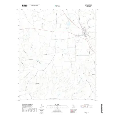
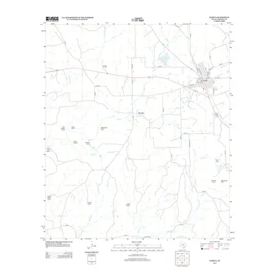 2012 Lometa2012 Print · USGSCovers Senterfitt, including Lometa, Lampasas County, and other nearby areas
 - 2016 Map of Lometa, 2016 Print
 2016 Lometa2016 Print · USGSCovers Senterfitt, including Lometa, Lampasas County, and other nearby areas
 - 2019 Map of Lometa, 2019 Print
 2019 Lometa2019 Print · USGSCovers Senterfitt, including Lometa, Lampasas County, and other nearby areas
 - 2022 Map of Lometa, 2022 Print
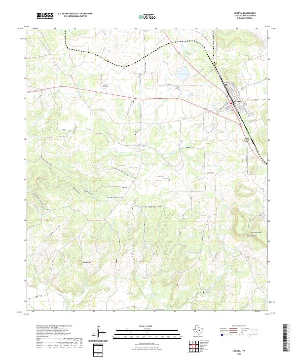 2022 Lometa2022 Print · USGSLometa and the surrounding Lampasas County ranch lands are detailed here during the early 2020s. Researchers can locate several family and community burial sites, including Senterfitt Cemetery and Medlin Cemetery, alongside natural landmarks like Panther Spring.
End of results
Showing maps 1-11 of 11
Top cities near Senterfitt
Frequently asked questions
- What are the different types of historical maps available for Senterfitt?
- What is the oldest map of Senterfitt?
- Where can I purchase historical maps of Senterfitt for my home or office?
- Where can I download high-res historical maps of Senterfitt?
- Are there historical topographic maps available for Senterfitt?
- Is there historical aerial imagery available for Senterfitt?
- Where are historical maps of Senterfitt sourced from?