Old Maps of Leon County, Texas for Metal Detecting
Plan your next treasure hunt with 80 historic maps of Leon County. Find old homesites, ghost towns, trails, and gathering spots that may be lost to time — perfect for identifying promising metal detecting locations.
- Locate forgotten sites: Uncover places like long-lost settlements, abandoned rail lines, or gathering spots.
- Plan better hunts: Use map overlays combined with LiDAR or satellite views to narrow in on historically rich areas.
- Made for detectorists: Thousands of hobbyists use these maps to discover relics, coins, and hidden history.
Use these historic maps to boost your research and find new opportunities beneath the surface of Leon County.
Leon County, TX maps
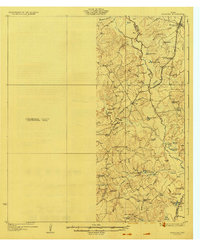
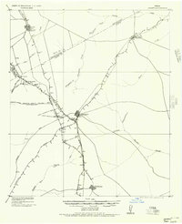
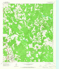
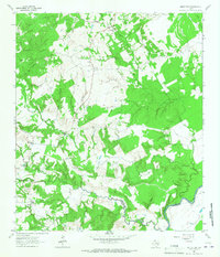
(80)- 1919 Map of Fairfield, 1956 Print
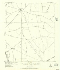 1919 Fairfield1956 Print · USGSFreestone County is captured here after the Great War, showing a network of rural post offices and schoolhouses linked by early wagon roads. You can trace the Trinity and Brazos Valley Railway near Freestone P.O. or locate old community centers like Dew and Turlington P.O..
 - 1925 Map of Iola No 2
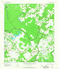
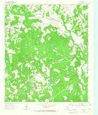
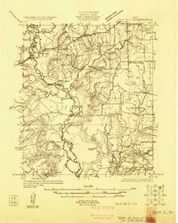 1925 Iola No 21925 Print · USGSThe Navasota River bottomlands at the Madison and Leon county line appear here in the mid-1920s as a landscape of winding oxbows and rural farmsteads. Researchers can locate family landmarks such as Keefer Cemetery, Burns Store, and the Morning Star School site.
 - 1925 Map of Marquez No. 1
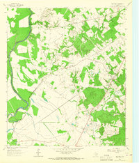
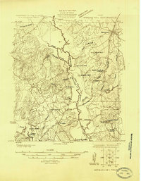 1925 Marquez No. 11925 Print · USGSThe Navasota River valley in the mid-1920s reveals a rural Texas landscape at the border of Leon and Robertson counties. Local researchers can locate vanished landmarks like Dolly School, the town of Venetia, and the historic Great Northern Trail.
 - 1925 Map of Marquez No. 4
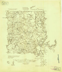 1925 Marquez No. 41925 Print · USGSThe Navasota River bottomlands in the mid-twenties were a complex maze of marshes and oxbows along the Robertson and Leon county line. Genealogists can locate rural schoolhouses like Elm Grove School or Navasota School and trace the early Pipe Line corridor near Easterly.
 - 1927 Map of Marquez
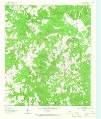
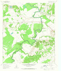
 1927 Marquez1927 Print · USGSThe Leon and Robertson county border in the 1920s was a landscape of small schools and river-bottom bottomlands centered on the Marquez settlement. Genealogists can trace family roots at Camp Creek Cemetery or locate old schoolhouses like Dolly School and Blue Grove School.2 unique versions available
 - 1930 Map of Marquez
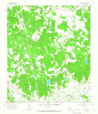
 1930 Marquez1930 Print · USGSRobertson and Leon counties are mapped here at the height of the steam-rail era. Genealogists can trace family footprints through rural post offices like Bald Prairie P.O. and community anchors like Holly Church and James School.
 - 1931 Map of Iola
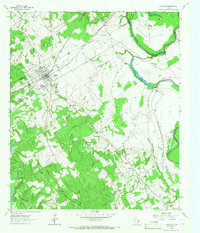
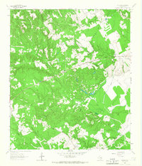
 1931 Iola1931 Print · USGSThe Navasota River basin in the mid-1920s shows a landscape of river-bottom lakes and rural outposts. Genealogists can locate family landmarks like Keefer Cem and Nash Cem or the local hub at Burns Store.2 unique versions available
 - 1951 Map of Elkhart, 1952 Print
 1951 Elkhart1952 Print · USGSEast Texas ranching and oil communities thrive along the river bottoms in the early fifties. Genealogists can trace family roots through numerous rural landmarks like Fort Houston Cem, Myrtle Springs Sch, and Old Salt Works Lake.2 unique versions available
 - 1953 Map of Palestine, 1964 Print
 1953 Palestine1964 Print · USGSEast Texas was defined by its deep pine forests and burgeoning energy sector in the mid-1950s. Genealogists and historians can trace the rail-and-river economy through settlements like Tennessee Colony and Pollok or explore the early footprints of the Cayuga Oil Field and Davy Crockett National Forest.2 unique versions available
 - 1954 Map of Waco, 1964 Print
 1954 Waco1964 Print · USGSCentral Texas during the mid-fifties shows a landscape defined by the expansion of Fort Hood Military Reservation and the Brazos river system. Trace the rail lines and early airfields like James Connally Air Force Base and settlements like Temple or McGregor.2 unique versions available
 - 1954 Map of Austin, 1964 Print
 1954 Austin1964 Print · USGSCentral Texas is captured during a period of steady growth as the capital city and its neighboring farm towns began to modernize. Researchers can trace historic rail corridors like the Southern Pacific RR or locate landmarks such as Bergstrom Air Force Base and Pilot Knob.4 unique versions available
 - 1955 Map of Waco
 1955 Waco1955 Print · USGSCentral Texas at the peak of the Cold War reveals a landscape defined by military expansion and major water projects. Researchers can trace the footprints of Fort Hood, the waters of Lake Waco, and regional hubs like Temple or Mexia.
 - 1956 Map of Jewett
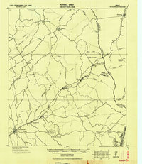
 1956 Jewett1956 Print · USGSLeon and Freestone counties emerge as a vital rail and mining hub in this early twentieth-century survey. Genealogists and historians can trace the growth of settlements like Jewett and Buffalo, or locate defunct stops such as Newly and the Evansville Coal Spur.
 - 1957 Map of Palestine
 1957 Palestine1957 Print · USGSEast Texas in the mid-fifties reveals a landscape of deep pine forests and winding river valleys before the era of massive reservoir construction. Researchers can trace the legacy of the timber and rail industries through labels for the Missouri Pacific RR, Davy Crockett National Forest, and Nacogdoches.
 - 1964 Map of Long Lake, 1967 Print
 1964 Long Lake1967 Print · USGSAnderson County during the mid-1960s was a landscape defined by the winding Trinity River and a burgeoning energy sector. Genealogists and local historians can pinpoint Mt Pilgrim Ch, the Green Bay High Sch, and the rail infrastructure of the Missouri Pacific.3 unique versions available
 - 1964 Map of Oakwood, 1967 Print
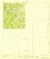
 1964 Oakwood1967 Print · USGSOakwood and the rural fringes of Leon County are captured here in the mid-1960s, centered on the Missouri Pacific rail corridor. Researchers can trace family roots through landmarks like Dunbar High Sch, Mount Pisgah Cem, and the Sand Flats settlement.
 - 1964 Map of Austonio, 1967 Print
 1964 Austonio1967 Print · USGSHouston County in the mid-1960s was a landscape of small agricultural hamlets and timbered ridges along the river. Genealogists can trace family roots through numerous rural landmarks like Monticello Cem, Mt Zion Ch, and the settlement of Austonio.2 unique versions available
 - 1964 Map of Centerville, 1967 Print
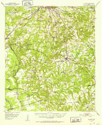
 1964 Centerville1967 Print · USGSCenterville and its surrounding Leon County countryside are captured here in the mid-1960s as a quiet network of rural parishes and family-named creek branches. Researchers can locate the Court House and High Sch or trace early community life through Hopewell Ch and Pleasant Springs.
 - 1964 Map of Flo, 1967 Print
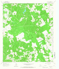
 1964 Flo1967 Print · USGSLeon County at the mid-century reveals a landscape defined by the Buffalo Oil Field and scattered family homesteads. Researchers can trace rural lineages through the Lummis Cem, Wheelock Cem, and the community hub at Flo.
 - 1964 Map of Spring Seat, 1967 Print
 1964 Spring Seat1967 Print · USGSLeon County's rural landscape is captured in the mid-1960s at a time when the railroad still defined the local geography through Flynn. Researchers can trace old family sites near Spring Creek Cem, Evans Chapel, and the vanished tracks of the F W & D line.2 unique versions available
 - 1964 Map of Eunice, 1967 Print
 1964 Eunice1967 Print · USGSLeon County's rural backcountry is documented here in the mid-sixties, showing a landscape of small settlements and creek-side cemeteries. Researchers can locate Victory Ch, trace the path of Nineveh Road, and find family history at Beaver Dam Cem.2 unique versions available
 - 1964 Map of Middleton, 1967 Print
 1964 Middleton1967 Print · USGSEastern Leon County during the mid-1960s was a landscape of small creek-side settlements and crossroads communities. Genealogists and local historians can trace family locations through landmarks like Spillers Store, the Thomason Cem, and Mount Airy Ch.3 unique versions available
 - 1964 Map of Halls Bluff, 1967 Print
 1964 Halls Bluff1967 Print · USGSThe Trinity River valley along the Houston and Leon county line is shown here in the mid-sixties. Researchers can trace the rural communities of Malvern and Wheeler Springs or locate family landmarks like Smith Cem and Union Prairie Ch.2 unique versions available
 - 1964 Map of Keechi, 1967 Print
 1964 Keechi1967 Print · USGSThe Freestone and Leon County line comes alive in the mid-1960s, showing a landscape defined by the Missouri Pacific rail line and local creek networks. Genealogists and historians can locate the Trahan Sch, Keechi Cem, and the specialized Oakwood Dome Oil Field.2 unique versions available
 - 1964 Map of Lake Leon, 1967 Print
 1964 Lake Leon1967 Print · USGSIn the mid-1960s, this area of Leon County was a hub of petroleum activity and small rural communities. Genealogists and historians can locate family burial grounds like North Creek Cemetery and Tubbs Cem near the oil derricks of the Navarro Crossing Oil Field.
Showing maps 1-25 of 80
Top cities of Leon County
- Buffalo historical maps
- Centerville historical maps
- Jewett historical maps
- Marquez historical maps
- Leona historical maps
Frequently asked questions
- What are the different types of historical maps available for Leon County?
- What is the oldest map of Leon County?
- Where can I purchase historical maps of Leon County for my home or office?
- Where can I download high-res historical maps of Leon County?
- Are there historical topographic maps available for Leon County?
- Is there historical aerial imagery available for Leon County?
- Where are historical maps of Leon County sourced from?