1960s Maps of Lubbock County, Texas
Explore 9 historic maps of Lubbock County from the 1960s. These maps offer a rare glimpse into what life looked like during the 1960s — showing old roads, neighborhoods, homes, and landmarks that have changed or disappeared over time.
Whether you're researching your family's past, planning a metal detecting trip, or studying how Lubbock County's landscape evolved across the 1960s, these high-resolution maps are a powerful tool for exploring the history of this region.
- Focus on a specific era: All maps on this page are from the 1960s, giving you a focused view of this time period.
- See what’s changed: Compare century-old streets, trails, and buildings to today's modern landscape using overlays and satellite layers.
- Research with precision: Use these maps for genealogy, historical research, land use analysis, or educational projects.
- View, download, or print: Maps are fully viewable online in high resolution, and can be downloaded or printed for your own records.
Start exploring Lubbock County's history through authentic maps from the 1960s. This is your window into the past.
Lubbock County, TX maps
(9)- 1962 Map of Brownfield
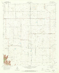
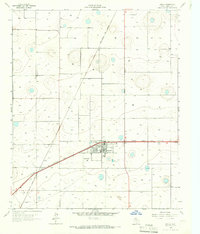
 1962 Brownfield1962 Print · USGSThe High Plains of Texas and New Mexico are captured in the early sixties as a thriving hub of oil production and ranching. Researchers can trace the industrial footprint of the Levelland and Slaughter Oil and Gas Field or locate smaller towns like Sundown and Littlefield.
 - 1965 Map of Acuff, 1966 Print
 1965 Acuff1966 Print · USGSThe Lubbock and Crosby county line during the mid-sixties shows a landscape shaped by petroleum and agricultural development. Genealogists and local historians can trace family-named roads and rural hubs like Acuff, Robertson, and the Ha-Na Field.
 - 1965 Map of Slaton, 1966 Print
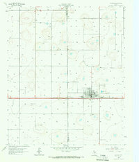
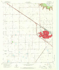 1965 Slaton1966 Print · USGSSlaton and the South Plains are captured in the mid-sixties as the railroad and agriculture define the landscape. Researchers can trace the community through Englewood Cem, Mercy Hospital, and local schools like Lubbock Sch.2 unique versions available
 - 1965 Map of Buffalo Springs Lake, 1966 Print
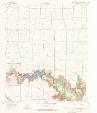 1965 Buffalo Springs Lake1966 Print · USGSThe Lubbock area during the mid-sixties reveals the dramatic carving of Yellow House Canyon through the Llano Estacado. Local researchers can trace the development of Buffalo Springs Lake and the rural community of Roosevelt at its mid-century peak.2 unique versions available
 - 1965 Map of Slaton NE, 1966 Print
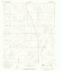
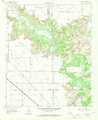 1965 Slaton NE1966 Print · USGSThe West Texas caprock country comes into focus in the mid-1960s as the rail lines and ranch lands around Lubbock County were being mapped in detail. Genealogists and local historians can trace the tracks of the Atchison Topeka and Santa Fe and locate family-named landmarks like Wood Ranch or the Katy K Ranch.2 unique versions available
 - 1965 Map of Idalou, 1966 Print
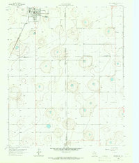
 1965 Idalou1966 Print · USGSLubbock County agricultural life is centered on Idalou in the mid-sixties, where two major rail lines intersect among the plains. Researchers can locate the Idalou Cem, the local Cotton Gin, and the small siding at Kitalou.2 unique versions available
 - 1965 Map of Petersburg, 1966 Print
 1965 Petersburg1966 Print · USGSThe South Plains of West Texas appear in the mid-1960s as a landscape of rural town centers and rail-side industry. Genealogists and historians can trace the Petersburg townsite and Estacado settlement, or locate the local Cemetery and the Fort Worth and Denver railroad.
 - 1965 Map of Lorenzo, 1966 Print
 1965 Lorenzo1966 Print · USGSTexas high plains life in the mid-sixties centered on the rail lines and agricultural hubs near the Lubbock County line. Genealogists and local historians can trace the foundations of Lorenzo through its Lorenzo Cem, Cotton Gin, and the Ralph Bunche Sch.
 - 1965 Map of Heckville, 1966 Print
 1965 Heckville1966 Print · USGSLubbock and Hale County farm life in the mid-sixties is centered on the railway and irrigation wells of the High Plains. Trace the path of the Fort Worth and Denver railroad through Becton and locate the historic Becton Cem and Heckville settlement.
End of results
Showing maps 1-9 of 9
Top cities of Lubbock County
- Lubbock historical maps
- Slaton historical maps
- Wolfforth historical maps
- Shallowater historical maps
- Idalou historical maps
- Ransom Canyon historical maps
See more
Frequently asked questions
- What are the different types of historical maps available for Lubbock County?
- What is the oldest map of Lubbock County?
- Where can I purchase historical maps of Lubbock County for my home or office?
- Where can I download high-res historical maps of Lubbock County?
- Are there historical topographic maps available for Lubbock County?
- Is there historical aerial imagery available for Lubbock County?
- Where are historical maps of Lubbock County sourced from?