1930s Maps of McLennan County, Texas
Explore 5 historic maps of McLennan County from the 1930s. These maps offer a rare glimpse into what life looked like during the 1930s — showing old roads, neighborhoods, homes, and landmarks that have changed or disappeared over time.
Whether you're researching your family's past, planning a metal detecting trip, or studying how McLennan County's landscape evolved across the 1930s, these high-resolution maps are a powerful tool for exploring the history of this region.
- Focus on a specific era: All maps on this page are from the 1930s, giving you a focused view of this time period.
- See what’s changed: Compare century-old streets, trails, and buildings to today's modern landscape using overlays and satellite layers.
- Research with precision: Use these maps for genealogy, historical research, land use analysis, or educational projects.
- View, download, or print: Maps are fully viewable online in high resolution, and can be downloaded or printed for your own records.
Start exploring McLennan County's history through authentic maps from the 1930s. This is your window into the past.
McLennan County, TX maps
(5)- 1931 Map of Whitney
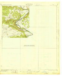 1931 Whitney1931 Print · USGSCentral Texas river life in the early twenties centers on the winding Brazos River before the era of modern dams. Genealogists can trace local school districts like Crackerbox Sch and river crossings such as Greenwade Bridge.2 unique versions available
 - 1931 Map of Valley Mills
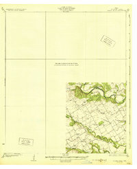 1931 Valley Mills1931 Print · USGSCentral Texas river valleys define the landscape in the mid-1920s, showing a rural network of farm-to-market crossings. Genealogists can trace family footprints near Speegleville or old meeting spots like Shiloh Ch and Caldwell Crossing.2 unique versions available
 - 1931 Map of Elm Mott
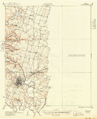
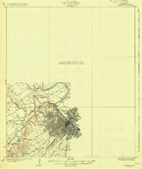 1931 Elm Mott1931 Print · USGSThe Waco area in the early thirties shows the city expanding toward the confluence of the Brazos and Bosque Rivers. Researchers can trace family roots through East Waco and McArthur Heights or locate rural landmarks like Whitehall Ch and Cameron Bridge.3 unique versions available
 - 1931 Map of Mc Gregor
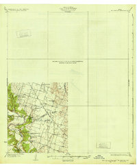 1931 Mc Gregor1931 Print · USGSCentral Texas rural life in the twenties is preserved here, showing a landscape densely dotted with family-named schools and country churches. Genealogists can trace ancestors through specific landmarks like Haunted Hill Sch, Blair Chapel, and the community at Eagle Springs.2 unique versions available
 - 1931 Map of Belton, 1949 Print
 1931 Belton1949 Print · USGSBell County in the 1920s and 30s reveals a landscape of river-valley farming and bustling railroad junctions centered on the county seat. Genealogists and historians can trace early community life through numerous rural landmarks like Moffat Sch, Tennessee Valley Ch, and the Belton and Temple Electric R R.
End of results
Showing maps 1-5 of 5
Top cities of McLennan County
- Waco historical maps
- Hewitt historical maps
- Robinson historical maps
- Bellmead historical maps
- Woodway historical maps
- Lacy Lakeview historical maps
See more
Frequently asked questions
- What are the different types of historical maps available for McLennan County?
- What is the oldest map of McLennan County?
- Where can I purchase historical maps of McLennan County for my home or office?
- Where can I download high-res historical maps of McLennan County?
- Are there historical topographic maps available for McLennan County?
- Is there historical aerial imagery available for McLennan County?
- Where are historical maps of McLennan County sourced from?