1950s Maps of McLennan County, Texas
Explore 29 historic maps of McLennan County from the 1950s. These maps offer a rare glimpse into what life looked like during the 1950s — showing old roads, neighborhoods, homes, and landmarks that have changed or disappeared over time.
Whether you're researching your family's past, planning a metal detecting trip, or studying how McLennan County's landscape evolved across the 1950s, these high-resolution maps are a powerful tool for exploring the history of this region.
- Focus on a specific era: All maps on this page are from the 1950s, giving you a focused view of this time period.
- See what’s changed: Compare century-old streets, trails, and buildings to today's modern landscape using overlays and satellite layers.
- Research with precision: Use these maps for genealogy, historical research, land use analysis, or educational projects.
- View, download, or print: Maps are fully viewable online in high resolution, and can be downloaded or printed for your own records.
Start exploring McLennan County's history through authentic maps from the 1950s. This is your window into the past.
McLennan County, TX maps
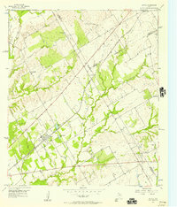
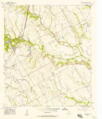
(29)- 1950 Map of Gatesville, 1953 Print
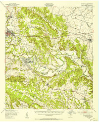 1950 Gatesville1953 Print · USGSCoryell County is captured here in the mid-twentieth century, showing the growing overlap between civilian life and the military footprint at North Fort Hood. Researchers can trace rural lineages through sites like Mound Cem, Leon Junction Sch, and the long-established State Reform School.
 - 1954 Map of Waco, 1964 Print
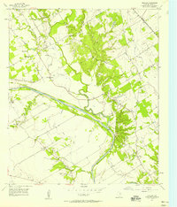
 1954 Waco1964 Print · USGSCentral Texas during the mid-fifties shows a landscape defined by the expansion of Fort Hood Military Reservation and the Brazos river system. Trace the rail lines and early airfields like James Connally Air Force Base and settlements like Temple or McGregor.2 unique versions available
 - 1955 Map of Waco
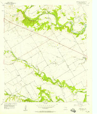
 1955 Waco1955 Print · USGSCentral Texas at the peak of the Cold War reveals a landscape defined by military expansion and major water projects. Researchers can trace the footprints of Fort Hood, the waters of Lake Waco, and regional hubs like Temple or Mexia.
 - 1955 Map of Coryell, 1956 Print
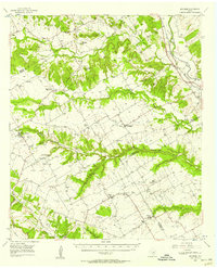
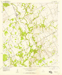
 1955 Coryell1956 Print · USGSCentral Texas ranching country comes into focus in the mid-1950s where three counties meet along the Middle Bosque River. Researchers can trace old family sites near Osage Sch, find the Sadler Cem, or locate the Prairie Chapel Sch.2 unique versions available
 - 1956 Map of Mosheim, 1957 Print
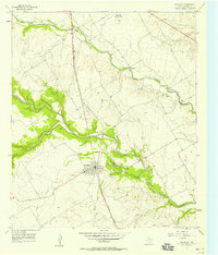
 1956 Mosheim1957 Print · USGSThe Bosque and McLennan county line comes alive in the mid-1950s, showing a rural landscape shaped by the Bosque River and central Texas rail lines. Genealogists and local historians can trace family roots through the Terrell Cemetery, Searsville Ch, and the small settlement of Mosheim.2 unique versions available
 - 1956 Map of Penelope, 1957 Print
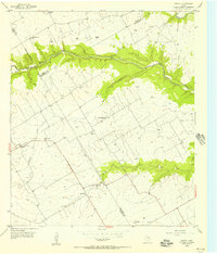
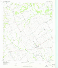
 1956 Penelope1957 Print · USGSThe Blackland Prairie of Hill and McLennan Counties was deeply tied to the Missouri Pacific railroad in the mid-fifties. Genealogists can trace family footprints through numerous rural burial sites like the Czech National Cem, Tabola Cem, and George Newton Cem.2 unique versions available
 - 1956 Map of Axtell, 1957 Print
 1956 Axtell1957 Print · USGSMid-century McLennan and Hill counties appear here at a busy rail-and-creek intersection just before significant modernization. Genealogists can trace rural family roots at TK Cem or Shead Cem, and follow the St Louis Southwestern rail line through Axtell.2 unique versions available
 - 1956 Map of West, 1957 Print
 1956 West1957 Print · USGSWest and the McLennan-Hill county line are captured here in the mid-1950s at a peak of rail and road connectivity. Researchers can trace family roots at National Cem or locate community hubs like the St Martins Sch and the local Rodeo Stadium.2 unique versions available
 - 1956 Map of Mosheim, 1957 Print
 1956 Mosheim1957 Print · USGSCentral Texas rural life in the mid-fifties is captured here across the Bosque, Coryell, and McLennan county lines. Genealogists can trace legacy sites from the Norway Mill to numerous local landmarks like Lanes Chapel and the Crossroad Store.
 - 1956 Map of Mart, 1958 Print
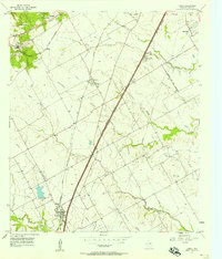
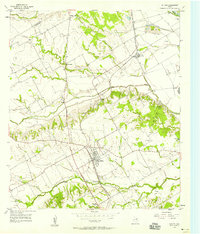
 1956 Mart1958 Print · USGSAgricultural life in McLennan County thrived in the mid-1950s as the town of Mart sat at the busy intersection of the Missouri Pacific rail line. Researchers can trace rural school locations like Anderson Sch and family burial sites at Evergreen Cem and Mart Cem.2 unique versions available
 - 1957 Map of Aquilla
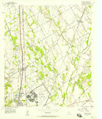
 1957 Aquilla1957 Print · USGSThe borderlands of Hill and McLennan counties come into focus during the late 1950s as a landscape of creekside farms and rail-side towns. Genealogists and local historians can pinpoint the Stotts Chapel Ch, Patten Lake, and the town of Aquilla.3 unique versions available
 - 1957 Map of Crawford
 1957 Crawford1957 Print · USGSIn the McLennan County countryside during the late 1950s, the town of Crawford thrived as a rail and ranching center. Researchers can trace family roots at Patton Ch or explore the river-driven landscape near Sycamore Hole and the Middle Bosque River.2 unique versions available
 - 1957 Map of Speegleville
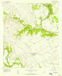
 1957 Speegleville1957 Print · USGSMcLennan County's river valleys and early oil industry are captured here in the mid-fifties, just as the region's rural character was beginning to shift. Researchers can trace family landmarks like Evergreen Cem and Shiloh Ch, or explore the footprint of the South Bosque Oil Field.4 unique versions available
 - 1957 Map of Prairie Hill
 1957 Prairie Hill1957 Print · USGSLimestone County in the late fifties remains a landscape of quiet creek-side communities and aviation history. Researchers can trace rural lineages through Mt Antioch Cem or locate the site of the Prairie Hill Air Force Auxiliary Airfield.2 unique versions available
 - 1957 Map of Bruceville, 1958 Print
 1957 Bruceville1958 Print · USGSThe Falls and McLennan County line in the late fifties shows a rural landscape shaped by the Missouri Kansas Texas rail line. Genealogists can trace family names through Beulah Cem, Mooreville Cem, and the Cottonwood Sch (Aband).4 unique versions available
 - 1957 Map of Gholson, 1958 Print
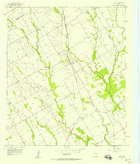
 1957 Gholson1958 Print · USGSMcLennan County in the late fifties shows a landscape shaped by the Brazos River and the Missouri Kansas Texas railroad. Genealogists can trace family names through numerous sites like Gholson Cemetery, Wesley Chapel, and the Gholson School.3 unique versions available
 - 1957 Map of Lorena, 1958 Print
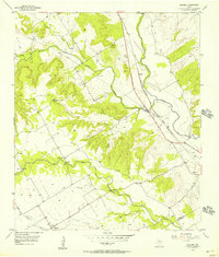
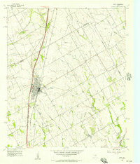
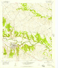
 1957 Lorena1958 Print · USGSThe community of Lorena and the developing outskirts of Robinson are captured in the mid-1950s as a new highway network begins to reshape the McLennan County landscape. Researchers can trace the path of the St Louis Southwestern railroad or locate family landmarks like Lawson Cem and Bledsoe Sch.5 unique versions available
 - 1957 Map of Otto, 1958 Print
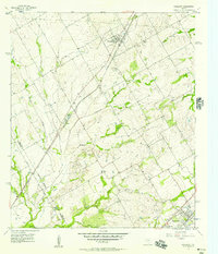
 1957 Otto1958 Print · USGSThe rural settlement of Otto and the surrounding Falls County countryside are captured here in the late fifties as family farms relied on the MISSOURI PACIFIC rail line. Researchers can locate many local landmarks including Metina Cem and the Corner Sch (Aband).
 - 1957 Map of Waco West, 1958 Print
 1957 Waco West1958 Print · USGSMid-century Waco expands toward the shores of the Bosque River as new suburban developments begin to ring the city. Researchers can trace the footprints of institutional landmarks like the Methodist Home and the Heart O' Texas Fairground.3 unique versions available
 - 1957 Map of Elm Mott, 1958 Print
 1957 Elm Mott1958 Print · USGSMcLennan County during the mid-fifties is captured here as a landscape of military aviation and railroad junctions. Researchers can trace the layout of the James Connally Air Force Base or locate local landmarks like Lindert Hall and Gerald Cemetery.3 unique versions available
 - 1957 Map of Riesel, 1958 Print
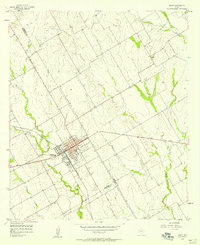
 1957 Riesel1958 Print · USGSCentral Texas farmland in the 1950s is captured here, centered on the rail-aligned town of Riesel. Trace the locations of rural schoolhouses and cemeteries like Sunset Sch, Hebron Cem, and the Blackland watershed headquarters.3 unique versions available
 - 1957 Map of Chilton, 1958 Print
 1957 Chilton1958 Print · USGSThe rural landscape of Falls County is captured here in the late fifties as rail lines and river bypasses shaped local life. Genealogists and historians can trace family roots through settlements like Chilton, Satin, and the Little Deer Creek Ch.3 unique versions available
 - 1957 Map of China Springs, 1958 Print
 1957 China Springs1958 Print · USGSCentral Texas farmland meets the winding Brazos River in the late fifties, showcasing a rural landscape defined by river bends and creek valleys. Genealogists can locate family landmarks like Patrick Cem, Oak Grove Ch, and the settlement of Erath.4 unique versions available
 - 1957 Map of Valley Mills, 1958 Print
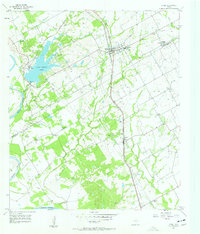
 1957 Valley Mills1958 Print · USGSThe Bosque River valley in the late fifties was a landscape of winding waterways and vital rail lines. Genealogists and local historians can trace family roots at Thiele Cem, explore the early footprint of Valley Mills, and locate the historic Waco Boys Camp (YMCA).2 unique versions available
 - 1957 Map of Waco East, 1958 Print
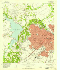
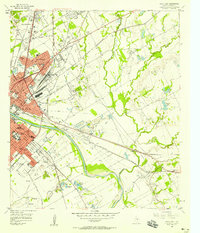 1957 Waco East1958 Print · USGSMid-century Waco and its eastern suburbs are shown here just as the post-war building boom transformed the Brazos River valley. Genealogists and historians can trace the foundations of Baylor University and locate numerous family sites at Restland Cemetery, Miller Memorial Cem, and East Waco.3 unique versions available
Showing maps 1-25 of 29
Top cities of McLennan County
- Waco historical maps
- Hewitt historical maps
- Robinson historical maps
- Bellmead historical maps
- Woodway historical maps
- Lacy Lakeview historical maps
See more
Frequently asked questions
- What are the different types of historical maps available for McLennan County?
- What is the oldest map of McLennan County?
- Where can I purchase historical maps of McLennan County for my home or office?
- Where can I download high-res historical maps of McLennan County?
- Are there historical topographic maps available for McLennan County?
- Is there historical aerial imagery available for McLennan County?
- Where are historical maps of McLennan County sourced from?