1900s (20th Century) Maps of Gholson, Texas
Explore 9 historic maps of Gholson from the 1900s (20th Century). These maps offer a rare glimpse into what life looked like during the 1900s — showing old roads, neighborhoods, homes, and landmarks that have changed or disappeared over time.
Whether you're researching your family's past, planning a metal detecting trip, or studying how Gholson's landscape evolved across the 1900s, these high-resolution maps are a powerful tool for exploring the history of this region.
- Focus on a specific era: All maps on this page are from the 1900s, giving you a focused view of this time period.
- See what’s changed: Compare century-old streets, trails, and buildings to today's modern landscape using overlays and satellite layers.
- Research with precision: Use these maps for genealogy, historical research, land use analysis, or educational projects.
- View, download, or print: Maps are fully viewable online in high resolution, and can be downloaded or printed for your own records.
Start exploring Gholson's history through authentic maps from the 1900s. This is your window into the past.
Gholson, TX maps
(9)- 1920 Map of Waco
 1920 Waco1920 Print · USGSWaco and its surrounding rail corridors are captured in high detail shortly after the first World War. Researchers can trace the legacy of Rifle Range Camp MacArthur and vanished river crossings like Greenwoods Ferry and Old Towash.
 - 1931 Map of Valley Mills
 1931 Valley Mills1931 Print · USGSCentral Texas river valleys define the landscape in the mid-1920s, showing a rural network of farm-to-market crossings. Genealogists can trace family footprints near Speegleville or old meeting spots like Shiloh Ch and Caldwell Crossing.2 unique versions available
 - 1931 Map of Elm Mott
 1931 Elm Mott1931 Print · USGSThe Waco area in the early thirties shows the city expanding toward the confluence of the Brazos and Bosque Rivers. Researchers can trace family roots through East Waco and McArthur Heights or locate rural landmarks like Whitehall Ch and Cameron Bridge.3 unique versions available
 - 1954 Map of Waco, 1964 Print
 1954 Waco1964 Print · USGSCentral Texas during the mid-fifties shows a landscape defined by the expansion of Fort Hood Military Reservation and the Brazos river system. Trace the rail lines and early airfields like James Connally Air Force Base and settlements like Temple or McGregor.2 unique versions available
 - 1955 Map of Waco
 1955 Waco1955 Print · USGSCentral Texas at the peak of the Cold War reveals a landscape defined by military expansion and major water projects. Researchers can trace the footprints of Fort Hood, the waters of Lake Waco, and regional hubs like Temple or Mexia.
 - 1957 Map of Aquilla
 1957 Aquilla1957 Print · USGSThe borderlands of Hill and McLennan counties come into focus during the late 1950s as a landscape of creekside farms and rail-side towns. Genealogists and local historians can pinpoint the Stotts Chapel Ch, Patten Lake, and the town of Aquilla.3 unique versions available
 - 1957 Map of Gholson, 1958 Print
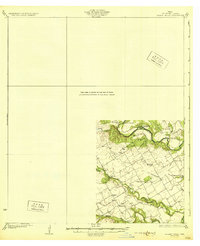
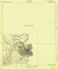
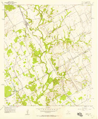
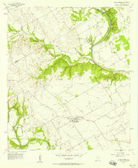
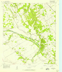 1957 Gholson1958 Print · USGSMcLennan County in the late fifties shows a landscape shaped by the Brazos River and the Missouri Kansas Texas railroad. Genealogists can trace family names through numerous sites like Gholson Cemetery, Wesley Chapel, and the Gholson School.3 unique versions available
 - 1957 Map of China Springs, 1958 Print
 1957 China Springs1958 Print · USGSCentral Texas farmland meets the winding Brazos River in the late fifties, showcasing a rural landscape defined by river bends and creek valleys. Genealogists can locate family landmarks like Patrick Cem, Oak Grove Ch, and the settlement of Erath.4 unique versions available
 - 1985 Map of Waco
 1985 Waco1985 Print · USGSCentral Texas in the mid-eighties shows a landscape of river-fed lakes and bustling transit hubs as the region expanded. Genealogists and historians can trace rail lines like the Missouri Kansas Texas or locate sites such as Rosemound Cem and Meridian State Park.2 unique versions available
End of results
Showing maps 1-9 of 9
Top cities near Gholson
- Waco historical maps
- Robinson historical maps
- Bellmead historical maps
- Woodway historical maps
- Hillsboro historical maps
- Lacy Lakeview historical maps
See more
Frequently asked questions
- What are the different types of historical maps available for Gholson?
- What is the oldest map of Gholson?
- Where can I purchase historical maps of Gholson for my home or office?
- Where can I download high-res historical maps of Gholson?
- Are there historical topographic maps available for Gholson?
- Is there historical aerial imagery available for Gholson?
- Where are historical maps of Gholson sourced from?