2020s Maps of Waco, Texas
Explore 9 historic maps of Waco from the 2020s. These maps offer a rare glimpse into what life looked like during the 2020s — showing old roads, neighborhoods, homes, and landmarks that have changed or disappeared over time.
Whether you're researching your family's past, planning a metal detecting trip, or studying how Waco's landscape evolved across the 2020s, these high-resolution maps are a powerful tool for exploring the history of this region.
- Focus on a specific era: All maps on this page are from the 2020s, giving you a focused view of this time period.
- See what’s changed: Compare century-old streets, trails, and buildings to today's modern landscape using overlays and satellite layers.
- Research with precision: Use these maps for genealogy, historical research, land use analysis, or educational projects.
- View, download, or print: Maps are fully viewable online in high resolution, and can be downloaded or printed for your own records.
Start exploring Waco's history through authentic maps from the 2020s. This is your window into the past.
Waco, TX maps
(9)- 2022 Map of Lorena, 2022 Print
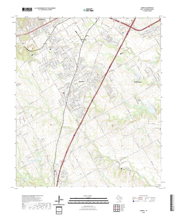 2022 Lorena2022 Print · USGSModern McLennan County comes into focus as the suburban growth of Hewitt and Lorena meets the winding banks of Bull Hide Cr. Genealogists can locate family landmarks such as Stanford Chapel Cem and Lawson Cem among the evolving residential grids.
 - 2022 Map of Gholson, 2022 Print
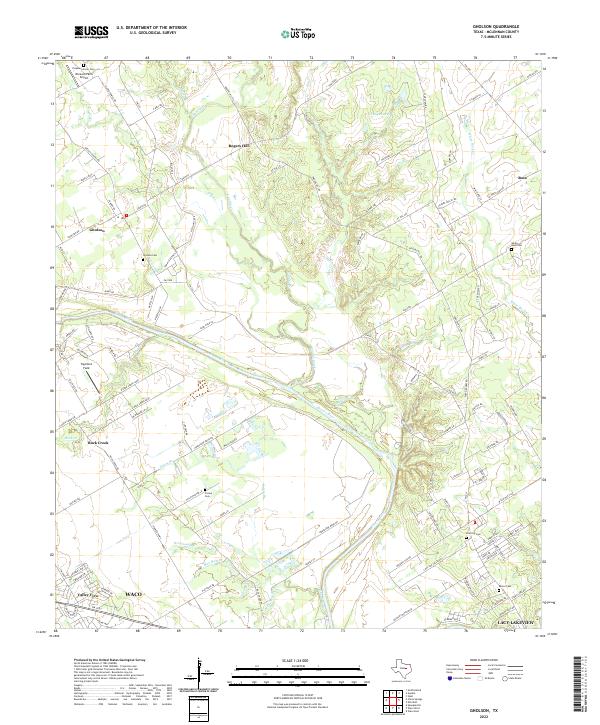 2022 Gholson2022 Print · USGSThe Brazos River valley north of Waco comes into focus in this recent survey of McLennan County. Genealogists and local historians can locate several historic burial sites, including White Rock Cem, Moore Cem, and the Pleasant Grove Cem.
 - 2022 Map of Elm Mott, 2022 Print
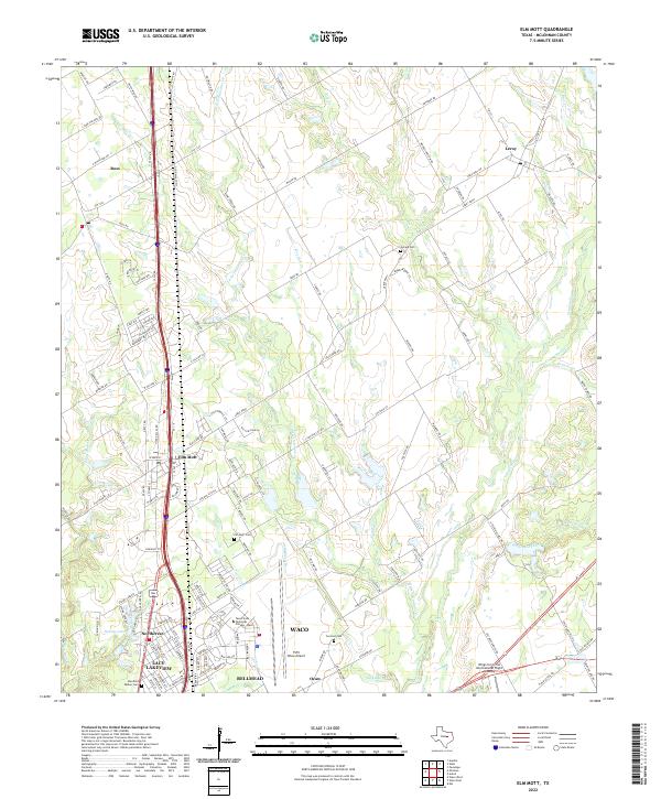 2022 Elm Mott2022 Print · USGSNorth of Waco during the early 2020s, this area shows a mix of rural prairie life and aviation hubs. Genealogists can locate family sites like Stanfield Walker Cemetery and Elm Mott Cemetery while tracing the waters of Tehuacana Creek.
 - 2022 Map of Waco East, 2022 Print
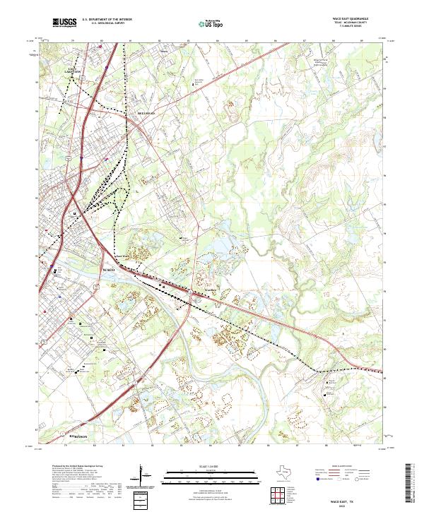 2022 Waco East2022 Print · USGSThe Brazos River serves as the central artery for this contemporary view of the Waco metropolitan area and its eastern suburbs. Genealogists can locate numerous burial grounds across the city, from First Street Cem to Rodef Sholom Cem and Chapel Hill Cem.
 - 2022 Map of China Springs, 2022 Print
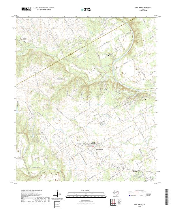 2022 China Springs2022 Print · USGSMcLennan County's river valleys northwest of Waco appear here in detail during the early twenty-first century. Genealogists and local historians can trace family locations near China Springs, the river loops at Wortham Bend, and rural burial sites like Patrick Cem.
 - 2022 Map of Waco West, 2022 Print
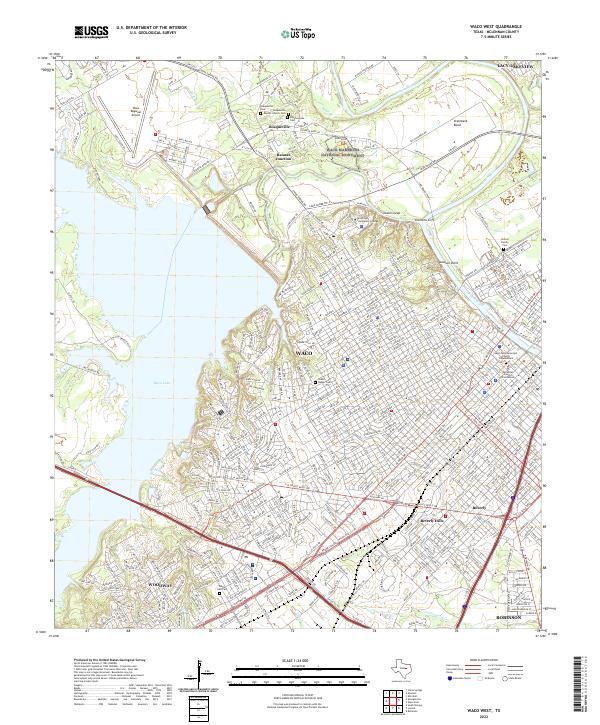 2022 Waco West2022 Print · USGSGreater Waco and the Brazos River corridor are shown here in the early twenty-first century as urban growth meets ancient history. Researchers can trace family sites at the Kellum Family Cem or explore the area around the Waco Mammoth National Monument.
 - 2022 Map of Speegleville, 2022 Print
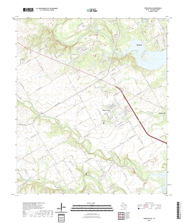 2022 Speegleville2022 Print · USGSMcLennan County in the early twenty-first century reveals a landscape shaped by the waters of Waco Lake and its tributary rivers. Researchers can locate family landmarks like Evergreen Cem and trace the rural reaches of Ocee and Speegleville.
 - 2022 Map of South Bosque, 2022 Print
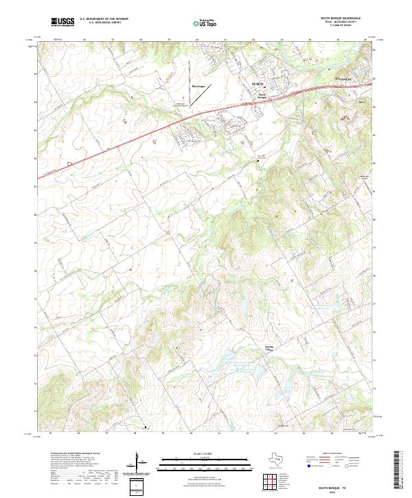 2022 South Bosque2022 Print · USGSMcLennan County at the start of the 2020s shows a landscape of growing communities and managed water resources west of Waco. Trace local family roots at Harris Creek Cem or explore the aviation history of McGregor Executive Airport and Rabbit Run Airport.
 - 2022 Map of Robinson, 2022 Print
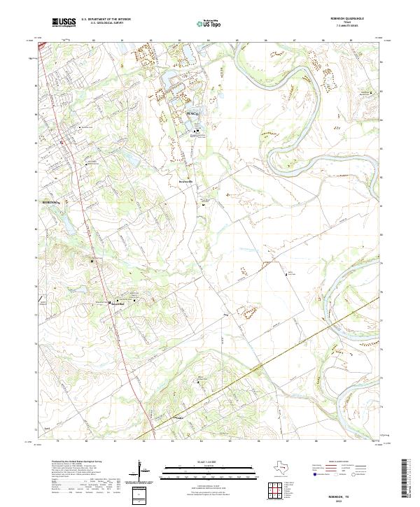 2022 Robinson2022 Print · USGSSettlements south of Waco thrive along the Brazos River in this modern Texas survey. Genealogists can locate family landmarks at Mount Olive Cem Old, Majors Chapel Cem, and old church sites in Downsville and Rosenthal.
End of results
Showing maps 1-9 of 9
Top cities near Waco
- Hewitt historical maps
- Robinson historical maps
- Bellmead historical maps
- Woodway historical maps
- Lacy Lakeview historical maps
- McGregor historical maps
See more
Top neighborhoods of Waco
- Ritchie historical maps
- Speegleville historical maps
- Vemo historical maps
- Bosqueville historical maps
- South Bosque historical maps
- Erath historical maps
See more
Frequently asked questions
- What are the different types of historical maps available for Waco?
- What is the oldest map of Waco?
- Where can I purchase historical maps of Waco for my home or office?
- Where can I download high-res historical maps of Waco?
- Are there historical topographic maps available for Waco?
- Is there historical aerial imagery available for Waco?
- Where are historical maps of Waco sourced from?