Old Maps of Double Ford, Texas for Metal Detecting
Plan your next treasure hunt with 14 historic maps of Double Ford. Find old homesites, ghost towns, trails, and gathering spots that may be lost to time — perfect for identifying promising metal detecting locations.
- Locate forgotten sites: Uncover places like long-lost settlements, abandoned rail lines, or gathering spots.
- Plan better hunts: Use map overlays combined with LiDAR or satellite views to narrow in on historically rich areas.
- Made for detectorists: Thousands of hobbyists use these maps to discover relics, coins, and hidden history.
Use these historic maps to boost your research and find new opportunities beneath the surface of Double Ford.
Double Ford, TX maps
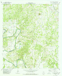
(14)- 1885 Map of San Saba
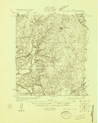
 1885 San Saba1885 Print · USGSCentral Texas in the late nineteenth century comes alive through this survey of the river valleys and high knobs. Genealogists and researchers can trace the early foundations of San Saba and Goldthwaite, or find forgotten locations like Regency and Bendy.
 - 1894 Map of San Saba
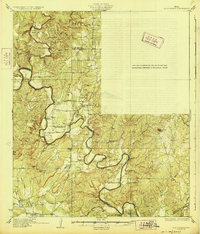
 1894 San Saba1894 Print · USGSCentral Texas in the late nineteenth century is defined here by the meeting of the San Saba River and the Colorado River. Researchers can trace the path of the Gulf Colorado and Santa Fe Railroad near Goldthwaite or locate early settlements like Richland Springs and Red Bluff.4 unique versions available
 - 1925 Map of San Saba 1-d
 1925 San Saba 1-d1925 Print · USGSThe Colorado River corridor between Mills and San Saba counties is captured here in the mid-1920s. Genealogists can locate rural community hubs like Nabors Creek School and Shaw Bend School or trace the early Santa Fe rail line.
 - 1928 Map of Goldthwaite
 1928 Goldthwaite1928 Print · USGSThe Colorado River snakes through the Mills and San Saba county line during the mid-twenties, a time of small schoolhouses and river fords. Genealogists can trace family landmarks like San Saba Peak, Big Valley Church, and the Rock Spring School.
 - 1948 Map of Goldthwaite, 1970 Print
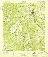
 1948 Goldthwaite1970 Print · USGSMills and San Saba Counties come to life in the late 1940s as the railroad and the Colorado River define the local economy. Researchers can trace ancestral footprints at McMillan Cem, Rock Spring School, or the remote Big Valley Church.
 - 1950 Map of Goldthwaite
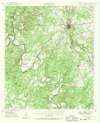
 1950 Goldthwaite1950 Print · USGSGoldthwaite and the surrounding ranchlands of Mills County are shown here at mid-century, following the winding meanders of the Colorado River. Researchers can locate several rural schools and churches like Flat Rock School and Lower Valley Church, or trace the path of the Gulf Colorado and Santa Fe Railway.
 - 1954 Map of Brownwood, 1955 Print
 1954 Brownwood1955 Print · USGSCentral Texas in the early fifties shows a landscape of rail-linked cattle towns and winding river valleys before modern highway expansion. Genealogists and historians can trace family-named peaks and vanished rail stops like Trickham, Santa Anna, and the Brady Mountains.3 unique versions available
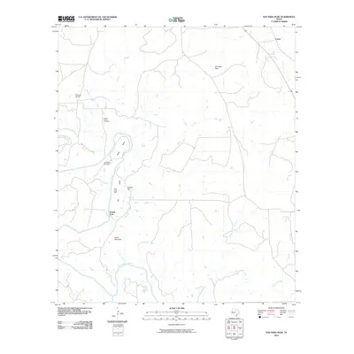
 - 1980 Map of San Saba Peak
 1980 San Saba Peak1980 Print · USGSThe Colorado River marks the county lines of San Saba and Mills in the late 1970s, framing a landscape of isolated peaks and river bends. Researchers can locate family landmarks such as Nabors Creek Cem and Shaw Bend Cem near the slopes of San Saba Peak.
 - 1985 Map of San Saba
 1985 San Saba1985 Print · USGSCentral Texas in the mid-eighties was a landscape of river-valley ranching and quiet railroad towns. Researchers can trace family history through sites like San Saba Cem, follow the Atchison Topeka and Santa Fe line, or explore landmarks near Pecan Bayou.2 unique versions available
 - 2010 Map of San Saba Peak, 2010 Print
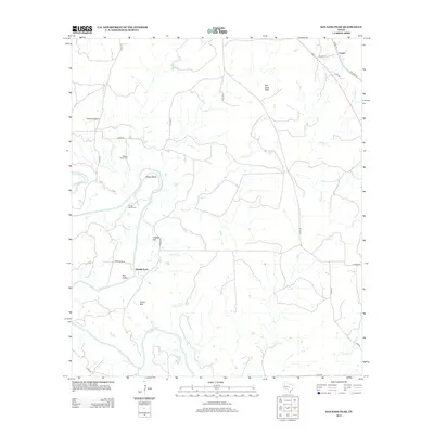
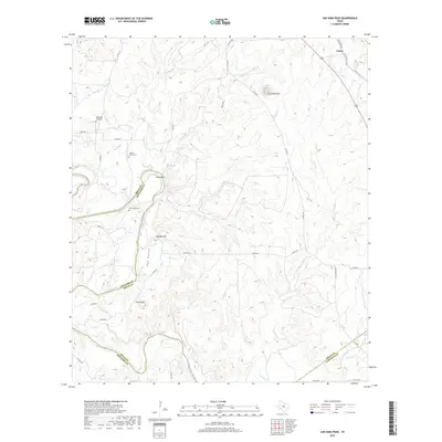
 2010 San Saba Peak2010 Print · USGSCovers Double Ford, including Castor, Mills County, and other nearby areas
 - 2013 Map of San Saba Peak, 2013 Print
 2013 San Saba Peak2013 Print · USGSCovers Double Ford, including Castor, Mills County, and other nearby areas
 - 2016 Map of San Saba Peak, 2016 Print
 2016 San Saba Peak2016 Print · USGSCovers Double Ford, including Castor, Mills County, and other nearby areas
 - 2019 Map of San Saba Peak, 2019 Print
 2019 San Saba Peak2019 Print · USGSCovers Double Ford, including Castor, Mills County, and other nearby areas
 - 2022 Map of San Saba Peak, 2022 Print
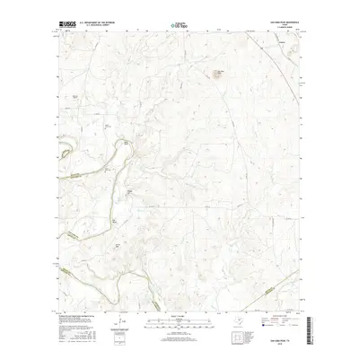
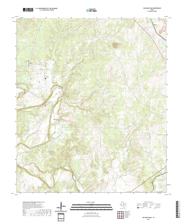 2022 San Saba Peak2022 Print · USGSCentral Texas rangeland and the winding Colorado River are captured here in the 2020s. Researchers can locate family landmarks like Nabors Creek Cem and Shaw Bend Cem, or trace the rugged topography near San Saba Peak.
End of results
Showing maps 1-14 of 14
Top cities near Double Ford
Frequently asked questions
- What are the different types of historical maps available for Double Ford?
- What is the oldest map of Double Ford?
- Where can I purchase historical maps of Double Ford for my home or office?
- Where can I download high-res historical maps of Double Ford?
- Are there historical topographic maps available for Double Ford?
- Is there historical aerial imagery available for Double Ford?
- Where are historical maps of Double Ford sourced from?