1960s Maps of Montague County, Texas
Explore 24 historic maps of Montague County from the 1960s. These maps offer a rare glimpse into what life looked like during the 1960s — showing old roads, neighborhoods, homes, and landmarks that have changed or disappeared over time.
Whether you're researching your family's past, planning a metal detecting trip, or studying how Montague County's landscape evolved across the 1960s, these high-resolution maps are a powerful tool for exploring the history of this region.
- Focus on a specific era: All maps on this page are from the 1960s, giving you a focused view of this time period.
- See what’s changed: Compare century-old streets, trails, and buildings to today's modern landscape using overlays and satellite layers.
- Research with precision: Use these maps for genealogy, historical research, land use analysis, or educational projects.
- View, download, or print: Maps are fully viewable online in high resolution, and can be downloaded or printed for your own records.
Start exploring Montague County's history through authentic maps from the 1960s. This is your window into the past.
Montague County, TX maps
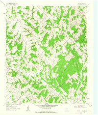
(24)- 1960 Map of Buzzard Roost Knob, 1963 Print
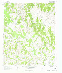
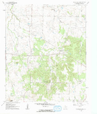 1960 Buzzard Roost Knob1963 Print · USGSMontague County ranching and early oil exploration are documented here during the early sixties. Genealogists and historians can trace the foundations of local life at Rock Spring Sch, Queens Peak, and the Texas Agricultural Experimental Station.2 unique versions available
 - 1961 Map of Muenster West, 1963 Print
 1961 Muenster West1963 Print · USGSThe Cooke and Montague county line comes alive in the early sixties, showing the agricultural prairie and the western outskirts of Muenster. Trace the diagonal route of the Missouri Kansas Texas railroad and locate early petroleum activity at numerous Oil Wells.2 unique versions available
 - 1961 Map of Saint Jo, 1963 Print
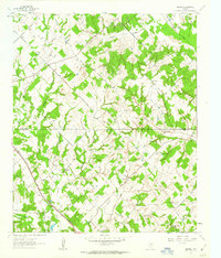
 1961 Saint Jo1963 Print · USGSSaint Jo and the surrounding Montague County hills are captured here in the early sixties, showing a landscape shaped by the Missouri Kansas Texas railroad. Researchers can locate family sites at Mountain Park (Cem) or trace the early oil and quarrying work along Deep Draw.2 unique versions available
 - 1961 Map of Stoneburg, 1963 Print
 1961 Stoneburg1963 Print · USGSMontague County's cattle and oil country is frozen in time just after the mid-century, centered on the railroad hub of Stoneburg. Local historians can trace family ties at Adora Cem or follow the old tracks of the Chicago Rock Island and Pacific.2 unique versions available
 - 1961 Map of Salona, 1963 Print
 1961 Salona1963 Print · USGSMontague County settlements and petroleum fields are well-established in this early 1960s survey. Genealogists can trace family footprints at Mitchell Cem or Denver Sch, while historians can map the early boundaries of Mueller Oil Field and Salona.2 unique versions available
 - 1961 Map of Brushy Mound, 1963 Print
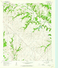
 1961 Brushy Mound1963 Print · USGSMontague County and Clay County are captured in the early sixties as the landscape shifted toward oil production and reservoir development. Genealogists and researchers can locate McDonald Cem and trace the rail lines of the Fort Worth and Denver near the expanding Lake Amon G. Carter.2 unique versions available
 - 1961 Map of Selma, 1963 Print
 1961 Selma1963 Print · USGSThe rural borderlands of North Texas are captured here in the early sixties as the waters of Lake Amon G Carter reach their modern levels. Researchers can trace family roots at Selma Cem or Crafton Cem and locate industrial landmarks like the Bowie SW Oil Field.2 unique versions available
 - 1961 Map of Freemound, 1963 Print
 1961 Freemound1963 Print · USGSNorth Texas ranch land and the rising petroleum industry meet in the early sixties along the Cooke County line. Researchers can trace rural life and energy development through local landmarks like Freemound, the Gatewood oil field, and Bingham Creek.
 - 1961 Map of New Harp, 1963 Print
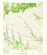
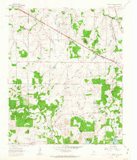
 1961 New Harp1963 Print · USGSThe Texas hill country where Wise and Montague counties meet is shown in the early sixties as a region of sparse ranching settlements and creek-carved terrain. Genealogists can trace the rural communities surrounding New Harp, including Audubon Ch and the remote Cottonwood Cem.3 unique versions available
 - 1961 Map of Montague, 1963 Print
 1961 Montague1963 Print · USGSMontague and the surrounding North Texas hill country are captured here in the early sixties as the petroleum industry reshaped the rural landscape. Trace local family roots at St Williams Cem or locate old operations in the sprawling Oil Field.2 unique versions available
 - 1961 Map of Sunset, 1963 Print
 1961 Sunset1963 Print · USGSSunset and the surrounding Montague County rangeland are captured here in the early sixties, as new dams reshaped the local watersheds. Genealogists and local historians can locate Carter Lake Chapel, the community of Fruitland, and the industrial site at the Gravel Pit.2 unique versions available
 - 1961 Map of Smyrna, 1963 Print
 1961 Smyrna1963 Print · USGSThe Montague and Wise county line met in the early sixties amidst a landscape of active petroleum extraction and public grasslands. Local historians can trace family ties at Smyrna, the Lake Valley Cem, and churches like Union Hill Ch.2 unique versions available
 - 1961 Map of Bowie, 1963 Print
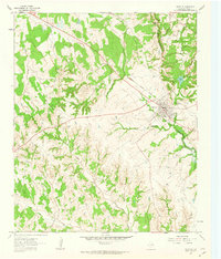
 1961 Bowie1963 Print · USGSBowie sat at a vital railway junction in the early sixties as the regional oil and gravel industries reached their peak. Genealogists can locate several schools and rural burial sites like Elmwood Cemetery, Lindale Cem, and Lone Star Ch.2 unique versions available
 - 1961 Map of Forestburg, 1963 Print
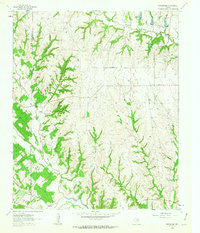
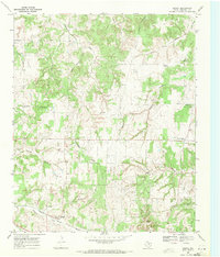
 1961 Forestburg1963 Print · USGSMontague County’s rural character is well-preserved in this early 1960s survey of the country surrounding Forestburg. Local historians can trace the foundations of the regional oil and gravel industries or locate family landmarks like Hardy Cem, Tadlock Hill, and the Mallard Oil Field.2 unique versions available
 - 1961 Map of Greenwood, 1964 Print
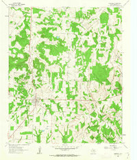
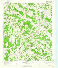
 1961 Greenwood1964 Print · USGSThe rural landscape of Wise County in the early sixties is detailed here, showing a network of small settlements and creek-side farms. Genealogists can trace family roots at Beasley Cem and visit the community centers at Greenwood and Dixon Creek Church.2 unique versions available
 - 1968 Map of Bonita, 1971 Print
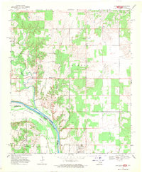
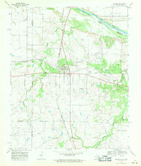
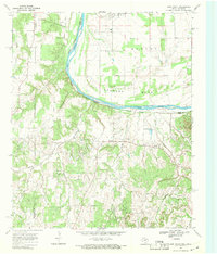
 1968 Bonita1971 Print · USGSMontague County during the late sixties was a landscape defined by cattle country and the steady hum of the oil industry. Genealogists and historians can trace the foundations of Bonita along the Missouri Kansas Texas rail line or locate quiet sites like Union Cem and Shady Grove Ch.
 - 1968 Map of Spanish Fort, 1971 Print
 1968 Spanish Fort1971 Print · USGSThe Oklahoma-Texas borderlands along the Red River appear here in the late sixties as a landscape of rural settlements and emerging energy fields. Researchers can locate early burial sites and communities like Petersburg Cem, Spanish Fort, and the Illinois Bend Oil Field.2 unique versions available
 - 1968 Map of Leon North, 1971 Print
 1968 Leon North1971 Print · USGSThe Red River frontier comes into focus during the late 1960s as it weaves between Oklahoma and Texas. Researchers can trace family roots at Courtney Cem or explore the river loops at Illinois Bend and the small settlements of Leon and Rubottom.2 unique versions available
 - 1968 Map of Terral, 1971 Print
 1968 Terral1971 Print · USGSThe Red River valley at the Oklahoma-Texas border in the late 1960s is defined by the winding Red River and the Chicago Rock Island and Pacific rail corridor. Genealogists and local historians can map out the town of Terral, locating the Terral Cem and the small nearby settlement of Fleet.2 unique versions available
 - 1968 Map of Nocona, 1971 Print
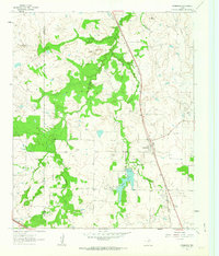
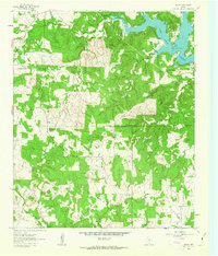
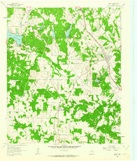
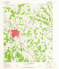
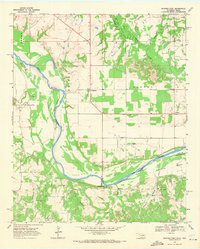
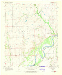
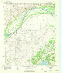
 1968 Nocona1971 Print · USGSMontague County in the late sixties shows the town of Nocona expanding alongside the waters of Lake Nocona. Local historians can trace family plots at Molsbee Cem or Robinson Cem and locate vanished cultural landmarks like the Drive-in Theatre and the Rodeo Ground.2 unique versions available
 - 1968 Map of Fleetwood, 1971 Print
 1968 Fleetwood1971 Print · USGSThe Oklahoma-Texas borderlands are captured here in the late sixties along the winding Red River. Researchers can trace the layout of Fleetwood, locate the church at Union, and map local industry through scattered Oil Wells and pipelines.
 - 1968 Map of Prairie Valley School, 1971 Print
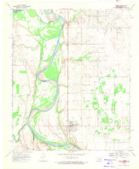
 1968 Prairie Valley School1971 Print · USGSThe borderlands of Montague County and Jefferson County come into focus during the late sixties as the Red River winds through the Spanish Fort Field. Researchers can locate Prairie Valley Sch, the Spanish Fort Cemeteries, and the early footprint of Hynds City alongside the waters of Lake Nocona.
 - 1968 Map of Ringgold, 1971 Print
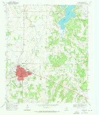
 1968 Ringgold1971 Print · USGSNorthern Montague County is captured here in the late sixties, anchored by the rail crossing at Ringgold. Genealogists and historians can locate Ringgold Cem, the Worsham Oil Field, and the banks of the Red River.
 - 1968 Map of Leon South, 1971 Print
 1968 Leon South1971 Print · USGSThe Red River frontier in the late sixties reveals a landscape of oil production and scattered prairie settlements along the Oklahoma-Texas line. Researchers can trace family history through numerous rural landmarks like Brushy Mound Cemetery, Bulcher, and Shiloh Ch Cem.
End of results
Showing maps 1-24 of 24
Top cities of Montague County
Frequently asked questions
- What are the different types of historical maps available for Montague County?
- What is the oldest map of Montague County?
- Where can I purchase historical maps of Montague County for my home or office?
- Where can I download high-res historical maps of Montague County?
- Are there historical topographic maps available for Montague County?
- Is there historical aerial imagery available for Montague County?
- Where are historical maps of Montague County sourced from?