
1960 Map of Buzzard Roost Knob
USGS Topo · Published 1963About this map
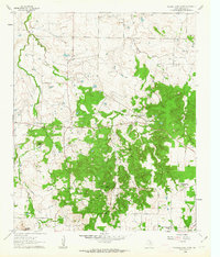
Queens Peak and the surrounding ranching landscape of Montague County are defined by a complex network of waterways and early community centers. This 1960 field-checked survey reveals a rural Texas economy transitioning through the mid-20th century, evidenced by the numerous Oil Wells and Drill Holes that dot the landscape alongside traditional landmarks like the Texas Agricultural Experimental Station. High points such as Buzzard Roost Knob, Colt Mtn, and Red Mound provide natural surveillance over the drainages of East Belknap Creek and Barrel Springs Creek. The social fabric of the era is captured through the presence of the Lone Star Sch and Rock Spring Sch, while local genealogy is grounded at the Oak Hill Cem and Rock Spring Cem. This survey also meticulously records property boundaries with fine red lines, indicating the established fence and field lines visible from aerial photography of the time.
Find a feature on this map
24 named features on this map. Tap any name to fly to it.
Don’t see what you’re looking for? This feature index may not catch every label — zoom into the map to look around manually.
Map Details
Editions of this 1960 Buzzard Roost Knob Map
2 editions found
Other maps of this area

1905 · Montague
USGS Topo · 1:125,000

1954 · Sherman
USGS Topo · 1:250,000

1958 · Sherman
USGS Topo · 1:250,000

1961 · Stoneburg
USGS Topo · 1:24,000

1961 · Salona
USGS Topo · 1:24,000

1961 · Brushy Mound
USGS Topo · 1:24,000

1961 · Montague
USGS Topo · 1:24,000

1961 · Bowie
USGS Topo · 1:24,000

1968 · Nocona
USGS Topo · 1:24,000
1968 · Ringgold
USGS Topo · 1:24,000