
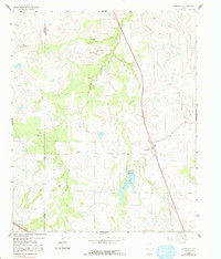
1961 Map of Stoneburg
USGS Topo · Published 1963About this map
Stoneburg serves as a central hub in this North Texas landscape, situated along the Chicago Rock Island and Pacific railroad line. The map highlights a rural community anchored by historical sites such as Hopewell Ch, Hopewell Cem, and Adora Cem, providing valuable location data for genealogists. The terrain is defined by the branching network of Belknap Creek, including its West and Middle forks, which feed into Bowie Lake near the Ford Spillway. Prominent topographic features like Double Mounds and Flag Mound rise above the drainage basins, while the Underwood Ray Field and scattered oil wells indicate the region's petroleum history. In the southwest corner, the Fort Worth and Denver railroad cuts across the Clay Co and Montague Co line, reflecting the importance of rail transport to the local economy during the early 1960s.
Find a feature on this map
21 named features on this map. Tap any name to fly to it.
Don’t see what you’re looking for? This feature index may not catch every label — zoom into the map to look around manually.
Map Details
Editions of this 1961 Stoneburg Map
2 editions found
Other maps of this area

1905 · Montague
USGS Topo · 1:125,000

1954 · Sherman
USGS Topo · 1:250,000

1954 · Wichita Falls
USGS Topo · 1:250,000

1956 · Henrietta
USGS Topo · 1:62,500

1958 · Wichita Falls
USGS Topo · 1:250,000

1958 · Sherman
USGS Topo · 1:250,000

1960 · Buzzard Roost Knob
USGS Topo · 1:24,000

1961 · Brushy Mound
USGS Topo · 1:24,000

1961 · Bowie
USGS Topo · 1:24,000
1963 · Vashti
USGS Topo · 1:24,000