
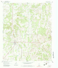
1961 Map of Montague
USGS Topo · Published 1963About this map
The town of Montague serves as a focal point in this early 1960s landscape, where the intersection of state routes 175, 59, and 38 connects a series of family-named landmarks and rural institutions. The terrain is marked by distinctive elevations like Buzzard Roost Knob to the west and Blue Mound to the east, while the northern section is dominated by the Greenbrier region. Local history and genealogy are anchored by the St Williams church and several burial grounds, including the St Williams Cem and Starkey Cem.
Find a feature on this map
25 named features on this map. Tap any name to fly to it.
Don’t see what you’re looking for? This feature index may not catch every label — zoom into the map to look around manually.
Map Details
Editions of this 1961 Montague Map
2 editions found
Other maps of this area

1905 · Montague
USGS Topo · 1:125,000

1954 · Sherman
USGS Topo · 1:250,000

1958 · Sherman
USGS Topo · 1:250,000

1960 · Buzzard Roost Knob
USGS Topo · 1:24,000

1961 · Saint Jo
USGS Topo · 1:24,000

1961 · Salona
USGS Topo · 1:24,000

1961 · Bowie
USGS Topo · 1:24,000
1961 · Forestburg
USGS Topo · 1:24,000
1968 · Bonita
USGS Topo · 1:24,000

1968 · Nocona
USGS Topo · 1:24,000