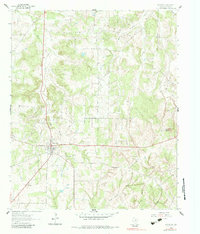
1961 Map of Montague
USGS Topo · Published 1984About this map
The community of Montague serves as a central hub on this topographic record, which details the rural landscape of North Texas as it appeared in the early 1960s. The settlement pattern is defined by its social and spiritual centers, such as St Williams Ch and its adjacent St Williams Cem, alongside another unnamed Cemetery to the north. These local landmarks provide significant data for genealogists tracing family histories in the county seat and surrounding countryside.
Find a feature on this map
16 named features on this map. Tap any name to fly to it.
Don’t see what you’re looking for? This feature index may not catch every label — zoom into the map to look around manually.
Map Details
Editions of this 1961 Montague Map
2 editions found
Other maps of this area

1905 · Montague
USGS Topo · 1:125,000

1954 · Sherman
USGS Topo · 1:250,000

1958 · Sherman
USGS Topo · 1:250,000

1960 · Buzzard Roost Knob
USGS Topo · 1:24,000

1961 · Saint Jo
USGS Topo · 1:24,000

1961 · Salona
USGS Topo · 1:24,000

1961 · Montague
USGS Topo · 1:24,000

1961 · Bowie
USGS Topo · 1:24,000
1961 · Forestburg
USGS Topo · 1:24,000
1968 · Bonita
USGS Topo · 1:24,000