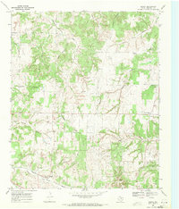
1968 Map of Bonita
USGS Topo · Published 1971About this map
The Missouri Kansas Texas railroad cuts through the southwestern corner of this Montague County landscape, anchoring the small settlement of Bonita. The surrounding terrain is a network of creek drainages including Cottonwood Creek, Turkey Creek, and Farmers Creek, punctuated by significant petroleum activity within the Bowers Oil Field. Numerous oil wells are scattered across the quadrangle, particularly concentrated around the northern branches and near Mount View.
Find a feature on this map
30 named features on this map. Tap any name to fly to it.
Don’t see what you’re looking for? This feature index may not catch every label — zoom into the map to look around manually.
Map Details
Editions of this 1968 Bonita Map
This is the sole edition of this map. No revisions or reprints were ever made.
Other maps of this area

1902 · Gainesville
USGS Topo · 1:125,000

1905 · Montague
USGS Topo · 1:125,000

1943 · Gainesville
USGS Topo · 1:125,000

1954 · Sherman
USGS Topo · 1:250,000

1958 · Sherman
USGS Topo · 1:250,000

1961 · Muenster West
USGS Topo · 1:24,000

1961 · Saint Jo
USGS Topo · 1:24,000

1961 · Montague
USGS Topo · 1:24,000
1968 · Spanish Fort
USGS Topo · 1:24,000
1968 · Leon North
USGS Topo · 1:24,000